Guinsang-an elevation
Guinsang-an (Soccsksargen, Province of South Cotabato), Philippines elevation is 128 meters and Guinsang-an elevation in feet is 420 ft above sea level [src 1]. Guinsang-an is a populated place (feature code) with elevation that is 40 meters (131 ft) bigger than average city elevation in Philippines.
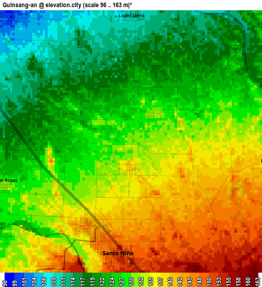
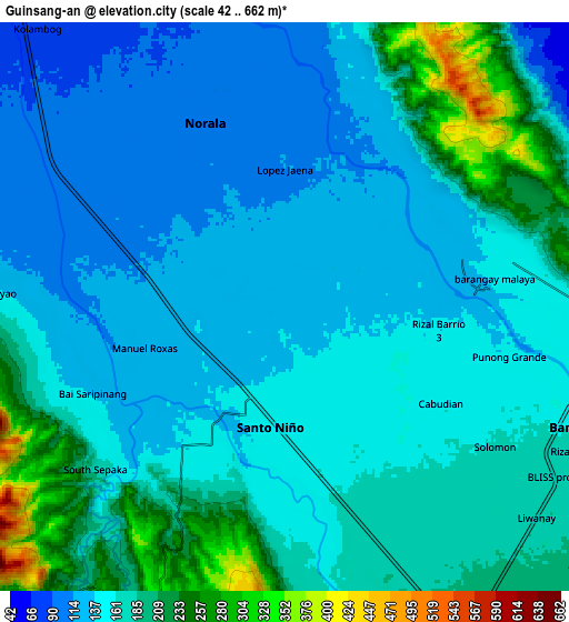
Below is the Elevation map of Guinsang-an, which displays elevation range with different colors. Scale of the first map is from 96 to 163 m (315 to 535 ft) with average elevation of 129.1 meters (=424 ft) [note 1]
These maps also provides idea of topography and contour of this city, they are displayed at different zoom levels. More info about maps, scale and edge coordinates you can find below images.
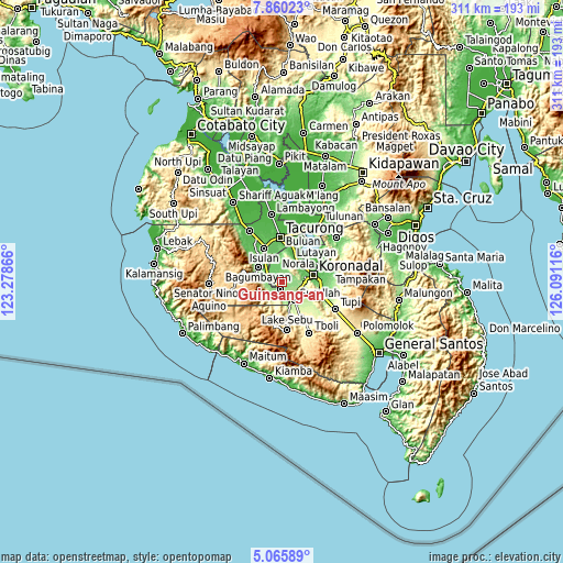
| \ | Map #1 | Map #2 | Topo.Map |
| Scale [m] | 96..163 m | 42..662 m | × |
| Scale [ft] | 315..535 ft | 138..2172 ft | × |
| Average | 129.1 m = 424 ft | 163.5 m = 536 ft | × |
| Width | 9.71 km = 6 mi | 19.42 km = 12.1 mi | 310.7 km = 193.1 mi |
| Height | 9.71 km = 6 mi | 19.42 km = 12.1 mi | 310.7 km = 193.1 mi |
| ↑Max Latitude | 6.508654° | 6.552314° | 7.86023° |
| Latitude at center | 6.46499° | 6.46499° | 6.46499° |
| ↓Min Latitude | 6.421322° | 6.377651° | 5.06589° |
| ← Min Longitude | 124.640965° | 124.597019° | 123.27866° |
| Longitude center | 124.68491° | 124.68491° | 124.68491° |
| →Max Longitude | 124.728855° | 124.772801° | 126.09116° |
Nearby cities:
Cities around Guinsang-an sort by population:
• Norala elevation 103 m
7 km,  336°
336°
• Santo Niño 148 m
3.6 km,  157°
157°
• Dahay 174 m
8.9 km, 158°
• Lopez Jaena 124 m
1.9 km,  50°
50°
• Manuel Roxas 138 m
3.3 km,  218°
218°
• San Miguel 120 m
3.3 km,  22°
22°
• Panay 104 m
6.3 km,  304°
304°
• Busok 106 m
10.5 km, 297°
• Liberty 91 m
8.5 km,  316°
316°
• Teresita 154 m
6.2 km, 155°
• Lapuz 99 m
6.8 km, 298°
• Esperanza 112 m
4.2 km,  332°
332°
Multilingual:
 En español:
Guinsang-an elevación 128 m.
 En France:
Guinsang-an élévation 128 m.
 Auf Deutsch:
Guinsang-an höhe über dem Meeresspiegel ist 128 m.

Sources and notes:
- [note 1] Map square and city borders are not equal. Map elevation data is calculated only from area inside that square.
- [src 1] Elevation data from geonames database provided with same terms of usage.
- [src 2] The elevation map of Guinsang-an is generated using elevation data from NASA's 3 arcsec (90m) resolution SRTM data.
- [src 3] Base (background) map © OpenStreetMap contributors tiles are generated by Geofabrik and OpenTopoMap.
Copyright & License:
This Guinsang-an Elevation Map is licensed under CC BY-SA. You may reuse any part from this page, if you give a proper credit by linking to this URL:
 More info on terms of use page.