Gumalang elevation
Gumalang (Davao, Province of Davao del Sur), Philippines elevation is 382 meters and Gumalang elevation in feet is 1253 ft above sea level [src 1]. Gumalang is a populated place (feature code) with elevation that is 294 meters (965 ft) bigger than average city elevation in Philippines.
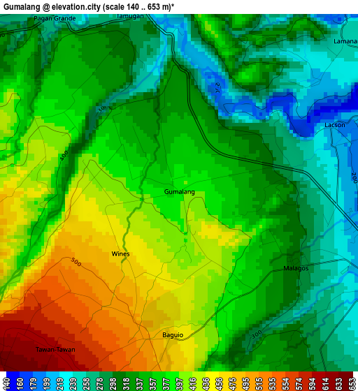
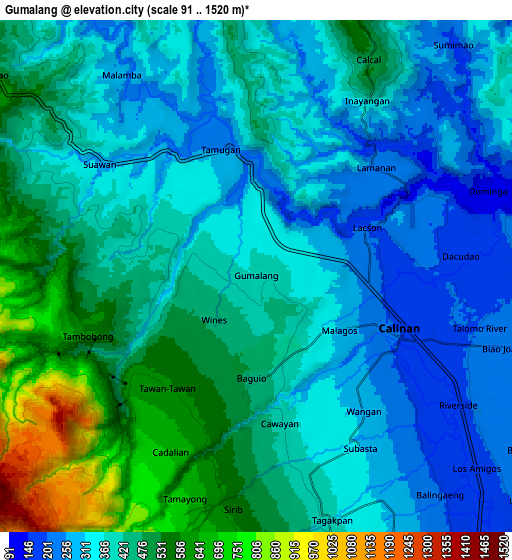
Below is the Elevation map of Gumalang, which displays elevation range with different colors. Scale of the first map is from 140 to 653 m (459 to 2142 ft) with average elevation of 359.7 meters (=1180 ft) [note 1]
These maps also provides idea of topography and contour of this city, they are displayed at different zoom levels. More info about maps, scale and edge coordinates you can find below images.
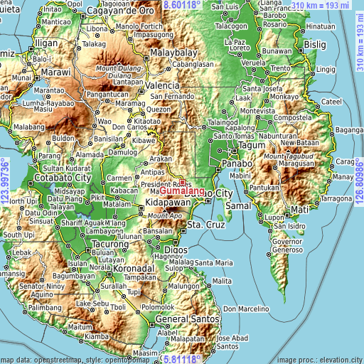
| \ | Map #1 | Map #2 | Topo.Map |
| Scale [m] | 140..653 m | 91..1520 m | × |
| Scale [ft] | 459..2142 ft | 299..4987 ft | × |
| Average | 359.7 m = 1180 ft | 408.8 m = 1341 ft | × |
| Width | 9.7 km = 6 mi | 19.39 km = 12 mi | 310.2 km = 192.7 mi |
| Height | 9.7 km = 6 mi | 19.39 km = 12 mi | 310.2 km = 192.7 mi |
| ↑Max Latitude | 7.251926° | 7.295518° | 8.60118° |
| Latitude at center | 7.20833° | 7.20833° | 7.20833° |
| ↓Min Latitude | 7.16473° | 7.121126° | 5.81118° |
| ← Min Longitude | 125.359665° | 125.315719° | 123.99736° |
| Longitude center | 125.40361° | 125.40361° | 125.40361° |
| →Max Longitude | 125.447555° | 125.491501° | 126.80986° |
Nearby cities:
Cities around Gumalang sort by population:
• Tamugan elevation 364 m
3.9 km,  309°
309°
• Wañgan 279 m
7.1 km,  139°
139°
• Tamayong 698 m
8.8 km,  197°
197°
• Sirib 482 m
8.3 km,  177°
177°
• Malagos 358 m
3.3 km, 141°
• Tagakpan 415 m
11 km,  165°
165°
• Lacson 218 m
4.3 km,  84°
84°
• Dacudao 192 m
7.5 km, 84°
• Tuli 271 m
3.1 km,  27°
27°
• Tawan tawan 605 m
5.5 km,  217°
217°
• Wines 454 m
2.3 km, 224°
• Ula 210 m
12.9 km,  130°
130°
Multilingual:
 En español:
Gumalang elevación 382 m.
 En France:
Gumalang élévation 382 m.
 Auf Deutsch:
Gumalang höhe über dem Meeresspiegel ist 382 m.

Sources and notes:
- [note 1] Map square and city borders are not equal. Map elevation data is calculated only from area inside that square.
- [src 1] Elevation data from geonames database provided with same terms of usage.
- [src 2] The elevation map of Gumalang is generated using elevation data from NASA's 3 arcsec (90m) resolution SRTM data.
- [src 3] Base (background) map © OpenStreetMap contributors tiles are generated by Geofabrik and OpenTopoMap.
Copyright & License:
This Gumalang Elevation Map is licensed under CC BY-SA. You may reuse any part from this page, if you give a proper credit by linking to this URL:
 More info on terms of use page.