Ibaan elevation
Ibaan (Calabarzon, Province of Batangas), Philippines elevation is 122 meters and Ibaan elevation in feet is 400 ft above sea level [src 1]. Ibaan is a seat of a third-order administrative division (feature code) with elevation that is 34 meters (112 ft) bigger than average city elevation in Philippines.
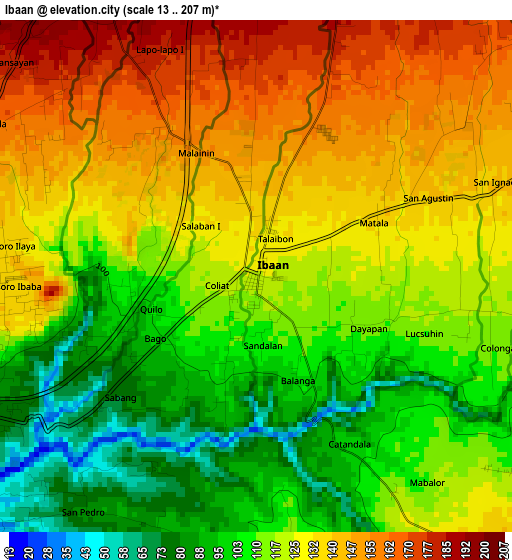
Below is the Elevation map of Ibaan, which displays elevation range with different colors. Scale of the first map is from 13 to 207 m (43 to 679 ft) with average elevation of 121.8 meters (=400 ft) [note 1]
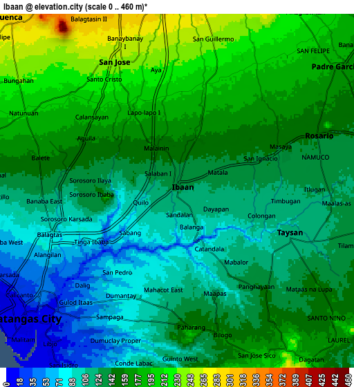
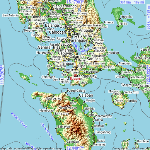
These maps also provides idea of topography and contour of this city, they are displayed at different zoom levels. More info about maps, scale and edge coordinates you can find below images.
| \ | Map #1 | Map #2 | Topo.Map |
| Scale [m] | 13..207 m | 0..460 m | × |
| Scale [ft] | 43..679 ft | 0..1509 ft | × |
| Average | 121.8 m = 400 ft | 144.4 m = 474 ft | × |
| Width | 9.49 km = 5.9 mi | 18.98 km = 11.8 mi | 303.6 km = 188.6 mi |
| Height | 9.49 km = 5.9 mi | 18.98 km = 11.8 mi | 303.7 km = 188.7 mi |
| ↑Max Latitude | 13.86027° | 13.902931° | 15.17903° |
| Latitude at center | 13.8176° | 13.8176° | 13.8176° |
| ↓Min Latitude | 13.774923° | 13.732237° | 12.44817° |
| ← Min Longitude | 121.089055° | 121.045109° | 119.72675° |
| Longitude center | 121.133° | 121.133° | 121.133° |
| →Max Longitude | 121.176945° | 121.220891° | 122.53925° |
Nearby cities:
Cities around Ibaan sort by population:
• Banaybanay elevation 152 m
8.1 km,  63°
63°
• Taysan 222 m
7 km,  326°
326°
• Lapolapo 145 m
1.9 km,  16°
16°
• Bukal 151 m
4.7 km,  296°
296°
• Santo Niño 174 m
3.5 km,  359°
359°
• Talaibon 151 m
2.4 km, 18°
• Rizal 205 m
7.1 km, 23°
• Santa Cruz 179 m
8 km,  48°
48°
• Matala 141 m
2.7 km, 62°
• Rosario 145 m
8.3 km,  68°
68°
• San Jose 238 m
7.4 km,  335°
335°
• Taysan 117 m
6.5 km,  109°
109°
Multilingual:
 En español:
Ibaan elevación 122 m.
 En France:
Ibaan élévation 122 m.


Sources and notes:
- [note 1] Map square and city borders are not equal. Map elevation data is calculated only from area inside that square.
- [src 1] Elevation data from geonames database provided with same terms of usage.
- [src 2] The elevation map of Ibaan is generated using elevation data from NASA's 3 arcsec (90m) resolution SRTM data.
- [src 3] Base (background) map © OpenStreetMap contributors tiles are generated by Geofabrik and OpenTopoMap.
Copyright & License:
This Ibaan Elevation Map is licensed under CC BY-SA. You may reuse any part from this page, if you give a proper credit by linking to this URL:
 More info on terms of use page.