Ineangan elevation
Ineangan (Cagayan Valley, Province of Nueva Vizcaya), Philippines elevation is 355 meters and Ineangan elevation in feet is 1165 ft above sea level [src 1]. Ineangan is a populated place (feature code) with elevation that is 267 meters (876 ft) bigger than average city elevation in Philippines.
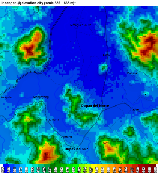
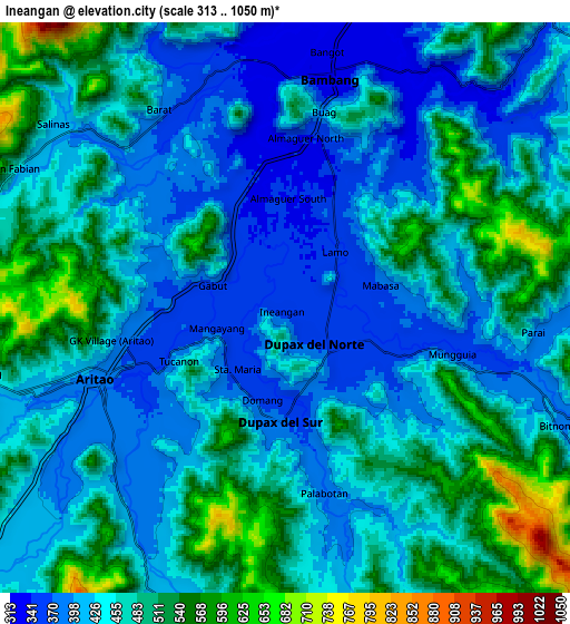
Below is the Elevation map of Ineangan, which displays elevation range with different colors. Scale of the first map is from 335 to 668 m (1099 to 2192 ft) with average elevation of 391.2 meters (=1283 ft) [note 1]
These maps also provides idea of topography and contour of this city, they are displayed at different zoom levels. More info about maps, scale and edge coordinates you can find below images.
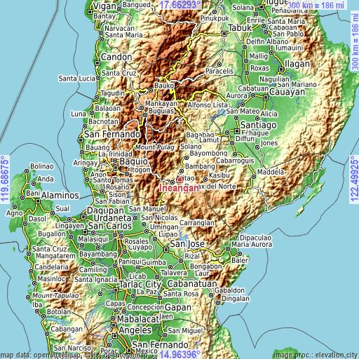
| \ | Map #1 | Map #2 | Topo.Map |
| Scale [m] | 335..668 m | 313..1050 m | × |
| Scale [ft] | 1099..2192 ft | 1027..3445 ft | × |
| Average | 391.2 m = 1283 ft | 456.1 m = 1496 ft | × |
| Width | 9.38 km = 5.8 mi | 18.76 km = 11.7 mi | 300.1 km = 186.5 mi |
| Height | 9.38 km = 5.8 mi | 18.76 km = 11.7 mi | 300.1 km = 186.5 mi |
| ↑Max Latitude | 16.36027° | 16.402432° | 17.66293° |
| Latitude at center | 16.3181° | 16.3181° | 16.3181° |
| ↓Min Latitude | 16.27592° | 16.233732° | 14.96396° |
| ← Min Longitude | 121.049055° | 121.005109° | 119.68675° |
| Longitude center | 121.093° | 121.093° | 121.093° |
| →Max Longitude | 121.136945° | 121.180891° | 122.49925° |
Nearby cities:
Cities around Ineangan sort by population:
• Bayombong elevation 280 m
19.1 km,  18°
18°
• Bambang 329 m
7.7 km,  10°
10°
• Aritao 389 m
6.6 km,  250°
250°
• Bone South 449 m
13.2 km,  231°
231°
• Malasin 365 m
2.1 km,  137°
137°
• Almaguer North 343 m
3.5 km,  359°
359°
• Busilak 302 m
18 km, 10°
• Banganan 360 m
4.1 km,  264°
264°
• Salinas 416 m
9.8 km,  305°
305°
• San Antonio 348 m
4 km,  25°
25°
• Mabasa 366 m
3.6 km,  84°
84°
• San Fernando 324 m
9 km, 28°
Multilingual:
 En español:
Ineangan elevación 355 m.
 En France:
Ineangan élévation 355 m.
 Auf Deutsch:
Ineangan höhe über dem Meeresspiegel ist 355 m.

Sources and notes:
- [note 1] Map square and city borders are not equal. Map elevation data is calculated only from area inside that square.
- [src 1] Elevation data from geonames database provided with same terms of usage.
- [src 2] The elevation map of Ineangan is generated using elevation data from NASA's 3 arcsec (90m) resolution SRTM data.
- [src 3] Base (background) map © OpenStreetMap contributors tiles are generated by Geofabrik and OpenTopoMap.
Copyright & License:
This Ineangan Elevation Map is licensed under CC BY-SA. You may reuse any part from this page, if you give a proper credit by linking to this URL:
 More info on terms of use page.