Iraga elevation
Iraga (Cagayan Valley, Province of Cagayan), Philippines elevation is 22 meters and Iraga elevation in feet is 72 ft above sea level [src 1]. Iraga is a populated place (feature code) with elevation that is 66 meters (217 ft) smaller than average city elevation in Philippines.
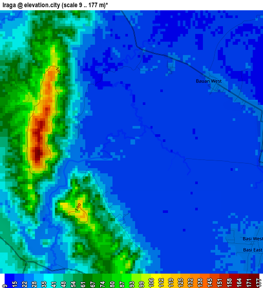
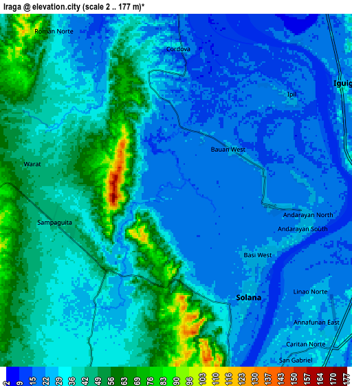
Below is the Elevation map of Iraga, which displays elevation range with different colors. Scale of the first map is from 9 to 177 m (30 to 581 ft) with average elevation of 34.6 meters (=114 ft) [note 1]
These maps also provides idea of topography and contour of this city, they are displayed at different zoom levels. More info about maps, scale and edge coordinates you can find below images.
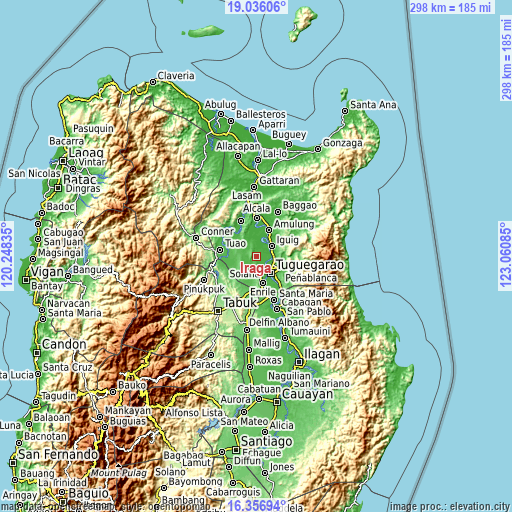
| \ | Map #1 | Map #2 | Topo.Map |
| Scale [m] | 9..177 m | 2..177 m | × |
| Scale [ft] | 30..581 ft | 7..581 ft | × |
| Average | 34.6 m = 114 ft | 33.9 m = 111 ft | × |
| Width | 9.31 km = 5.8 mi | 18.62 km = 11.6 mi | 297.9 km = 185.1 mi |
| Height | 9.31 km = 5.8 mi | 18.62 km = 11.6 mi | 297.9 km = 185.1 mi |
| ↑Max Latitude | 17.74336° | 17.78521° | 19.03606° |
| Latitude at center | 17.7015° | 17.7015° | 17.7015° |
| ↓Min Latitude | 17.65963° | 17.617751° | 16.35694° |
| ← Min Longitude | 121.610655° | 121.566709° | 120.24835° |
| Longitude center | 121.6546° | 121.6546° | 121.6546° |
| →Max Longitude | 121.698545° | 121.742491° | 123.06085° |
Nearby cities:
Cities around Iraga sort by population:
• Solana elevation 28 m
6.6 km,  144°
144°
• Nattapian 25 m
5.9 km,  119°
119°
• Bauan 23 m
3.6 km,  49°
49°
• Atulayan 26 m
5.8 km,  134°
134°
• Dassun 23 m
7.7 km, 51°
• Lanna 26 m
4.9 km,  97°
97°
• Iguig 28 m
10.2 km,  57°
57°
• Carig 19 m
10.5 km, 116°
• Gadu 36 m
9.3 km,  210°
210°
• Gammad 29 m
9.5 km,  84°
84°
• Maddarulug Norte 53 m
10.7 km,  167°
167°
• Minanga Norte 24 m
10.3 km, 50°
Multilingual:
 En español:
Iraga elevación 22 m.
 En France:
Iraga élévation 22 m.


Sources and notes:
- [note 1] Map square and city borders are not equal. Map elevation data is calculated only from area inside that square.
- [src 1] Elevation data from geonames database provided with same terms of usage.
- [src 2] The elevation map of Iraga is generated using elevation data from NASA's 3 arcsec (90m) resolution SRTM data.
- [src 3] Base (background) map © OpenStreetMap contributors tiles are generated by Geofabrik and OpenTopoMap.
Copyright & License:
This Iraga Elevation Map is licensed under CC BY-SA. You may reuse any part from this page, if you give a proper credit by linking to this URL:
 More info on terms of use page.