Jaena elevation
Jaena (Western Visayas, Province of Capiz), Philippines elevation is 176 meters and Jaena elevation in feet is 577 ft above sea level [src 1]. Jaena is a populated place (feature code) with elevation that is 88 meters (289 ft) bigger than average city elevation in Philippines.
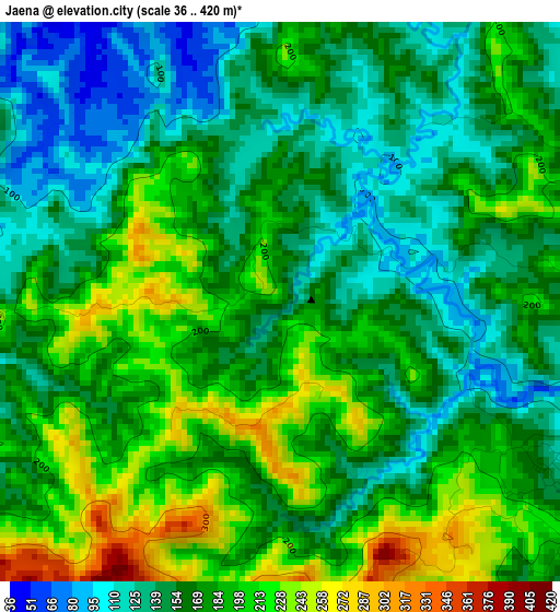
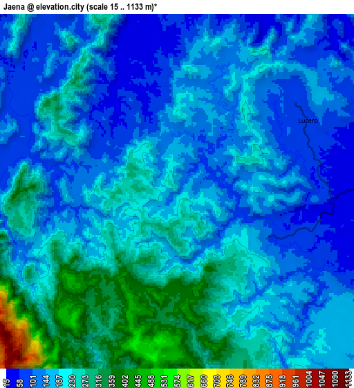
Below is the Elevation map of Jaena, which displays elevation range with different colors. Scale of the first map is from 36 to 420 m (118 to 1378 ft) with average elevation of 171.7 meters (=563 ft) [note 1]
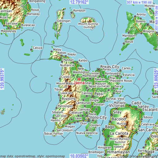
These maps also provides idea of topography and contour of this city, they are displayed at different zoom levels. More info about maps, scale and edge coordinates you can find below images.
| \ | Map #1 | Map #2 | Topo.Map |
| Scale [m] | 36..420 m | 15..1133 m | × |
| Scale [ft] | 118..1378 ft | 49..3717 ft | × |
| Average | 171.7 m = 563 ft | 187.1 m = 614 ft | × |
| Width | 9.58 km = 6 mi | 19.16 km = 11.9 mi | 306.5 km = 190.4 mi |
| Height | 9.58 km = 6 mi | 19.16 km = 11.9 mi | 306.5 km = 190.4 mi |
| ↑Max Latitude | 11.459743° | 11.502808° | 12.79162° |
| Latitude at center | 11.41667° | 11.41667° | 11.41667° |
| ↓Min Latitude | 11.373591° | 11.330505° | 10.03502° |
| ← Min Longitude | 122.356055° | 122.312109° | 120.99375° |
| Longitude center | 122.4° | 122.4° | 122.4° |
| →Max Longitude | 122.443945° | 122.487891° | 123.80625° |
Nearby cities:
Cities around Jaena sort by population:
• Arcangel elevation 24 m
14.9 km,  336°
336°
• Manika 105 m
13.5 km,  256°
256°
• Libacao 60 m
12.6 km,  304°
304°
• Odiong 16 m
15.1 km,  28°
28°
• Morales 4 m
14.6 km,  349°
349°
• Cortez 26 m
12.6 km,  358°
358°
• Ag-ambulong 52 m
13.1 km,  114°
114°
• Lupo 22 m
13.3 km,  40°
40°
• Jamindan 36 m
10.9 km,  99°
99°
• Lucero 69 m
8.2 km,  59°
59°
• Madalag 44 m
15.9 km,  320°
320°
• Balete 9 m
15.6 km, 352°
Multilingual:
 En español:
Jaena elevación 176 m.
 En France:
Jaena élévation 176 m.


Sources and notes:
- [note 1] Map square and city borders are not equal. Map elevation data is calculated only from area inside that square.
- [src 1] Elevation data from geonames database provided with same terms of usage.
- [src 2] The elevation map of Jaena is generated using elevation data from NASA's 3 arcsec (90m) resolution SRTM data.
- [src 3] Base (background) map © OpenStreetMap contributors tiles are generated by Geofabrik and OpenTopoMap.
Copyright & License:
This Jaena Elevation Map is licensed under CC BY-SA. You may reuse any part from this page, if you give a proper credit by linking to this URL:
 More info on terms of use page.