Katidtuan elevation
Katidtuan (Autonomous Region in Muslim Mindanao, Province of Maguindanao), Philippines elevation is 10 meters and Katidtuan elevation in feet is 33 ft above sea level [src 1]. Katidtuan is a populated place (feature code) with elevation that is 78 meters (256 ft) smaller than average city elevation in Philippines.
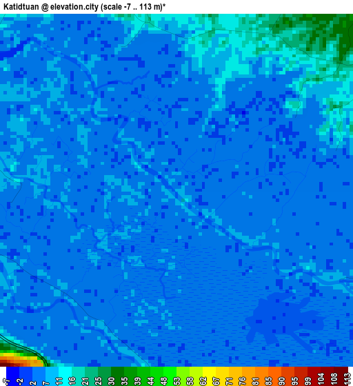
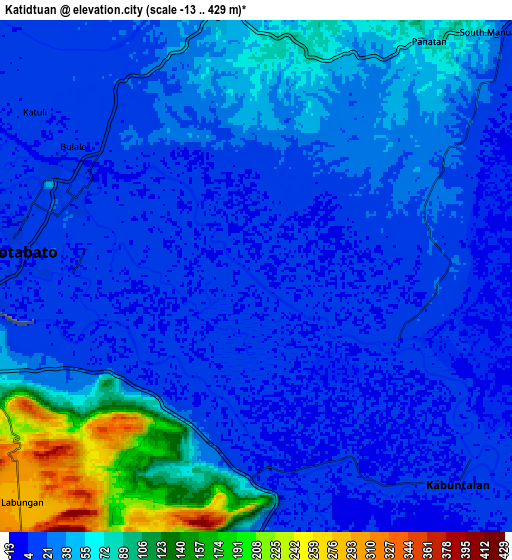
Below is the Elevation map of Katidtuan, which displays elevation range with different colors. Scale of the first map is from -7 to 113 m (-23 to 371 ft) with average elevation of 6.3 meters (=21 ft) [note 1]
These maps also provides idea of topography and contour of this city, they are displayed at different zoom levels. More info about maps, scale and edge coordinates you can find below images.
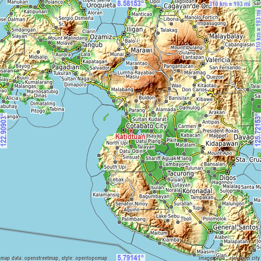
| \ | Map #1 | Map #2 | Topo.Map |
| Scale [m] | -7..113 m | -13..429 m | × |
| Scale [ft] | -23..371 ft | -43..1407 ft | × |
| Average | 6.3 m = 21 ft | 38.5 m = 126 ft | × |
| Width | 9.7 km = 6 mi | 19.39 km = 12 mi | 310.2 km = 192.7 mi |
| Height | 9.7 km = 6 mi | 19.39 km = 12 mi | 310.3 km = 192.8 mi |
| ↑Max Latitude | 7.232208° | 7.275801° | 8.58153° |
| Latitude at center | 7.18861° | 7.18861° | 7.18861° |
| ↓Min Latitude | 7.145008° | 7.101402° | 5.79141° |
| ← Min Longitude | 124.271335° | 124.227389° | 122.90903° |
| Longitude center | 124.31528° | 124.31528° | 124.31528° |
| →Max Longitude | 124.359225° | 124.403171° | 125.72153° |
Nearby cities:
Cities around Katidtuan sort by population:
• Cotabato elevation 7 m
8.5 km,  297°
297°
• Pagaluñgan 4 m
8.9 km,  125°
125°
• Dalumangcob 3 m
3.5 km,  331°
331°
• Awang 66 m
11.1 km,  249°
249°
• Tamontaka 8 m
9.9 km,  264°
264°
• Limbo 11 m
10.5 km,  311°
311°
• Simuay 51 m
9.9 km,  354°
354°
• Salimbao 10 m
7.8 km, 298°
• Gang 10 m
8.3 km,  319°
319°
• Taviran 5 m
7.3 km,  176°
176°
• Pinaring 10 m
4.5 km, 353°
• Sultan Kudarat 7 m
7.8 km, 305°
Multilingual:
 En español:
Katidtuan elevación 10 m.
 En France:
Katidtuan élévation 10 m.
 Auf Deutsch:
Katidtuan höhe über dem Meeresspiegel ist 10 m.

Sources and notes:
- [note 1] Map square and city borders are not equal. Map elevation data is calculated only from area inside that square.
- [src 1] Elevation data from geonames database provided with same terms of usage.
- [src 2] The elevation map of Katidtuan is generated using elevation data from NASA's 3 arcsec (90m) resolution SRTM data.
- [src 3] Base (background) map © OpenStreetMap contributors tiles are generated by Geofabrik and OpenTopoMap.
Copyright & License:
This Katidtuan Elevation Map is licensed under CC BY-SA. You may reuse any part from this page, if you give a proper credit by linking to this URL:
 More info on terms of use page.