Kauran elevation
Kauran (Autonomous Region in Muslim Mindanao, Province of Maguindanao), Philippines elevation is 25 meters and Kauran elevation in feet is 82 ft above sea level [src 1]. Kauran is a populated place (feature code) with elevation that is 63 meters (207 ft) smaller than average city elevation in Philippines.
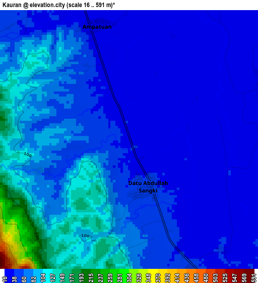
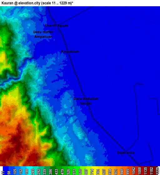
Below is the Elevation map of Kauran, which displays elevation range with different colors. Scale of the first map is from 16 to 591 m (52 to 1939 ft) with average elevation of 63.8 meters (=209 ft) [note 1]
These maps also provides idea of topography and contour of this city, they are displayed at different zoom levels. More info about maps, scale and edge coordinates you can find below images.
| \ | Map #1 | Map #2 | Topo.Map |
| Scale [m] | 16..591 m | 11..1229 m | × |
| Scale [ft] | 52..1939 ft | 36..4032 ft | × |
| Average | 63.8 m = 209 ft | 191 m = 627 ft | × |
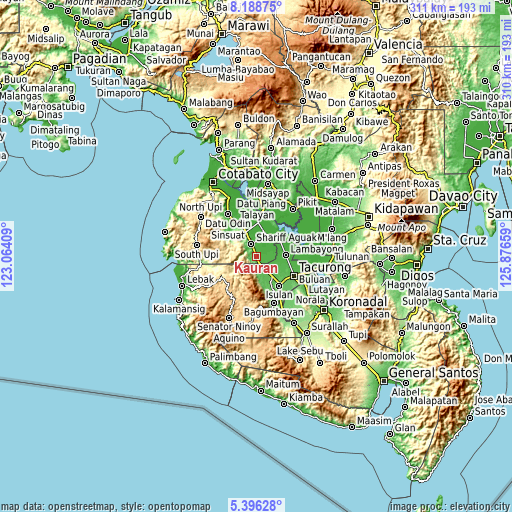
| Width | 9.7 km = 6 mi | 19.41 km = 12.1 mi | 310.5 km = 192.9 mi |
| Height | 9.7 km = 6 mi | 19.41 km = 12.1 mi | 310.5 km = 192.9 mi |
| ↑Max Latitude | 6.838175° | 6.881805° | 8.18875° |
| Latitude at center | 6.79454° | 6.79454° | 6.79454° |
| ↓Min Latitude | 6.750901° | 6.707259° | 5.39628° |
| ← Min Longitude | 124.426395° | 124.382449° | 123.06409° |
| Longitude center | 124.47034° | 124.47034° | 124.47034° |
| →Max Longitude | 124.514285° | 124.558231° | 125.87659° |
Nearby cities:
Cities around Kauran sort by population:
• Laguilayan elevation 59 m
14.9 km,  156°
156°
• Maganoy 35 m
8.4 km,  337°
337°
• Esperanza 43 m
9.6 km,  145°
145°
• Satan 122 m
10.2 km,  318°
318°
• Ampatuan 20 m
8 km,  357°
357°
• Sagasa 32 m
11.7 km,  101°
101°
• New Panay 34 m
11.4 km,  120°
120°
• Pamantingan 900 m
13.3 km,  227°
227°
• Villamor 45 m
11.5 km, 151°
• Matiompong 49 m
15.2 km,  135°
135°
• Sadsalan 19 m
15.8 km,  75°
75°
• Bagan 23 m
15.6 km, 339°
Multilingual:
 En español:
Kauran elevación 25 m.
 En France:
Kauran élévation 25 m.


Sources and notes:
- [note 1] Map square and city borders are not equal. Map elevation data is calculated only from area inside that square.
- [src 1] Elevation data from geonames database provided with same terms of usage.
- [src 2] The elevation map of Kauran is generated using elevation data from NASA's 3 arcsec (90m) resolution SRTM data.
- [src 3] Base (background) map © OpenStreetMap contributors tiles are generated by Geofabrik and OpenTopoMap.
Copyright & License:
This Kauran Elevation Map is licensed under CC BY-SA. You may reuse any part from this page, if you give a proper credit by linking to this URL:
 More info on terms of use page.