Kibungan elevation
Kibungan (Cordillera, Province of Benguet), Philippines elevation is 1274 meters and Kibungan elevation in feet is 4180 ft above sea level [src 1]. Kibungan is a seat of a third-order administrative division (feature code) with elevation that is 1186 meters (3891 ft) bigger than average city elevation in Philippines.
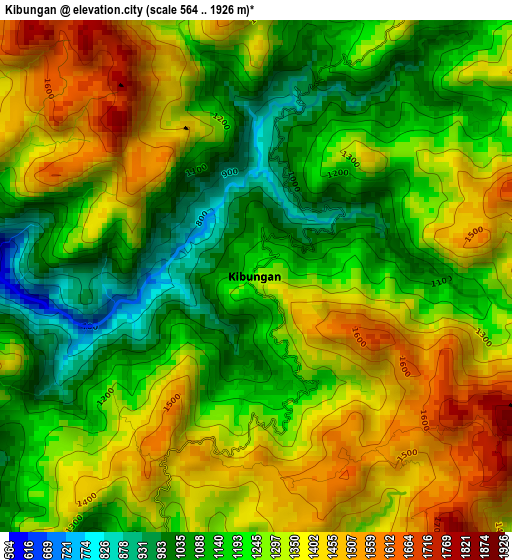
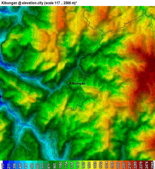
Below is the Elevation map of Kibungan, which displays elevation range with different colors. Scale of the first map is from 564 to 1926 m (1850 to 6319 ft) with average elevation of 1264.1 meters (=4147 ft) [note 1]
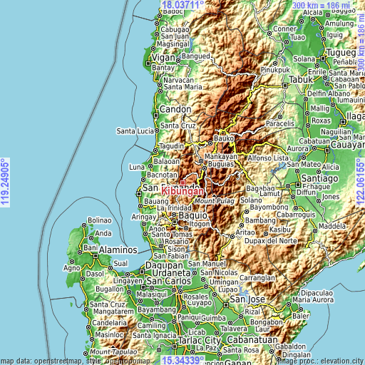
These maps also provides idea of topography and contour of this city, they are displayed at different zoom levels. More info about maps, scale and edge coordinates you can find below images.
| \ | Map #1 | Map #2 | Topo.Map |
| Scale [m] | 564..1926 m | 117..2568 m | × |
| Scale [ft] | 1850..6319 ft | 384..8425 ft | × |
| Average | 1264.1 m = 4147 ft | 1314.1 m = 4311 ft | × |
| Width | 9.36 km = 5.8 mi | 18.72 km = 11.6 mi | 299.5 km = 186.1 mi |
| Height | 9.36 km = 5.8 mi | 18.72 km = 11.6 mi | 299.5 km = 186.1 mi |
| ↑Max Latitude | 16.737088° | 16.779167° | 18.03711° |
| Latitude at center | 16.695° | 16.695° | 16.695° |
| ↓Min Latitude | 16.652902° | 16.610796° | 15.34339° |
| ← Min Longitude | 120.611355° | 120.567409° | 119.24905° |
| Longitude center | 120.6553° | 120.6553° | 120.6553° |
| →Max Longitude | 120.699245° | 120.743191° | 122.06155° |
Nearby cities:
Cities around Kibungan sort by population:
• Loacan elevation 1045 m
16.2 km,  175°
175°
• Buguias 1463 m
18.7 km,  80°
80°
• Tublay 971 m
17.6 km,  196°
196°
• Gambang 1702 m
14.9 km,  65°
65°
• Tacadang 1454 m
3.8 km,  335°
335°
• Topdac 1573 m
16.7 km,  158°
158°
• Natubleng 2262 m
13.3 km,  89°
89°
• Dalipey 1234 m
13.4 km,  29°
29°
• Atok 994 m
13.3 km, 159°
• Ampusungan 1369 m
12 km,  37°
37°
• Kapangan 951 m
14.8 km, 204°
• Bakun 1143 m
10.5 km,  4°
4°
Multilingual:
 En español:
Kibungan elevación 1274 m.
 En France:
Kibungan élévation 1274 m.
 Auf Deutsch:
Kibungan höhe über dem Meeresspiegel ist 1274 m.

Sources and notes:
- [note 1] Map square and city borders are not equal. Map elevation data is calculated only from area inside that square.
- [src 1] Elevation data from geonames database provided with same terms of usage.
- [src 2] The elevation map of Kibungan is generated using elevation data from NASA's 3 arcsec (90m) resolution SRTM data.
- [src 3] Base (background) map © OpenStreetMap contributors tiles are generated by Geofabrik and OpenTopoMap.
Copyright & License:
This Kibungan Elevation Map is licensed under CC BY-SA. You may reuse any part from this page, if you give a proper credit by linking to this URL:
 More info on terms of use page.