Kitaotao elevation
Kitaotao (Northern Mindanao, Province of Bukidnon), Philippines elevation is 339 meters and Kitaotao elevation in feet is 1112 ft above sea level [src 1]. Kitaotao is a seat of a third-order administrative division (feature code) with elevation that is 251 meters (823 ft) bigger than average city elevation in Philippines.
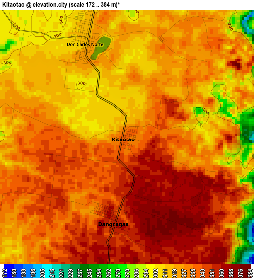
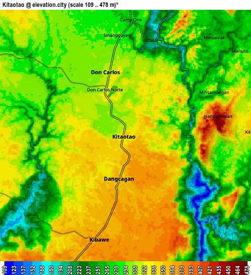
Below is the Elevation map of Kitaotao, which displays elevation range with different colors. Scale of the first map is from 172 to 384 m (564 to 1260 ft) with average elevation of 328.1 meters (=1076 ft) [note 1]
These maps also provides idea of topography and contour of this city, they are displayed at different zoom levels. More info about maps, scale and edge coordinates you can find below images.
| \ | Map #1 | Map #2 | Topo.Map |
| Scale [m] | 172..384 m | 109..478 m | × |
| Scale [ft] | 564..1260 ft | 358..1568 ft | × |
| Average | 328.1 m = 1076 ft | 303.9 m = 997 ft | × |
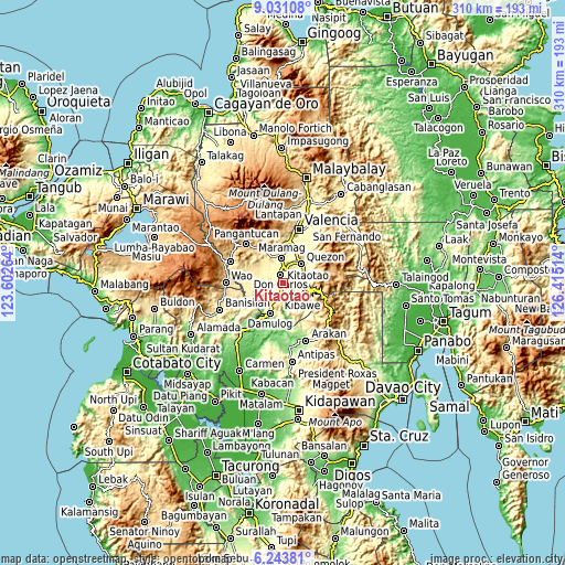
| Width | 9.69 km = 6 mi | 19.37 km = 12 mi | 309.9 km = 192.6 mi |
| Height | 9.69 km = 6 mi | 19.37 km = 12 mi | 309.9 km = 192.6 mi |
| ↑Max Latitude | 7.683273° | 7.726822° | 9.03108° |
| Latitude at center | 7.63972° | 7.63972° | 7.63972° |
| ↓Min Latitude | 7.596163° | 7.552601° | 6.24381° |
| ← Min Longitude | 124.964945° | 124.920999° | 123.60264° |
| Longitude center | 125.00889° | 125.00889° | 125.00889° |
| →Max Longitude | 125.052835° | 125.096781° | 126.41514° |
Nearby cities:
Cities around Kitaotao sort by population:
• Maramag elevation 276 m
13.7 km,  358°
358°
• Quezon 273 m
14.1 km,  44°
44°
• Don Carlos 307 m
4.5 km,  354°
354°
• Kadingilan 338 m
11.9 km,  248°
248°
• Salawagan 285 m
13.8 km,  58°
58°
• San Jose 271 m
12.7 km,  32°
32°
• Kibawe 365 m
8.2 km,  196°
196°
• Dancagan 359 m
3.4 km,  188°
188°
• Miaray 396 m
8.2 km,  151°
151°
• Natalungan 381 m
12.1 km,  172°
172°
• San Vicente 324 m
3.1 km,  65°
65°
• Kitobo 227 m
12.8 km,  124°
124°
Multilingual:
 En español:
Kitaotao elevación 339 m.
 En France:
Kitaotao élévation 339 m.
 Auf Deutsch:
Kitaotao höhe über dem Meeresspiegel ist 339 m.

Sources and notes:
- [note 1] Map square and city borders are not equal. Map elevation data is calculated only from area inside that square.
- [src 1] Elevation data from geonames database provided with same terms of usage.
- [src 2] The elevation map of Kitaotao is generated using elevation data from NASA's 3 arcsec (90m) resolution SRTM data.
- [src 3] Base (background) map © OpenStreetMap contributors tiles are generated by Geofabrik and OpenTopoMap.
Copyright & License:
This Kitaotao Elevation Map is licensed under CC BY-SA. You may reuse any part from this page, if you give a proper credit by linking to this URL:
 More info on terms of use page.