Koronadal elevation
Koronadal (Soccsksargen, Province of South Cotabato), Philippines elevation is 52 meters and Koronadal elevation in feet is 171 ft above sea level [src 1]. Koronadal is a seat of a first-order administrative division (feature code) with elevation that is 36 meters (118 ft) smaller than average city elevation in Philippines.
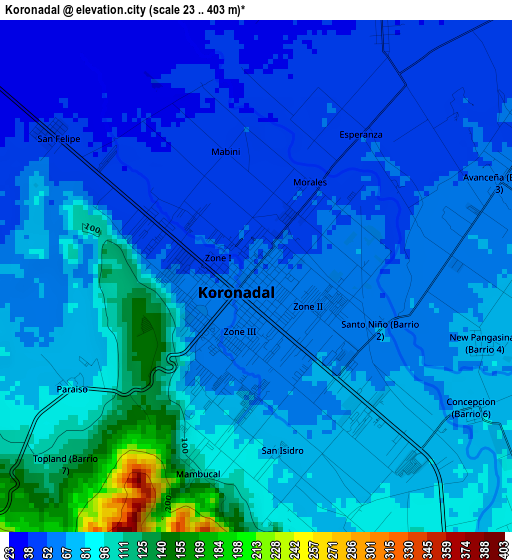
Below is the Elevation map of Koronadal, which displays elevation range with different colors. Scale of the first map is from 23 to 403 m (75 to 1322 ft) with average elevation of 71.5 meters (=235 ft) [note 1]
These maps also provides idea of topography and contour of this city, they are displayed at different zoom levels. More info about maps, scale and edge coordinates you can find below images.
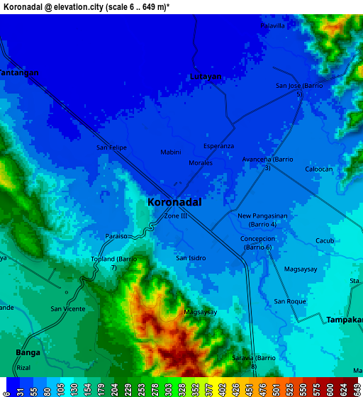
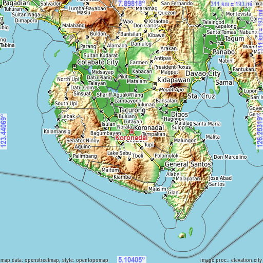
| \ | Map #1 | Map #2 | Topo.Map |
| Scale [m] | 23..403 m | 6..649 m | × |
| Scale [ft] | 75..1322 ft | 20..2129 ft | × |
| Average | 71.5 m = 235 ft | 109.6 m = 360 ft | × |
| Width | 9.71 km = 6 mi | 19.42 km = 12.1 mi | 310.7 km = 193.1 mi |
| Height | 9.71 km = 6 mi | 19.42 km = 12.1 mi | 310.7 km = 193.1 mi |
| ↑Max Latitude | 6.546721° | 6.590378° | 7.89818° |
| Latitude at center | 6.50306° | 6.50306° | 6.50306° |
| ↓Min Latitude | 6.459396° | 6.415727° | 5.10405° |
| ← Min Longitude | 124.802995° | 124.759049° | 123.44069° |
| Longitude center | 124.84694° | 124.84694° | 124.84694° |
| →Max Longitude | 124.890885° | 124.934831° | 126.25319° |
Nearby cities:
Cities around Koronadal sort by population:
• Tamnag elevation 48 m
8.6 km,  25°
25°
• Carpenter Hill 100 m
7.6 km,  149°
149°
• Blingkong 47 m
10.6 km, 26°
• Paraiso 88 m
5.1 km,  233°
233°
• New Iloilo 27 m
8.1 km,  308°
308°
• Bukay Pait 38 m
11 km, 306°
• San Vicente 155 m
9.2 km, 233°
• Maindang 20 m
9.6 km,  0°
0°
• Mabini 79 m
6.8 km,  87°
87°
• Rotonda 74 m
4.5 km,  106°
106°
• Maibu 15 m
9.5 km,  321°
321°
• Libas 82 m
7.4 km,  284°
284°
Multilingual:
 En español:
Koronadal elevación 52 m.
 En France:
Koronadal élévation 52 m.
 Auf Deutsch:
Koronadal City höhe über dem Meeresspiegel ist 52 m.

Sources and notes:
- [note 1] Map square and city borders are not equal. Map elevation data is calculated only from area inside that square.
- [src 1] Elevation data from geonames database provided with same terms of usage.
- [src 2] The elevation map of Koronadal is generated using elevation data from NASA's 3 arcsec (90m) resolution SRTM data.
- [src 3] Base (background) map © OpenStreetMap contributors tiles are generated by Geofabrik and OpenTopoMap.
Copyright & License:
This Koronadal Elevation Map is licensed under CC BY-SA. You may reuse any part from this page, if you give a proper credit by linking to this URL:
 More info on terms of use page.