Larap elevation
Larap (Bicol, Province of Camarines Norte), Philippines elevation is 8 meters and Larap elevation in feet is 26 ft above sea level [src 1]. Larap is a populated place (feature code) with elevation that is 80 meters (262 ft) smaller than average city elevation in Philippines.
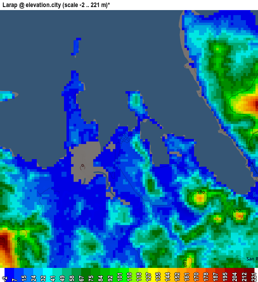
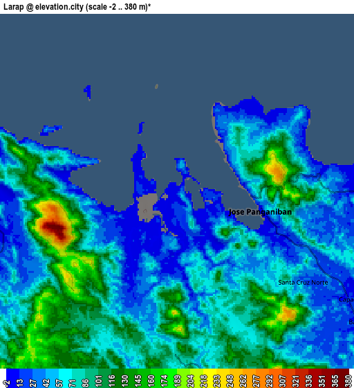
Below is the Elevation map of Larap, which displays elevation range with different colors. Scale of the first map is from -2 to 221 m (-7 to 725 ft) with average elevation of 37.7 meters (=124 ft) [note 1]
These maps also provides idea of topography and contour of this city, they are displayed at different zoom levels. More info about maps, scale and edge coordinates you can find below images.
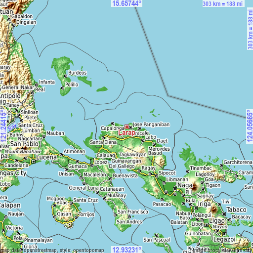
| \ | Map #1 | Map #2 | Topo.Map |
| Scale [m] | -2..221 m | -2..380 m | × |
| Scale [ft] | -7..725 ft | -7..1247 ft | × |
| Average | 37.7 m = 124 ft | 73.8 m = 242 ft | × |
| Width | 9.47 km = 5.9 mi | 18.94 km = 11.8 mi | 303 km = 188.3 mi |
| Height | 9.47 km = 5.9 mi | 18.94 km = 11.8 mi | 303 km = 188.3 mi |
| ↑Max Latitude | 14.34158° | 14.384152° | 15.65744° |
| Latitude at center | 14.299° | 14.299° | 14.299° |
| ↓Min Latitude | 14.256412° | 14.213816° | 12.93231° |
| ← Min Longitude | 122.606455° | 122.562509° | 121.24415° |
| Longitude center | 122.6504° | 122.6504° | 122.6504° |
| →Max Longitude | 122.694345° | 122.738291° | 124.05665° |
Nearby cities:
Cities around Larap sort by population:
• Jose Pañganiban elevation 5 m
4.5 km,  101°
101°
• Paracale 5 m
15 km, 97°
• Batobalane 9 m
13 km,  124°
124°
• Palali 8 m
17.8 km,  272°
272°
• Luklukan 8 m
7.3 km,  66°
66°
• Banocboc 157 m
7.2 km, 270°
• Capalonga 5 m
17.2 km,  281°
281°
• Tugos 46 m
11.3 km,  108°
108°
• Daguit 28 m
14.7 km,  146°
146°
• Alayao 4 m
10.7 km,  259°
259°
• Gumaus 6 m
7.9 km,  80°
80°
• Santa Rosa Sur 37 m
9 km, 119°
Multilingual:
 En español:
Larap elevación 8 m.
 En France:
Larap élévation 8 m.


Sources and notes:
- [note 1] Map square and city borders are not equal. Map elevation data is calculated only from area inside that square.
- [src 1] Elevation data from geonames database provided with same terms of usage.
- [src 2] The elevation map of Larap is generated using elevation data from NASA's 3 arcsec (90m) resolution SRTM data.
- [src 3] Base (background) map © OpenStreetMap contributors tiles are generated by Geofabrik and OpenTopoMap.
Copyright & License:
This Larap Elevation Map is licensed under CC BY-SA. You may reuse any part from this page, if you give a proper credit by linking to this URL:
 More info on terms of use page.