Lepanto elevation
Lepanto (Central Visayas, Province of Cebu), Philippines elevation is 575 meters and Lepanto elevation in feet is 1886 ft above sea level [src 1]. Lepanto is a populated place (feature code) with elevation that is 487 meters (1598 ft) bigger than average city elevation in Philippines.
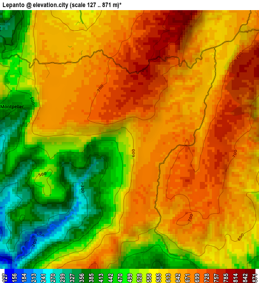
Below is the Elevation map of Lepanto, which displays elevation range with different colors. Scale of the first map is from 127 to 871 m (417 to 2858 ft) with average elevation of 587.1 meters (=1926 ft) [note 1]
These maps also provides idea of topography and contour of this city, they are displayed at different zoom levels. More info about maps, scale and edge coordinates you can find below images.
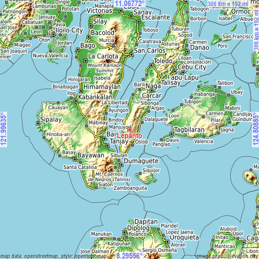
| \ | Map #1 | Topo.Map |
| Scale [m] | 127..871 m | × |
| Scale [ft] | 417..2858 ft | × |
| Average | 587.1 m = 1926 ft | × |
| Width | 9.63 km = 6 mi | 308.2 km = 191.5 mi |
| Height | 9.63 km = 6 mi | 308.3 km = 191.6 mi |
| ↑Max Latitude | 9.727816° | 11.06772° |
| Latitude at center | 9.6845° | 9.6845° |
| ↓Min Latitude | 9.641178° | 8.29556° |
| ← Min Longitude | 123.358655° | 121.99635° |
| Longitude center | 123.4026° | 123.4026° |
| →Max Longitude | 123.446545° | 124.80885° |
Nearby cities:
Cities around Lepanto sort by population:
• Valencia elevation 232 m
10.4 km,  338°
338°
• Boljoon 12 m
10.4 km,  127°
127°
• Talangnan 447 m
9.3 km,  233°
233°
• Guadalupe 681 m
4.3 km,  358°
358°
• Santa Filomena 58 m
9.8 km,  319°
319°
• Montaneza 14 m
8.1 km,  270°
270°
• Nugas 688 m
4.5 km,  72°
72°
• Malabuyoc 18 m
9.2 km,  247°
247°
• El Pardo 23 m
10.4 km,  105°
105°
• Malbug 14 m
8.7 km,  308°
308°
• Alegria 12 m
8.5 km, 305°
• Becerril 586 m
4.9 km,  135°
135°
Multilingual:
 En español:
Lepanto elevación 575 m.
 En France:
Lepanto élévation 575 m.


Sources and notes:
- [note 1] Map square and city borders are not equal. Map elevation data is calculated only from area inside that square.
- [src 1] Elevation data from geonames database provided with same terms of usage.
- [src 2] The elevation map of Lepanto is generated using elevation data from NASA's 3 arcsec (90m) resolution SRTM data.
- [src 3] Base (background) map © OpenStreetMap contributors tiles are generated by Geofabrik and OpenTopoMap.
Copyright & License:
This Lepanto Elevation Map is licensed under CC BY-SA. You may reuse any part from this page, if you give a proper credit by linking to this URL:
 More info on terms of use page.