Linmansangan elevation
Linmansangan (Ilocos, Province of Pangasinan), Philippines elevation is 15 meters and Linmansangan elevation in feet is 49 ft above sea level [src 1]. Linmansangan is a populated place (feature code) with elevation that is 73 meters (240 ft) smaller than average city elevation in Philippines.
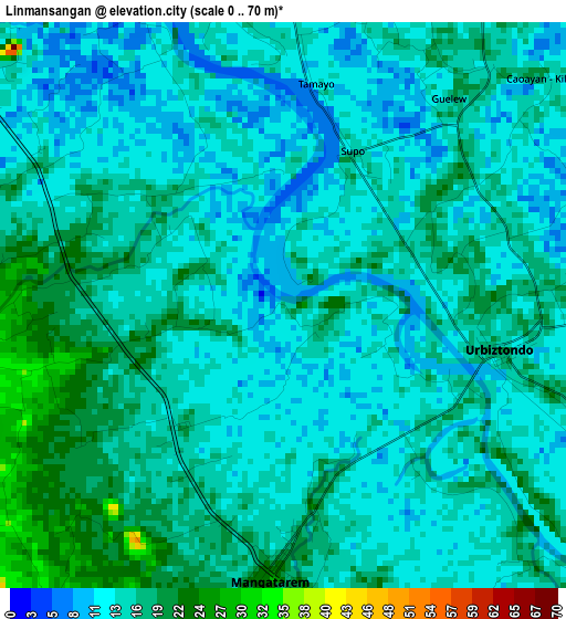
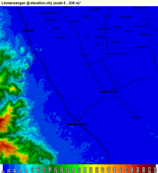
Below is the Elevation map of Linmansangan, which displays elevation range with different colors. Scale of the first map is from 0 to 70 m (0 to 230 ft) with average elevation of 15.1 meters (=50 ft) [note 1]
These maps also provides idea of topography and contour of this city, they are displayed at different zoom levels. More info about maps, scale and edge coordinates you can find below images.
| \ | Map #1 | Map #2 | Topo.Map |
| Scale [m] | 0..70 m | 0..638 m | × |
| Scale [ft] | 0..230 ft | 0..2093 ft | × |
| Average | 15.1 m = 50 ft | 47.2 m = 155 ft | × |
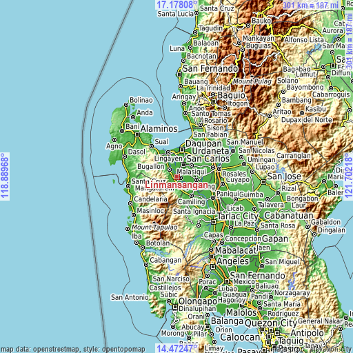
| Width | 9.4 km = 5.8 mi | 18.8 km = 11.7 mi | 300.8 km = 186.9 mi |
| Height | 9.4 km = 5.8 mi | 18.8 km = 11.7 mi | 300.9 km = 187 mi |
| ↑Max Latitude | 15.872074° | 15.91434° | 17.17808° |
| Latitude at center | 15.8298° | 15.8298° | 15.8298° |
| ↓Min Latitude | 15.787517° | 15.745225° | 14.47247° |
| ← Min Longitude | 120.251985° | 120.208039° | 118.88968° |
| Longitude center | 120.29593° | 120.29593° | 120.29593° |
| →Max Longitude | 120.339875° | 120.383821° | 121.70218° |
Nearby cities:
Cities around Linmansangan sort by population:
• Urbiztondo elevation 19 m
3.7 km,  102°
102°
• Mangatarem 24 m
4.7 km,  184°
184°
• Tamayo 14 m
5.4 km,  347°
347°
• Dorongan Punta 16 m
3.3 km,  120°
120°
• Ninoy 13 m
6.1 km,  302°
302°
• Libas 17 m
5.8 km,  22°
22°
• Bayaoas 21 m
3.4 km,  278°
278°
• Angatel 20 m
5.7 km, 117°
• Malibong East 15 m
3.8 km,  60°
60°
• Real 18 m
5.8 km,  113°
113°
• Pogonsili 30 m
4 km,  254°
254°
• Calsib 17 m
3.9 km, 299°
Multilingual:
 En español:
Linmansangan elevación 15 m.
 En France:
Linmansangan élévation 15 m.
 Auf Deutsch:
Linmansangan höhe über dem Meeresspiegel ist 15 m.

Sources and notes:
- [note 1] Map square and city borders are not equal. Map elevation data is calculated only from area inside that square.
- [src 1] Elevation data from geonames database provided with same terms of usage.
- [src 2] The elevation map of Linmansangan is generated using elevation data from NASA's 3 arcsec (90m) resolution SRTM data.
- [src 3] Base (background) map © OpenStreetMap contributors tiles are generated by Geofabrik and OpenTopoMap.
Copyright & License:
This Linmansangan Elevation Map is licensed under CC BY-SA. You may reuse any part from this page, if you give a proper credit by linking to this URL:
 More info on terms of use page.