Macalelon elevation
Macalelon (Calabarzon, Province of Quezon), Philippines elevation is 12 meters and Macalelon elevation in feet is 39 ft above sea level [src 1]. Macalelon is a populated place (feature code) with elevation that is 76 meters (249 ft) smaller than average city elevation in Philippines.
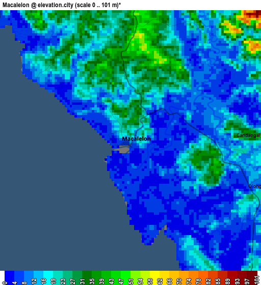
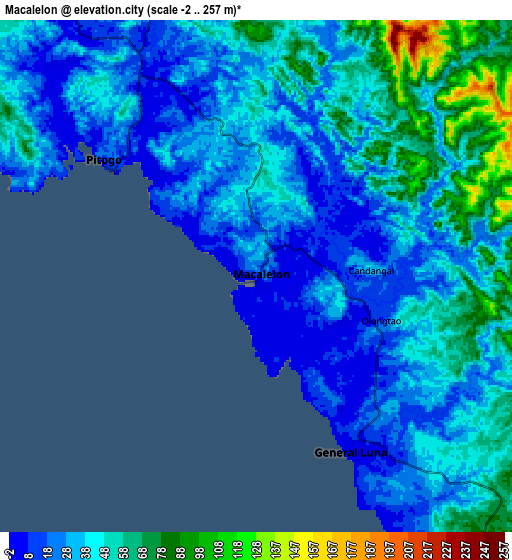
Below is the Elevation map of Macalelon, which displays elevation range with different colors. Scale of the first map is from 0 to 101 m (0 to 331 ft) with average elevation of 15.7 meters (=52 ft) [note 1]
These maps also provides idea of topography and contour of this city, they are displayed at different zoom levels. More info about maps, scale and edge coordinates you can find below images.
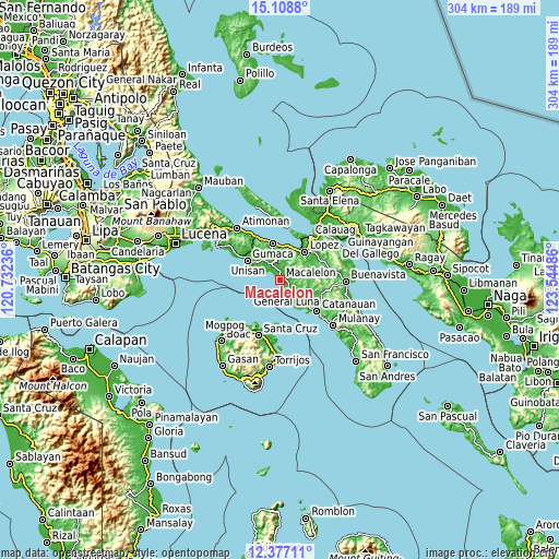
| \ | Map #1 | Map #2 | Topo.Map |
| Scale [m] | 0..101 m | -2..257 m | × |
| Scale [ft] | 0..331 ft | -7..843 ft | × |
| Average | 15.7 m = 52 ft | 39.3 m = 129 ft | × |
| Width | 9.49 km = 5.9 mi | 18.99 km = 11.8 mi | 303.7 km = 188.7 mi |
| Height | 9.49 km = 5.9 mi | 18.99 km = 11.8 mi | 303.8 km = 188.8 mi |
| ↑Max Latitude | 13.789623° | 13.832297° | 15.1088° |
| Latitude at center | 13.74694° | 13.74694° | 13.74694° |
| ↓Min Latitude | 13.70425° | 13.661551° | 12.37711° |
| ← Min Longitude | 122.094665° | 122.050719° | 120.73236° |
| Longitude center | 122.13861° | 122.13861° | 122.13861° |
| →Max Longitude | 122.182555° | 122.226501° | 123.54486° |
Nearby cities:
Cities around Macalelon sort by population:
• Gumaca elevation 7 m
19.8 km,  347°
347°
• General Luna 6 m
7.6 km,  152°
152°
• Pitogo 17 m
6.6 km,  308°
308°
• Rosario 15 m
19.5 km,  48°
48°
• Camohaguin 11 m
18.3 km,  9°
9°
• San Isidro 65 m
17 km,  138°
138°
• San Vicente 7 m
18.1 km,  23°
23°
• Progreso 50 m
18.7 km,  343°
343°
• San Francisco 67 m
16.8 km,  73°
73°
• Mabunga 18 m
15 km,  329°
329°
• Tuhian 41 m
16.3 km, 148°
• Panikihan 14 m
18 km,  357°
357°
Multilingual:
 En español:
Macalelon elevación 12 m.
 En France:
Macalelon élévation 12 m.
 Auf Deutsch:
Macalelon höhe über dem Meeresspiegel ist 12 m.

Sources and notes:
- [note 1] Map square and city borders are not equal. Map elevation data is calculated only from area inside that square.
- [src 1] Elevation data from geonames database provided with same terms of usage.
- [src 2] The elevation map of Macalelon is generated using elevation data from NASA's 3 arcsec (90m) resolution SRTM data.
- [src 3] Base (background) map © OpenStreetMap contributors tiles are generated by Geofabrik and OpenTopoMap.
Copyright & License:
This Macalelon Elevation Map is licensed under CC BY-SA. You may reuse any part from this page, if you give a proper credit by linking to this URL:
 More info on terms of use page.