Mauraro elevation
Mauraro (Bicol, Province of Albay), Philippines elevation is 159 meters and Mauraro elevation in feet is 522 ft above sea level [src 1]. Mauraro is a populated place (feature code) with elevation that is 71 meters (233 ft) bigger than average city elevation in Philippines.
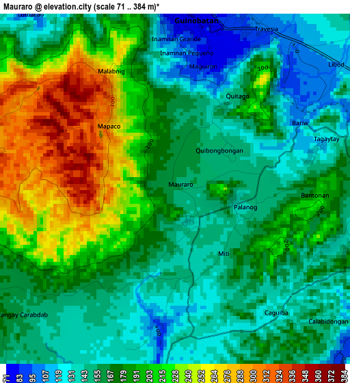
Below is the Elevation map of Mauraro, which displays elevation range with different colors. Scale of the first map is from 71 to 384 m (233 to 1260 ft) with average elevation of 178.6 meters (=586 ft) [note 1]
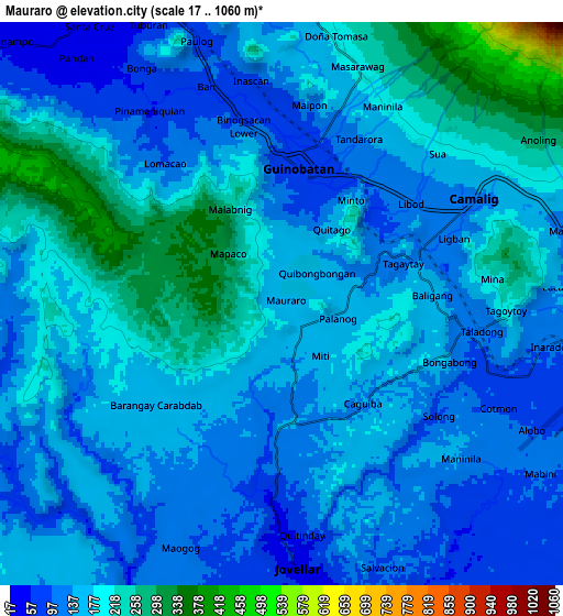
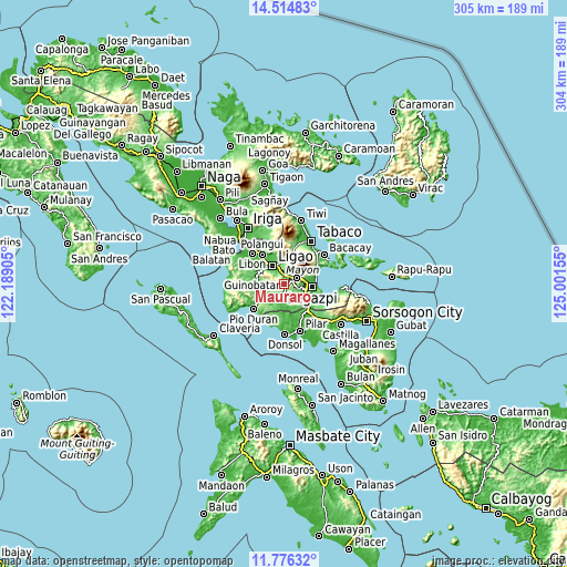
These maps also provides idea of topography and contour of this city, they are displayed at different zoom levels. More info about maps, scale and edge coordinates you can find below images.
| \ | Map #1 | Map #2 | Topo.Map |
| Scale [m] | 71..384 m | 17..1060 m | × |
| Scale [ft] | 233..1260 ft | 56..3478 ft | × |
| Average | 178.6 m = 586 ft | 165.3 m = 542 ft | × |
| Width | 9.52 km = 5.9 mi | 19.03 km = 11.8 mi | 304.5 km = 189.2 mi |
| Height | 9.52 km = 5.9 mi | 19.03 km = 11.8 mi | 304.5 km = 189.2 mi |
| ↑Max Latitude | 13.192189° | 13.234971° | 14.51483° |
| Latitude at center | 13.1494° | 13.1494° | 13.1494° |
| ↓Min Latitude | 13.106603° | 13.063799° | 11.77632° |
| ← Min Longitude | 123.551355° | 123.507409° | 122.18905° |
| Longitude center | 123.5953° | 123.5953° | 123.5953° |
| →Max Longitude | 123.639245° | 123.683191° | 125.00155° |
Nearby cities:
Cities around Mauraro sort by population:
• Baligang elevation 150 m
5.2 km,  84°
84°
• Tinago 130 m
7 km,  57°
57°
• Jovellar 33 m
8.9 km,  176°
176°
• San Rafael 165 m
7.5 km,  3°
3°
• Masaraway 198 m
8.9 km,  13°
13°
• Salvacion 103 m
9.5 km,  165°
165°
• Cotmon 93 m
8.2 km,  115°
115°
• Bonga 67 m
8.9 km,  326°
326°
• Cabognon 174 m
9.7 km,  67°
67°
• Lacag 146 m
9.3 km,  85°
85°
• Camalig 131 m
7.4 km, 60°
• Guinobatan 74 m
4.7 km, 4°
Multilingual:
 En español:
Mauraro elevación 159 m.
 En France:
Mauraro élévation 159 m.


Sources and notes:
- [note 1] Map square and city borders are not equal. Map elevation data is calculated only from area inside that square.
- [src 1] Elevation data from geonames database provided with same terms of usage.
- [src 2] The elevation map of Mauraro is generated using elevation data from NASA's 3 arcsec (90m) resolution SRTM data.
- [src 3] Base (background) map © OpenStreetMap contributors tiles are generated by Geofabrik and OpenTopoMap.
Copyright & License:
This Mauraro Elevation Map is licensed under CC BY-SA. You may reuse any part from this page, if you give a proper credit by linking to this URL:
 More info on terms of use page.