Maya elevation
Maya (Central Visayas, Province of Cebu), Philippines elevation is 13 meters and Maya elevation in feet is 43 ft above sea level [src 1]. Maya is a populated place (feature code) with elevation that is 75 meters (246 ft) smaller than average city elevation in Philippines.
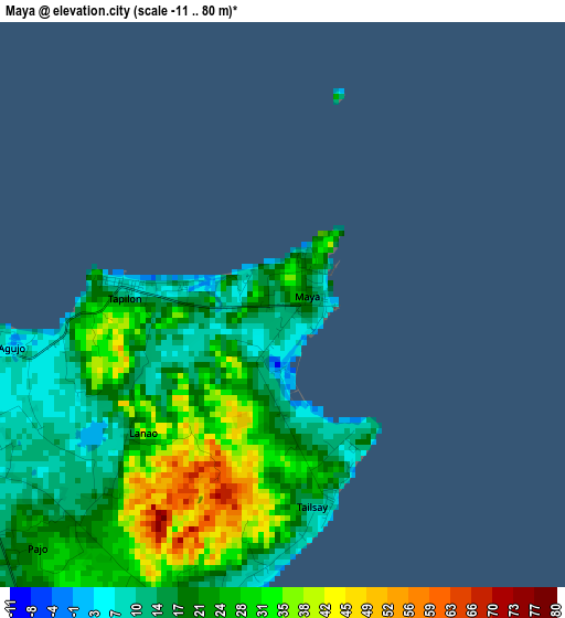
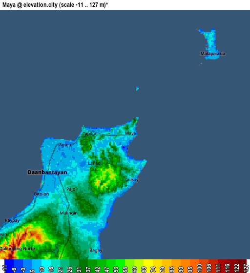
Below is the Elevation map of Maya, which displays elevation range with different colors. Scale of the first map is from -11 to 80 m (-36 to 262 ft) with average elevation of 22.5 meters (=74 ft) [note 1]
These maps also provides idea of topography and contour of this city, they are displayed at different zoom levels. More info about maps, scale and edge coordinates you can find below images.
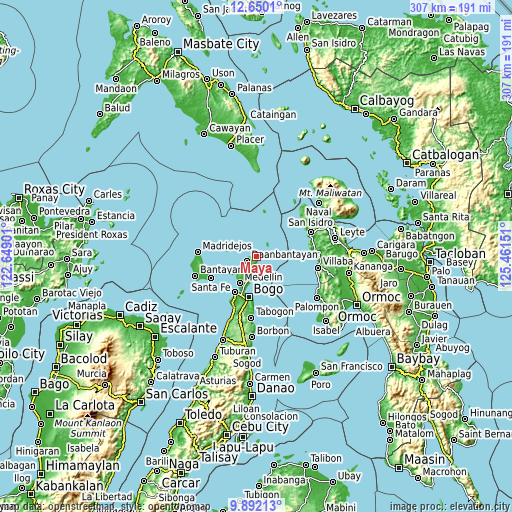
| \ | Map #1 | Map #2 | Topo.Map |
| Scale [m] | -11..80 m | -11..127 m | × |
| Scale [ft] | -36..262 ft | -36..417 ft | × |
| Average | 22.5 m = 74 ft | 26.5 m = 87 ft | × |
| Width | 9.58 km = 6 mi | 19.17 km = 11.9 mi | 306.7 km = 190.6 mi |
| Height | 9.58 km = 6 mi | 19.17 km = 11.9 mi | 306.7 km = 190.6 mi |
| ↑Max Latitude | 11.317514° | 11.360602° | 12.6501° |
| Latitude at center | 11.27442° | 11.27442° | 11.27442° |
| ↓Min Latitude | 11.23132° | 11.188213° | 9.89213° |
| ← Min Longitude | 124.011315° | 123.967369° | 122.64901° |
| Longitude center | 124.05526° | 124.05526° | 124.05526° |
| →Max Longitude | 124.099205° | 124.143151° | 125.46151° |
Nearby cities:
Cities around Maya sort by population:
• Daanbantayan elevation 7 m
5.4 km,  235°
235°
• Tapilon 7 m
2.7 km,  277°
277°
• Bagay 12 m
9 km,  194°
194°
• Biton 9 m
7.7 km,  232°
232°
• Talisay 37 m
3.3 km,  180°
180°
• Logon 6 m
9 km,  46°
46°
• Tominhao 40 m
4.8 km,  206°
206°
• Pajo 12 m
6.1 km, 232°
• Lanao 9 m
3.9 km, 239°
• Calape 10 m
11.2 km, 192°
• Paypay 5 m
10.8 km, 232°
• Tinubuan 75 m
11.1 km, 207°
Multilingual:
 En español:
Maya elevación 13 m.
 En France:
Maya élévation 13 m.


Sources and notes:
- [note 1] Map square and city borders are not equal. Map elevation data is calculated only from area inside that square.
- [src 1] Elevation data from geonames database provided with same terms of usage.
- [src 2] The elevation map of Maya is generated using elevation data from NASA's 3 arcsec (90m) resolution SRTM data.
- [src 3] Base (background) map © OpenStreetMap contributors tiles are generated by Geofabrik and OpenTopoMap.
Copyright & License:
This Maya Elevation Map is licensed under CC BY-SA. You may reuse any part from this page, if you give a proper credit by linking to this URL:
 More info on terms of use page.