Miranda elevation
Miranda (Western Visayas, Province of Negros Occidental), Philippines elevation is 9 meters and Miranda elevation in feet is 30 ft above sea level [src 1]. Miranda is a populated place (feature code) with elevation that is 79 meters (259 ft) smaller than average city elevation in Philippines.
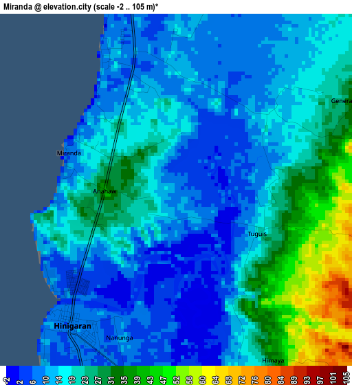
Below is the Elevation map of Miranda, which displays elevation range with different colors. Scale of the first map is from -2 to 105 m (-7 to 344 ft) with average elevation of 18.7 meters (=61 ft) [note 1]
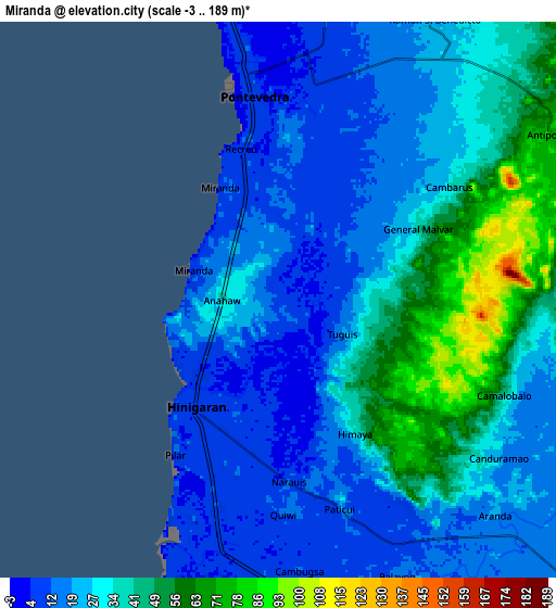
These maps also provides idea of topography and contour of this city, they are displayed at different zoom levels. More info about maps, scale and edge coordinates you can find below images.
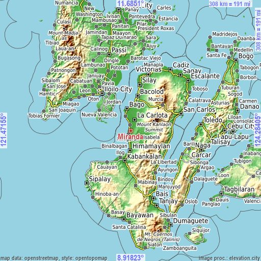
| \ | Map #1 | Map #2 | Topo.Map |
| Scale [m] | -2..105 m | -3..189 m | × |
| Scale [ft] | -7..344 ft | -10..620 ft | × |
| Average | 18.7 m = 61 ft | 28.5 m = 94 ft | × |
| Width | 9.61 km = 6 mi | 19.23 km = 11.9 mi | 307.6 km = 191.1 mi |
| Height | 9.61 km = 6 mi | 19.23 km = 11.9 mi | 307.7 km = 191.2 mi |
| ↑Max Latitude | 10.347934° | 10.391161° | 11.6851° |
| Latitude at center | 10.3047° | 10.3047° | 10.3047° |
| ↓Min Latitude | 10.261461° | 10.218215° | 8.91823° |
| ← Min Longitude | 122.833855° | 122.789909° | 121.47155° |
| Longitude center | 122.8778° | 122.8778° | 122.8778° |
| →Max Longitude | 122.921745° | 122.965691° | 124.28405° |
Nearby cities:
Cities around Miranda sort by population:
• Hinigaran elevation 10 m
4.8 km,  218°
218°
• Pontevedra 10 m
7.8 km,  352°
352°
• Antipolo 77 m
11.1 km,  58°
58°
• Carmen Grande 16 m
9.2 km,  26°
26°
• Aranda 21 m
10.7 km,  135°
135°
• Calape 21 m
11.1 km,  108°
108°
• San Juan 10 m
9.2 km, 351°
• Baliwagan 9 m
10.4 km,  8°
8°
• Patique 18 m
7.9 km,  162°
162°
• Camalobalo 29 m
8.7 km, 113°
• Marawis 17 m
6.7 km,  171°
171°
• Canroma 14 m
6.2 km,  1°
1°
Multilingual:
 En español:
Miranda elevación 9 m.
 En France:
Miranda élévation 9 m.


Sources and notes:
- [note 1] Map square and city borders are not equal. Map elevation data is calculated only from area inside that square.
- [src 1] Elevation data from geonames database provided with same terms of usage.
- [src 2] The elevation map of Miranda is generated using elevation data from NASA's 3 arcsec (90m) resolution SRTM data.
- [src 3] Base (background) map © OpenStreetMap contributors tiles are generated by Geofabrik and OpenTopoMap.
Copyright & License:
This Miranda Elevation Map is licensed under CC BY-SA. You may reuse any part from this page, if you give a proper credit by linking to this URL:
 More info on terms of use page.