Mungo elevation
Mungo (Cagayan Valley, Province of Cagayan), Philippines elevation is 41 meters and Mungo elevation in feet is 135 ft above sea level [src 1]. Mungo is a populated place (feature code) with elevation that is 47 meters (154 ft) smaller than average city elevation in Philippines.
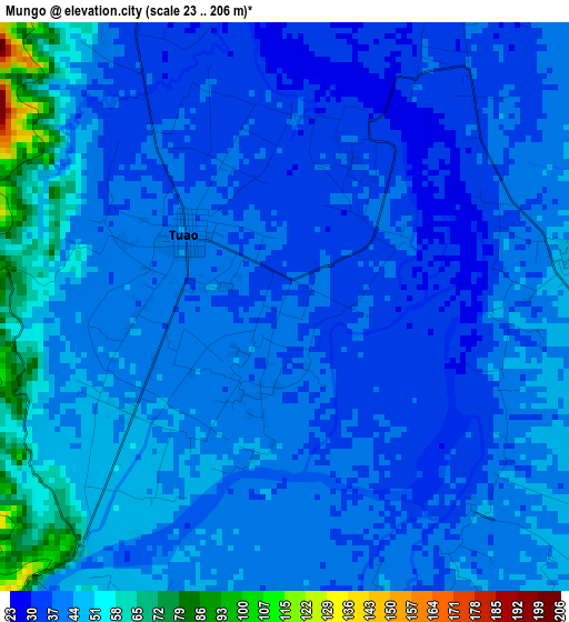
Below is the Elevation map of Mungo, which displays elevation range with different colors. Scale of the first map is from 23 to 206 m (75 to 676 ft) with average elevation of 43 meters (=141 ft) [note 1]
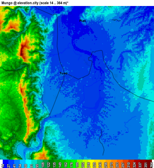
These maps also provides idea of topography and contour of this city, they are displayed at different zoom levels. More info about maps, scale and edge coordinates you can find below images.
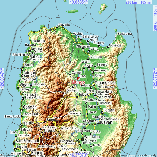
| \ | Map #1 | Map #2 | Topo.Map |
| Scale [m] | 23..206 m | 14..364 m | × |
| Scale [ft] | 75..676 ft | 46..1194 ft | × |
| Average | 43 m = 141 ft | 77 m = 253 ft | × |
| Width | 9.31 km = 5.8 mi | 18.62 km = 11.6 mi | 297.9 km = 185.1 mi |
| Height | 9.31 km = 5.8 mi | 18.62 km = 11.6 mi | 297.9 km = 185.1 mi |
| ↑Max Latitude | 17.765974° | 17.807819° | 19.05851° |
| Latitude at center | 17.72412° | 17.72412° | 17.72412° |
| ↓Min Latitude | 17.682256° | 17.640382° | 16.37973° |
| ← Min Longitude | 121.427015° | 121.383069° | 120.06471° |
| Longitude center | 121.47096° | 121.47096° | 121.47096° |
| →Max Longitude | 121.514905° | 121.558851° | 122.87721° |
Nearby cities:
Cities around Mungo sort by population:
• Piat elevation 56 m
7.4 km,  5°
5°
• Bagumbayan 43 m
2.5 km,  266°
266°
• Alabug 38 m
1 km,  340°
340°
• Maguilling 37 m
5.8 km,  29°
29°
• Conner 88 m
17.2 km,  297°
297°
• Accusilian 38 m
2.8 km, 341°
• Battung 43 m
1.3 km,  262°
262°
• Dagupan 41 m
4.4 km,  126°
126°
• Pata 45 m
3.4 km,  106°
106°
• Tuao 37 m
2.1 km,  311°
311°
• Lallayug 49 m
3.6 km,  238°
238°
• Pinukpuk 74 m
14.1 km,  212°
212°
Multilingual:
 En español:
Mungo elevación 41 m.
 En France:
Mungo élévation 41 m.


Sources and notes:
- [note 1] Map square and city borders are not equal. Map elevation data is calculated only from area inside that square.
- [src 1] Elevation data from geonames database provided with same terms of usage.
- [src 2] The elevation map of Mungo is generated using elevation data from NASA's 3 arcsec (90m) resolution SRTM data.
- [src 3] Base (background) map © OpenStreetMap contributors tiles are generated by Geofabrik and OpenTopoMap.
Copyright & License:
This Mungo Elevation Map is licensed under CC BY-SA. You may reuse any part from this page, if you give a proper credit by linking to this URL:
 More info on terms of use page.