Paradahan elevation
Paradahan (Calabarzon, Province of Cavite), Philippines elevation is 66 meters and Paradahan elevation in feet is 217 ft above sea level [src 1]. Paradahan is a populated place (feature code) with elevation that is 22 meters (72 ft) smaller than average city elevation in Philippines.
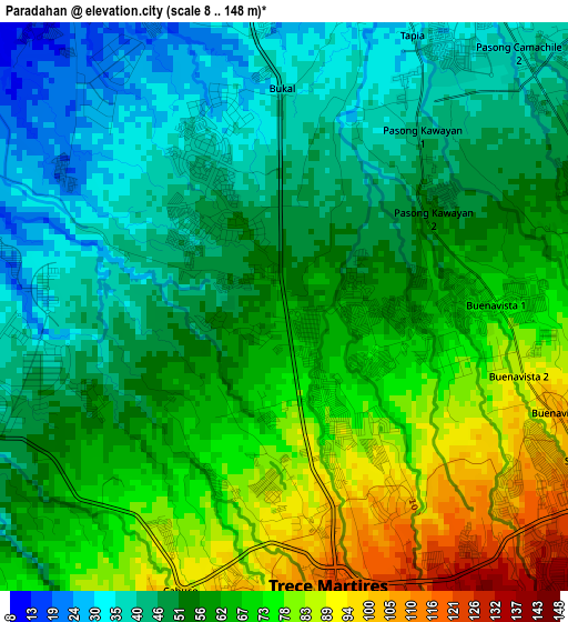
Below is the Elevation map of Paradahan, which displays elevation range with different colors. Scale of the first map is from 8 to 148 m (26 to 486 ft) with average elevation of 59.1 meters (=194 ft) [note 1]
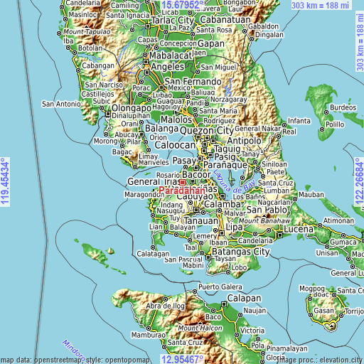
These maps also provides idea of topography and contour of this city, they are displayed at different zoom levels. More info about maps, scale and edge coordinates you can find below images.
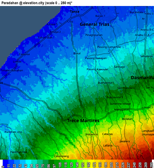
| \ | Map #1 | Map #2 | Topo.Map |
| Scale [m] | 8..148 m | 0..280 m | × |
| Scale [ft] | 26..486 ft | 0..919 ft | × |
| Average | 59.1 m = 194 ft | 74.5 m = 244 ft | × |
| Width | 9.47 km = 5.9 mi | 18.94 km = 11.8 mi | 303 km = 188.3 mi |
| Height | 9.47 km = 5.9 mi | 18.94 km = 11.8 mi | 303 km = 188.3 mi |
| ↑Max Latitude | 14.363806° | 14.406373° | 15.67952° |
| Latitude at center | 14.32123° | 14.32123° | 14.32123° |
| ↓Min Latitude | 14.278646° | 14.236055° | 12.95467° |
| ← Min Longitude | 120.816645° | 120.772699° | 119.45434° |
| Longitude center | 120.86059° | 120.86059° | 120.86059° |
| →Max Longitude | 120.904535° | 120.948481° | 122.26684° |
Nearby cities:
Cities around Paradahan sort by population:
• Dasmariñas elevation 82 m
8.2 km,  83°
83°
• General Trias 22 m
7.7 km,  17°
17°
• Manggahan 119 m
5.5 km,  126°
126°
• Halayhay 7 m
7.8 km,  318°
318°
• Palangue 61 m
6.7 km,  232°
232°
• Pasong Kawayan Primero 47 m
3.3 km,  42°
42°
• Sabang 38 m
6.4 km,  254°
254°
• Javalera 198 m
9.2 km,  139°
139°
• Bitangan 178 m
7.7 km,  165°
165°
• Malainen Luma 50 m
9.6 km, 233°
• Aliang 124 m
4.9 km,  149°
149°
• Tanza 14 m
8.6 km,  356°
356°
Multilingual:
 En español:
Paradahan elevación 66 m.
 En France:
Paradahan élévation 66 m.
 Auf Deutsch:
Paradahan höhe über dem Meeresspiegel ist 66 m.

Sources and notes:
- [note 1] Map square and city borders are not equal. Map elevation data is calculated only from area inside that square.
- [src 1] Elevation data from geonames database provided with same terms of usage.
- [src 2] The elevation map of Paradahan is generated using elevation data from NASA's 3 arcsec (90m) resolution SRTM data.
- [src 3] Base (background) map © OpenStreetMap contributors tiles are generated by Geofabrik and OpenTopoMap.
Copyright & License:
This Paradahan Elevation Map is licensed under CC BY-SA. You may reuse any part from this page, if you give a proper credit by linking to this URL:
 More info on terms of use page.