Pinayagan Norte elevation
Pinayagan Norte (Central Visayas, Bohol), Philippines elevation is 16 meters and Pinayagan Norte elevation in feet is 52 ft above sea level [src 1]. Pinayagan Norte is a populated place (feature code) with elevation that is 72 meters (236 ft) smaller than average city elevation in Philippines.
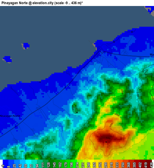
Below is the Elevation map of Pinayagan Norte, which displays elevation range with different colors. Scale of the first map is from -9 to 436 m (-30 to 1430 ft) with average elevation of 97.4 meters (=320 ft) [note 1]
These maps also provides idea of topography and contour of this city, they are displayed at different zoom levels. More info about maps, scale and edge coordinates you can find below images.
| \ | Map #1 | Map #2 | Topo.Map |
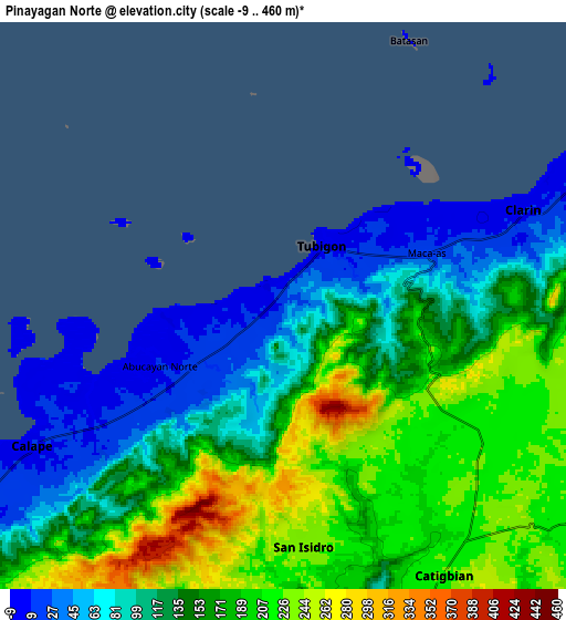
| Scale [m] | -9..436 m | -9..460 m | × |
| Scale [ft] | -30..1430 ft | -30..1509 ft | × |
| Average | 97.4 m = 320 ft | 149.6 m = 491 ft | × |
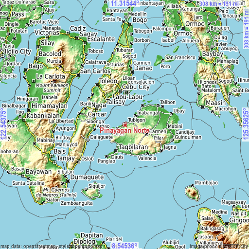
| Width | 9.63 km = 6 mi | 19.25 km = 12 mi | 308 km = 191.4 mi |
| Height | 9.63 km = 6 mi | 19.25 km = 12 mi | 308 km = 191.4 mi |
| ↑Max Latitude | 9.976614° | 10.019892° | 11.31544° |
| Latitude at center | 9.93333° | 9.93333° | 9.93333° |
| ↓Min Latitude | 9.890041° | 9.846746° | 8.54536° |
| ← Min Longitude | 123.906055° | 123.862109° | 122.54375° |
| Longitude center | 123.95° | 123.95° | 123.95° |
| →Max Longitude | 123.993945° | 124.037891° | 125.35625° |
Nearby cities:
Cities around Pinayagan Norte sort by population:
• Tibigan elevation 3 m
2.5 km,  33°
33°
• San Isidro 2 m
7.5 km,  255°
255°
• Sagbayan 265 m
15.7 km,  97°
97°
• Calape 8 m
9.4 km,  240°
240°
• Clarin 10 m
8.8 km,  69°
69°
• Canmaya Diot 233 m
15.8 km,  87°
87°
• Panaytayon 11 m
4.1 km,  63°
63°
• Nahawan 12 m
11.6 km, 68°
• Abucayan 2 m
3.9 km, 262°
• Bagacay 385 m
8.2 km,  205°
205°
• Inabanga 2 m
16.8 km,  49°
49°
• Catigbian 224 m
10.7 km,  149°
149°
Multilingual:
 En español:
Pinayagan Norte elevación 16 m.
 En France:
Pinayagan Norte élévation 16 m.
 Auf Deutsch:
Pinayagan Norte höhe über dem Meeresspiegel ist 16 m.

Sources and notes:
- [note 1] Map square and city borders are not equal. Map elevation data is calculated only from area inside that square.
- [src 1] Elevation data from geonames database provided with same terms of usage.
- [src 2] The elevation map of Pinayagan Norte is generated using elevation data from NASA's 3 arcsec (90m) resolution SRTM data.
- [src 3] Base (background) map © OpenStreetMap contributors tiles are generated by Geofabrik and OpenTopoMap.
Copyright & License:
This Pinayagan Norte Elevation Map is licensed under CC BY-SA. You may reuse any part from this page, if you give a proper credit by linking to this URL:
 More info on terms of use page.