Plaridel elevation
Plaridel (Central Luzon, Province of Bulacan), Philippines elevation is 14 meters and Plaridel elevation in feet is 46 ft above sea level [src 1]. Plaridel is a seat of a third-order administrative division (feature code) with elevation that is 74 meters (243 ft) smaller than average city elevation in Philippines.
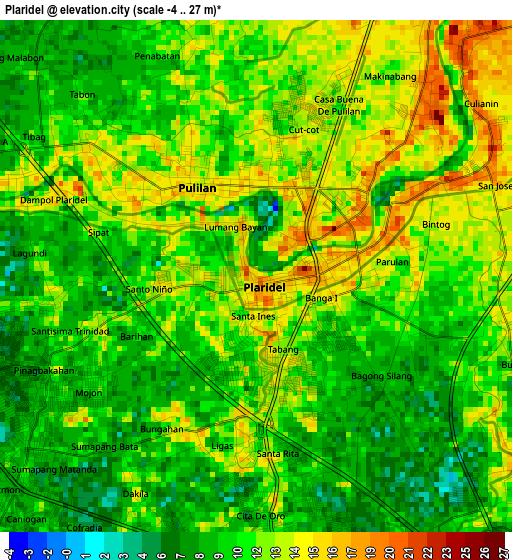
Below is the Elevation map of Plaridel, which displays elevation range with different colors. Scale of the first map is from -4 to 27 m (-13 to 89 ft) with average elevation of 11 meters (=36 ft) [note 1]
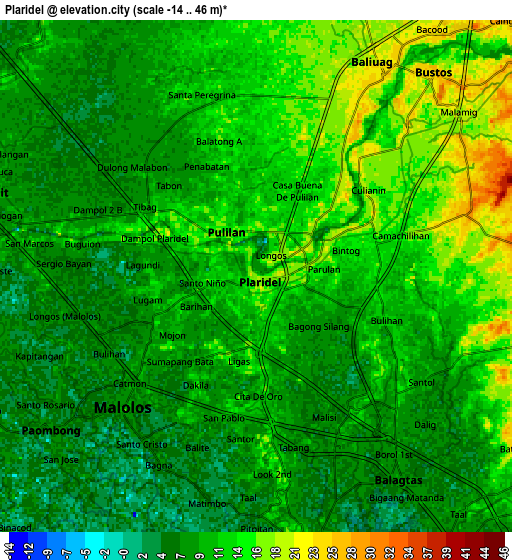
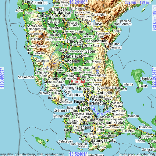
These maps also provides idea of topography and contour of this city, they are displayed at different zoom levels. More info about maps, scale and edge coordinates you can find below images.
| \ | Map #1 | Map #2 | Topo.Map |
| Scale [m] | -4..27 m | -14..46 m | × |
| Scale [ft] | -13..89 ft | -46..151 ft | × |
| Average | 11 m = 36 ft | 10.6 m = 35 ft | × |
| Width | 9.44 km = 5.9 mi | 18.89 km = 11.7 mi | 302.2 km = 187.8 mi |
| Height | 9.44 km = 5.9 mi | 18.89 km = 11.7 mi | 302.2 km = 187.8 mi |
| ↑Max Latitude | 14.929686° | 14.972144° | 16.24186° |
| Latitude at center | 14.88722° | 14.88722° | 14.88722° |
| ↓Min Latitude | 14.844746° | 14.802263° | 13.52401° |
| ← Min Longitude | 120.813275° | 120.769329° | 119.45097° |
| Longitude center | 120.85722° | 120.85722° | 120.85722° |
| →Max Longitude | 120.901165° | 120.945111° | 122.26347° |
Nearby cities:
Cities around Plaridel sort by population:
• Malolos elevation 9 m
6.9 km,  226°
226°
• Baliuag 22 m
8.6 km,  29°
29°
• Pulilan 16 m
1.8 km,  331°
331°
• Guiguinto 10 m
6.6 km,  154°
154°
• Balagtas 12 m
7.9 km,  172°
172°
• Culianin 15 m
5.4 km,  55°
55°
• Bulihan 13 m
4.3 km,  107°
107°
• Pulong Gubat 12 m
6.1 km,  120°
120°
• Liciada 27 m
8.6 km,  69°
69°
• Dampol 16 m
4.1 km,  292°
292°
• Balite 8 m
7.6 km,  276°
276°
• Manatal 12 m
6.5 km,  100°
100°
Multilingual:
 En español:
Plaridel elevación 14 m.
 En France:
Plaridel élévation 14 m.


Sources and notes:
- [note 1] Map square and city borders are not equal. Map elevation data is calculated only from area inside that square.
- [src 1] Elevation data from geonames database provided with same terms of usage.
- [src 2] The elevation map of Plaridel is generated using elevation data from NASA's 3 arcsec (90m) resolution SRTM data.
- [src 3] Base (background) map © OpenStreetMap contributors tiles are generated by Geofabrik and OpenTopoMap.
Copyright & License:
This Plaridel Elevation Map is licensed under CC BY-SA. You may reuse any part from this page, if you give a proper credit by linking to this URL:
 More info on terms of use page.