Punao elevation
Punao (Western Visayas, Province of Negros Occidental), Philippines elevation is 126 meters and Punao elevation in feet is 413 ft above sea level [src 1]. Punao is a populated place (feature code) with elevation that is 38 meters (125 ft) bigger than average city elevation in Philippines.
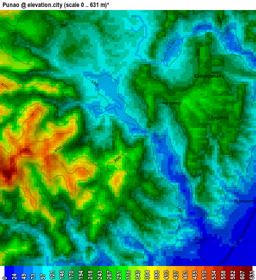
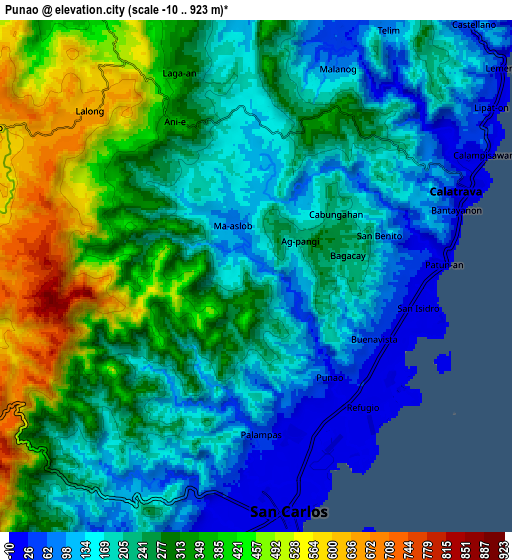
Below is the Elevation map of Punao, which displays elevation range with different colors. Scale of the first map is from 0 to 631 m (0 to 2070 ft) with average elevation of 192.8 meters (=633 ft) [note 1]
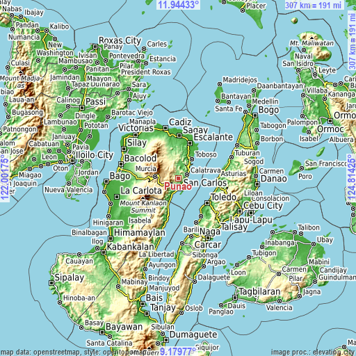
These maps also provides idea of topography and contour of this city, they are displayed at different zoom levels. More info about maps, scale and edge coordinates you can find below images.
| \ | Map #1 | Map #2 | Topo.Map |
| Scale [m] | 0..631 m | -10..923 m | × |
| Scale [ft] | 0..2070 ft | -33..3028 ft | × |
| Average | 192.8 m = 633 ft | 256.8 m = 843 ft | × |
| Width | 9.61 km = 6 mi | 19.21 km = 11.9 mi | 307.4 km = 191 mi |
| Height | 9.61 km = 6 mi | 19.21 km = 11.9 mi | 307.4 km = 191 mi |
| ↑Max Latitude | 10.608357° | 10.651548° | 11.94433° |
| Latitude at center | 10.56516° | 10.56516° | 10.56516° |
| ↓Min Latitude | 10.521957° | 10.478747° | 9.17977° |
| ← Min Longitude | 123.364055° | 123.320109° | 122.00175° |
| Longitude center | 123.408° | 123.408° | 123.408° |
| →Max Longitude | 123.451945° | 123.495891° | 124.81425° |
Nearby cities:
Cities around Punao sort by population:
• Ualog elevation 114 m
1.9 km,  301°
301°
• Guadalupe 6 m
12.9 km,  197°
197°
• Calatrava 8 m
8.9 km,  68°
68°
• Palampas 52 m
4.7 km,  162°
162°
• Minapasoc 258 m
16.2 km,  336°
336°
• Bugang 211 m
19.7 km,  355°
355°
• Prosperidad 697 m
12.2 km,  243°
243°
• Patonan 1 m
7 km,  87°
87°
• Buenavista 43 m
4.9 km,  118°
118°
• Calampisauan 11 m
9 km,  56°
56°
• Hacienda Refugio 7 m
6.3 km,  140°
140°
• Agpangi 234 m
2.1 km,  51°
51°
Multilingual:
 En español:
Punao elevación 126 m.
 En France:
Punao élévation 126 m.


Sources and notes:
- [note 1] Map square and city borders are not equal. Map elevation data is calculated only from area inside that square.
- [src 1] Elevation data from geonames database provided with same terms of usage.
- [src 2] The elevation map of Punao is generated using elevation data from NASA's 3 arcsec (90m) resolution SRTM data.
- [src 3] Base (background) map © OpenStreetMap contributors tiles are generated by Geofabrik and OpenTopoMap.
Copyright & License:
This Punao Elevation Map is licensed under CC BY-SA. You may reuse any part from this page, if you give a proper credit by linking to this URL:
 More info on terms of use page.