Quilo-quilo elevation
Quilo-quilo (Calabarzon, Province of Batangas), Philippines elevation is 158 meters and Quilo-quilo elevation in feet is 518 ft above sea level [src 1]. Quilo-quilo is a populated place (feature code) with elevation that is 70 meters (230 ft) bigger than average city elevation in Philippines.
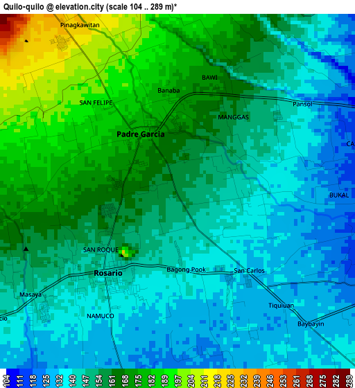
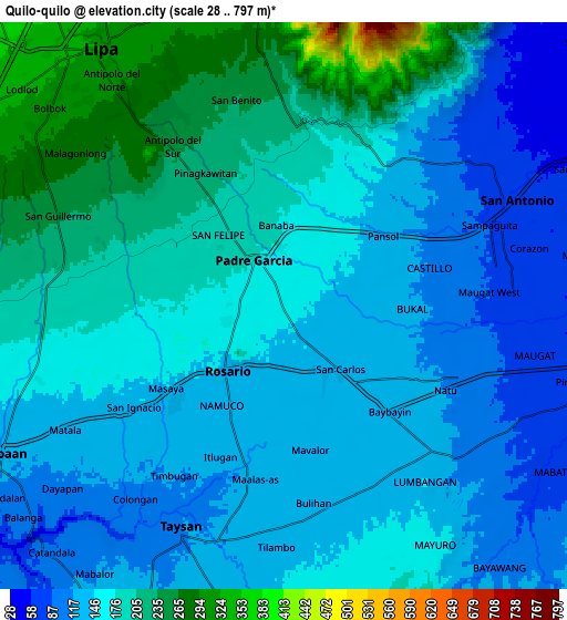
Below is the Elevation map of Quilo-quilo, which displays elevation range with different colors. Scale of the first map is from 104 to 289 m (341 to 948 ft) with average elevation of 154.2 meters (=506 ft) [note 1]
These maps also provides idea of topography and contour of this city, they are displayed at different zoom levels. More info about maps, scale and edge coordinates you can find below images.
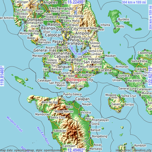
| \ | Map #1 | Map #2 | Topo.Map |
| Scale [m] | 104..289 m | 28..797 m | × |
| Scale [ft] | 341..948 ft | 92..2615 ft | × |
| Average | 154.2 m = 506 ft | 163.3 m = 536 ft | × |
| Width | 9.49 km = 5.9 mi | 18.98 km = 11.8 mi | 303.6 km = 188.6 mi |
| Height | 9.49 km = 5.9 mi | 18.98 km = 11.8 mi | 303.6 km = 188.6 mi |
| ↑Max Latitude | 13.906461° | 13.949114° | 15.22495° |
| Latitude at center | 13.8638° | 13.8638° | 13.8638° |
| ↓Min Latitude | 13.821131° | 13.778454° | 12.49462° |
| ← Min Longitude | 121.176955° | 121.133009° | 119.81465° |
| Longitude center | 121.2209° | 121.2209° | 121.2209° |
| →Max Longitude | 121.264845° | 121.308791° | 122.62715° |
Nearby cities:
Cities around Quilo-quilo sort by population:
• Banaybanay elevation 152 m
2.7 km,  235°
235°
• Pansol 147 m
3.5 km,  43°
43°
• San Carlos 135 m
3.3 km,  137°
137°
• Padre Garcia 173 m
1.9 km,  336°
336°
• Bulihan 141 m
6.8 km,  153°
153°
• San Miguel 184 m
2.7 km,  294°
294°
• Rizal 205 m
6.8 km,  281°
281°
• Banaba 199 m
3.8 km, 342°
• Santa Cruz 179 m
3.5 km,  272°
272°
• Maugat West 84 m
6.7 km,  92°
92°
• San Francisco 145 m
4.8 km, 37°
• Rosario 145 m
2.7 km,  220°
220°
Multilingual:
 En español:
Quilo-quilo elevación 158 m.
 En France:
Quilo-quilo élévation 158 m.
 Auf Deutsch:
Quilo-quilo höhe über dem Meeresspiegel ist 158 m.

Sources and notes:
- [note 1] Map square and city borders are not equal. Map elevation data is calculated only from area inside that square.
- [src 1] Elevation data from geonames database provided with same terms of usage.
- [src 2] The elevation map of Quilo-quilo is generated using elevation data from NASA's 3 arcsec (90m) resolution SRTM data.
- [src 3] Base (background) map © OpenStreetMap contributors tiles are generated by Geofabrik and OpenTopoMap.
Copyright & License:
This Quilo-quilo Elevation Map is licensed under CC BY-SA. You may reuse any part from this page, if you give a proper credit by linking to this URL:
 More info on terms of use page.