San Antonio elevation
San Antonio (Central Luzon, Province of Nueva Ecija), Philippines elevation is 22 meters and San Antonio elevation in feet is 72 ft above sea level [src 1]. San Antonio is a seat of a third-order administrative division (feature code) with elevation that is 66 meters (217 ft) smaller than average city elevation in Philippines.
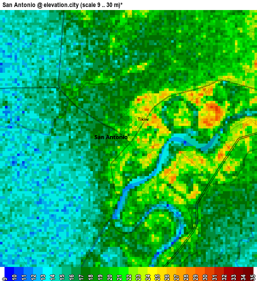
Below is the Elevation map of San Antonio, which displays elevation range with different colors. Scale of the first map is from 9 to 30 m (30 to 98 ft) with average elevation of 17.1 meters (=56 ft) [note 1]
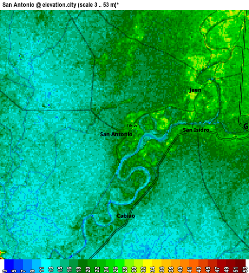
These maps also provides idea of topography and contour of this city, they are displayed at different zoom levels. More info about maps, scale and edge coordinates you can find below images.
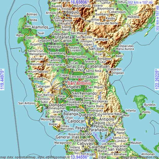
| \ | Map #1 | Map #2 | Topo.Map |
| Scale [m] | 9..30 m | 3..53 m | × |
| Scale [ft] | 30..98 ft | 10..174 ft | × |
| Average | 17.1 m = 56 ft | 16.8 m = 55 ft | × |
| Width | 9.43 km = 5.9 mi | 18.85 km = 11.7 mi | 301.6 km = 187.4 mi |
| Height | 9.43 km = 5.9 mi | 18.85 km = 11.7 mi | 301.6 km = 187.4 mi |
| ↑Max Latitude | 15.348582° | 15.390956° | 16.65806° |
| Latitude at center | 15.3062° | 15.3062° | 15.3062° |
| ↓Min Latitude | 15.263809° | 15.22141° | 13.94556° |
| ← Min Longitude | 120.812055° | 120.768109° | 119.44975° |
| Longitude center | 120.856° | 120.856° | 120.856° |
| →Max Longitude | 120.899945° | 120.943891° | 122.26225° |
Nearby cities:
Cities around San Antonio sort by population:
• Cabiao elevation 15 m
6.4 km,  181°
181°
• Papaya 17 m
2.7 km,  305°
305°
• San Francisco 21 m
5.8 km,  342°
342°
• Santo Cristo 22 m
3.8 km,  105°
105°
• San Mariano 24 m
2.7 km,  52°
52°
• Entablado 19 m
2.3 km,  160°
160°
• Alua 23 m
4.2 km,  81°
81°
• Calaba 23 m
2.1 km, 107°
• Buliran Segundo 21 m
4.5 km,  165°
165°
• Santa Cruz 21 m
0.4 km, 305°
• Tikiw 24 m
0.8 km,  40°
40°
• Lawang Kupang 22 m
4.7 km,  2°
2°
Multilingual:
 En español:
San Antonio elevación 22 m.
 En France:
San Antonio élévation 22 m.
 Auf Deutsch:
San Antonio höhe über dem Meeresspiegel ist 22 m.

Sources and notes:
- [note 1] Map square and city borders are not equal. Map elevation data is calculated only from area inside that square.
- [src 1] Elevation data from geonames database provided with same terms of usage.
- [src 2] The elevation map of San Antonio is generated using elevation data from NASA's 3 arcsec (90m) resolution SRTM data.
- [src 3] Base (background) map © OpenStreetMap contributors tiles are generated by Geofabrik and OpenTopoMap.
Copyright & License:
This San Antonio Elevation Map is licensed under CC BY-SA. You may reuse any part from this page, if you give a proper credit by linking to this URL:
 More info on terms of use page.