San Eugenio elevation
San Eugenio (Ilocos, Province of La Union), Philippines elevation is 27 meters and San Eugenio elevation in feet is 89 ft above sea level [src 1]. San Eugenio is a populated place (feature code) with elevation that is 61 meters (200 ft) smaller than average city elevation in Philippines.
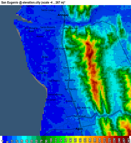
Below is the Elevation map of San Eugenio, which displays elevation range with different colors. Scale of the first map is from -4 to 267 m (-13 to 876 ft) with average elevation of 48 meters (=157 ft) [note 1]
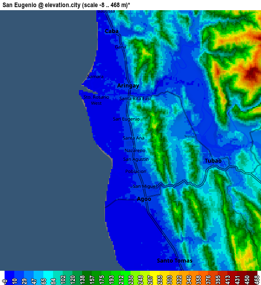
These maps also provides idea of topography and contour of this city, they are displayed at different zoom levels. More info about maps, scale and edge coordinates you can find below images.
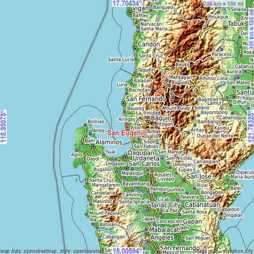
| \ | Map #1 | Map #2 | Topo.Map |
| Scale [m] | -4..267 m | -8..468 m | × |
| Scale [ft] | -13..876 ft | -26..1535 ft | × |
| Average | 48 m = 157 ft | 81.7 m = 268 ft | × |
| Width | 9.38 km = 5.8 mi | 18.75 km = 11.7 mi | 300 km = 186.4 mi |
| Height | 9.38 km = 5.8 mi | 18.75 km = 11.7 mi | 300.1 km = 186.5 mi |
| ↑Max Latitude | 16.401961° | 16.444114° | 17.70434° |
| Latitude at center | 16.3598° | 16.3598° | 16.3598° |
| ↓Min Latitude | 16.317629° | 16.27545° | 15.00594° |
| ← Min Longitude | 120.313055° | 120.269109° | 118.95075° |
| Longitude center | 120.357° | 120.357° | 120.357° |
| →Max Longitude | 120.400945° | 120.444891° | 121.76325° |
Nearby cities:
Cities around San Eugenio sort by population:
• Aringay elevation 16 m
3.8 km,  355°
355°
• Lloren 48 m
8.6 km,  110°
110°
• Caba 14 m
8.1 km,  350°
350°
• Macalva Norte 54 m
3.4 km, 111°
• Leones East 33 m
3.7 km,  84°
84°
• Halog West 23 m
6.2 km, 82°
• Pugo 65 m
12.5 km, 109°
• Namboongan 7 m
6.6 km,  162°
162°
• Bail 49 m
9.4 km,  150°
150°
• Santo Tomas 8 m
9.2 km,  165°
165°
• Tubao 32 m
6 km,  102°
102°
• Agoo 20 m
4.2 km, 166°
Multilingual:
 En español:
San Eugenio elevación 27 m.
 En France:
San Eugenio élévation 27 m.
 Auf Deutsch:
San Eugenio höhe über dem Meeresspiegel ist 27 m.

Sources and notes:
- [note 1] Map square and city borders are not equal. Map elevation data is calculated only from area inside that square.
- [src 1] Elevation data from geonames database provided with same terms of usage.
- [src 2] The elevation map of San Eugenio is generated using elevation data from NASA's 3 arcsec (90m) resolution SRTM data.
- [src 3] Base (background) map © OpenStreetMap contributors tiles are generated by Geofabrik and OpenTopoMap.
Copyright & License:
This San Eugenio Elevation Map is licensed under CC BY-SA. You may reuse any part from this page, if you give a proper credit by linking to this URL:
 More info on terms of use page.