San Francisco elevation
San Francisco (Central Luzon, Province of Pampanga), Philippines elevation is 22 meters and San Francisco elevation in feet is 72 ft above sea level [src 1]. San Francisco is a populated place (feature code) with elevation that is 66 meters (217 ft) smaller than average city elevation in Philippines.
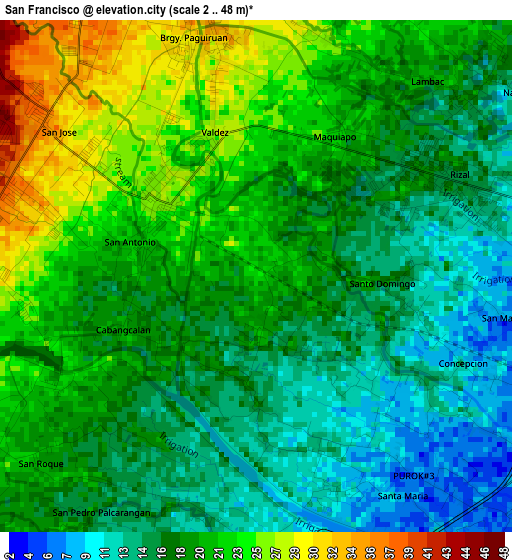
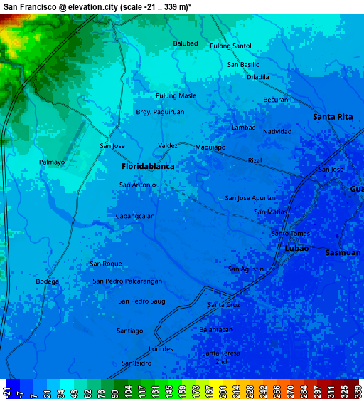
Below is the Elevation map of San Francisco, which displays elevation range with different colors. Scale of the first map is from 2 to 48 m (7 to 157 ft) with average elevation of 18.6 meters (=61 ft) [note 1]
These maps also provides idea of topography and contour of this city, they are displayed at different zoom levels. More info about maps, scale and edge coordinates you can find below images.
| \ | Map #1 | Map #2 | Topo.Map |
| Scale [m] | 2..48 m | -21..339 m | × |
| Scale [ft] | 7..157 ft | -69..1112 ft | × |
| Average | 18.6 m = 61 ft | 26.8 m = 88 ft | × |
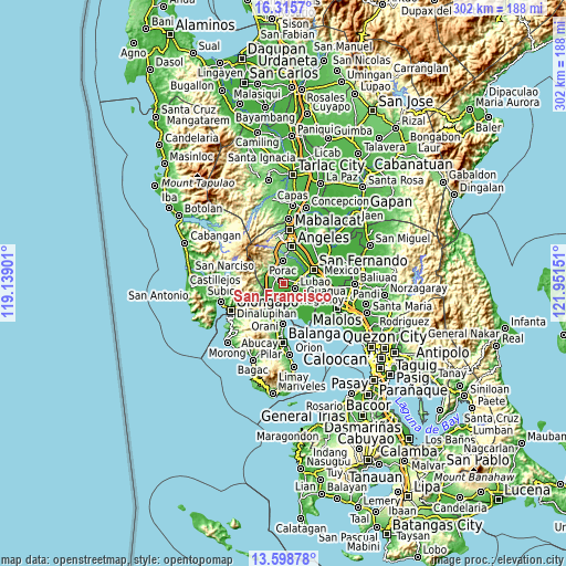
| Width | 9.44 km = 5.9 mi | 18.88 km = 11.7 mi | 302.1 km = 187.7 mi |
| Height | 9.44 km = 5.9 mi | 18.88 km = 11.7 mi | 302.1 km = 187.7 mi |
| ↑Max Latitude | 15.003991° | 15.046434° | 16.3157° |
| Latitude at center | 14.96154° | 14.96154° | 14.96154° |
| ↓Min Latitude | 14.91908° | 14.876612° | 13.59878° |
| ← Min Longitude | 120.501315° | 120.457369° | 119.13901° |
| Longitude center | 120.54526° | 120.54526° | 120.54526° |
| →Max Longitude | 120.589205° | 120.633151° | 121.95151° |
Nearby cities:
Cities around San Francisco sort by population:
• Lubao elevation 11 m
6.4 km,  111°
111°
• Santa Cruz 8 m
5.9 km,  157°
157°
• San Roque Dau First 15 m
3.8 km,  62°
62°
• Pulungmasle 25 m
4.5 km,  17°
17°
• Santa Teresa First 11 m
4.1 km, 160°
• Calantas 45 m
7.1 km,  335°
335°
• Del Carmen 34 m
5 km,  346°
346°
• Pias 35 m
6.4 km, 16°
• Santo Domingo 20 m
1.3 km,  71°
71°
• Gutad 23 m
7.1 km,  237°
237°
• Maquiapo 22 m
3 km,  28°
28°
• Floridablanca 25 m
2.5 km,  314°
314°
Multilingual:
 En español:
San Francisco elevación 22 m.
 En France:
San Francisco élévation 22 m.
 Auf Deutsch:
San Francisco höhe über dem Meeresspiegel ist 22 m.

Sources and notes:
- [note 1] Map square and city borders are not equal. Map elevation data is calculated only from area inside that square.
- [src 1] Elevation data from geonames database provided with same terms of usage.
- [src 2] The elevation map of San Francisco is generated using elevation data from NASA's 3 arcsec (90m) resolution SRTM data.
- [src 3] Base (background) map © OpenStreetMap contributors tiles are generated by Geofabrik and OpenTopoMap.
Copyright & License:
This San Francisco Elevation Map is licensed under CC BY-SA. You may reuse any part from this page, if you give a proper credit by linking to this URL:
 More info on terms of use page.