San Joaquin elevation
San Joaquin (Western Visayas, Province of Iloilo), Philippines elevation is 19 meters and San Joaquin elevation in feet is 62 ft above sea level [src 1]. San Joaquin is a seat of a third-order administrative division (feature code) with elevation that is 69 meters (226 ft) smaller than average city elevation in Philippines.
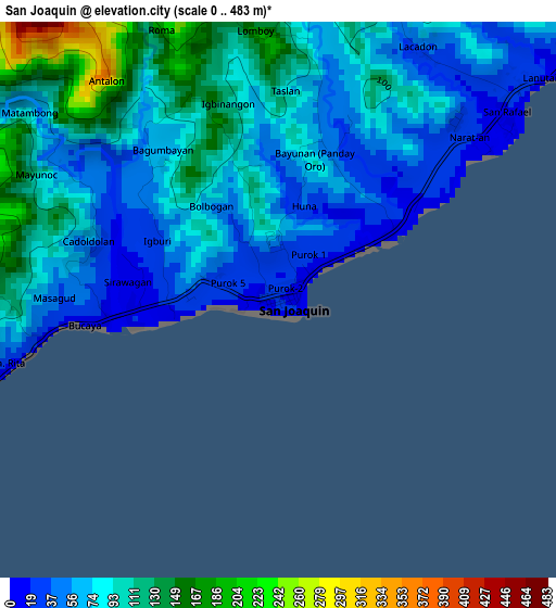
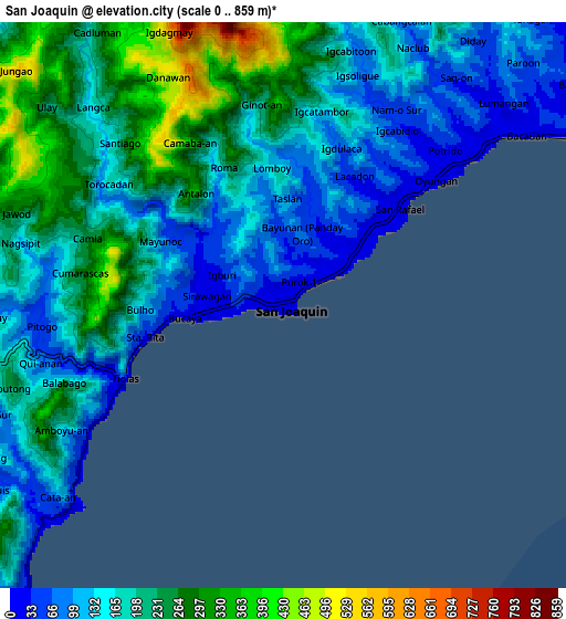
Below is the Elevation map of San Joaquin, which displays elevation range with different colors. Scale of the first map is from 0 to 483 m (0 to 1585 ft) with average elevation of 82 meters (=269 ft) [note 1]
These maps also provides idea of topography and contour of this city, they are displayed at different zoom levels. More info about maps, scale and edge coordinates you can find below images.
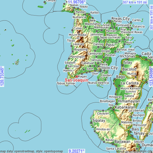
| \ | Map #1 | Map #2 | Topo.Map |
| Scale [m] | 0..483 m | 0..859 m | × |
| Scale [ft] | 0..1585 ft | 0..2818 ft | × |
| Average | 82 m = 269 ft | 185.9 m = 610 ft | × |
| Width | 9.61 km = 6 mi | 19.21 km = 11.9 mi | 307.4 km = 191 mi |
| Height | 9.61 km = 6 mi | 19.21 km = 11.9 mi | 307.4 km = 191 mi |
| ↑Max Latitude | 10.631194° | 10.674382° | 11.96706° |
| Latitude at center | 10.588° | 10.588° | 10.588° |
| ↓Min Latitude | 10.5448° | 10.501594° | 9.20271° |
| ← Min Longitude | 122.095755° | 122.051809° | 120.73345° |
| Longitude center | 122.1397° | 122.1397° | 122.1397° |
| →Max Longitude | 122.183645° | 122.227591° | 123.54595° |
Nearby cities:
Cities around San Joaquin sort by population:
• Miagao elevation 22 m
12.2 km,  59°
59°
• Guimbal 14 m
21.7 km,  67°
67°
• Buga 43 m
19.9 km,  44°
44°
• Hamtic 8 m
21.4 km,  306°
306°
• Buyuan 9 m
25.5 km, 68°
• Tobias Fornier 17 m
22.7 km,  249°
249°
• Egaña 26 m
22.7 km,  321°
321°
• Lawigan 13 m
15.4 km,  222°
222°
• Piape I 7 m
24.1 km, 310°
• Catungan 19 m
24.5 km,  326°
326°
• Igcocolo 31 m
22.6 km, 60°
• Igbaras 49 m
19.8 km, 44°
Multilingual:
 En español:
San Joaquin elevación 19 m.
 En France:
San Joaquin élévation 19 m.
 Auf Deutsch:
San Joaquin höhe über dem Meeresspiegel ist 19 m.

Sources and notes:
- [note 1] Map square and city borders are not equal. Map elevation data is calculated only from area inside that square.
- [src 1] Elevation data from geonames database provided with same terms of usage.
- [src 2] The elevation map of San Joaquin is generated using elevation data from NASA's 3 arcsec (90m) resolution SRTM data.
- [src 3] Base (background) map © OpenStreetMap contributors tiles are generated by Geofabrik and OpenTopoMap.
Copyright & License:
This San Joaquin Elevation Map is licensed under CC BY-SA. You may reuse any part from this page, if you give a proper credit by linking to this URL:
 More info on terms of use page.