San Manuel elevation
San Manuel (Central Luzon, Province of Tarlac), Philippines elevation is 35 meters and San Manuel elevation in feet is 115 ft above sea level [src 1]. San Manuel is a populated place (feature code) with elevation that is 53 meters (174 ft) smaller than average city elevation in Philippines.
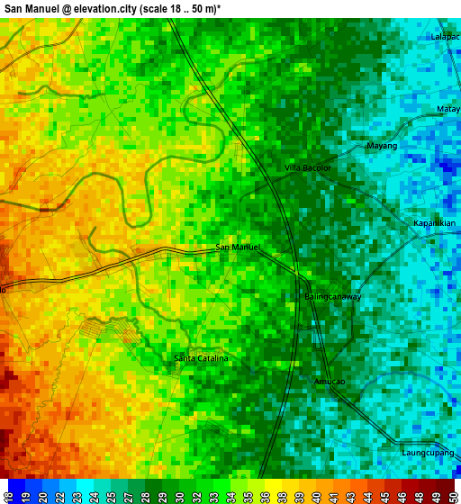
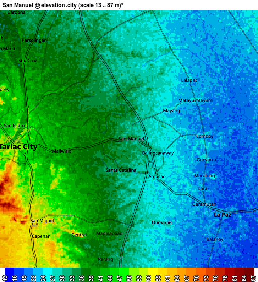
Below is the Elevation map of San Manuel, which displays elevation range with different colors. Scale of the first map is from 18 to 50 m (59 to 164 ft) with average elevation of 31.9 meters (=105 ft) [note 1]
These maps also provides idea of topography and contour of this city, they are displayed at different zoom levels. More info about maps, scale and edge coordinates you can find below images.
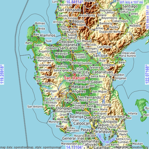
| \ | Map #1 | Map #2 | Topo.Map |
| Scale [m] | 18..50 m | 13..87 m | × |
| Scale [ft] | 59..164 ft | 43..285 ft | × |
| Average | 31.9 m = 105 ft | 32.7 m = 107 ft | × |
| Width | 9.42 km = 5.9 mi | 18.84 km = 11.7 mi | 301.3 km = 187.2 mi |
| Height | 9.42 km = 5.9 mi | 18.84 km = 11.7 mi | 301.4 km = 187.3 mi |
| ↑Max Latitude | 15.532875° | 15.575211° | 16.84114° |
| Latitude at center | 15.49053° | 15.49053° | 15.49053° |
| ↓Min Latitude | 15.448177° | 15.405815° | 14.13104° |
| ← Min Longitude | 120.621485° | 120.577539° | 119.25918° |
| Longitude center | 120.66543° | 120.66543° | 120.66543° |
| →Max Longitude | 120.709375° | 120.753321° | 122.07168° |
Nearby cities:
Cities around San Manuel sort by population:
• Balingcanaway elevation 31 m
2.3 km,  113°
113°
• Mapalacsiao 40 m
7.1 km,  191°
191°
• Bundoc 28 m
5.6 km,  95°
95°
• Bakulong 39 m
6 km,  331°
331°
• Dumarais 29 m
6.9 km,  155°
155°
• Lomboy 25 m
5.6 km,  87°
87°
• San Jacinto 33 m
6.1 km,  4°
4°
• Matayumtayum 25 m
5.6 km,  58°
58°
• Maluid 34 m
6.7 km,  348°
348°
• Amucao 27 m
3.7 km,  142°
142°
• San Pascual 33 m
1.2 km,  8°
8°
• Tariji 42 m
6.4 km,  301°
301°
Multilingual:
 En español:
San Manuel elevación 35 m.
 En France:
San Manuel élévation 35 m.
 Auf Deutsch:
San Manuel höhe über dem Meeresspiegel ist 35 m.

Sources and notes:
- [note 1] Map square and city borders are not equal. Map elevation data is calculated only from area inside that square.
- [src 1] Elevation data from geonames database provided with same terms of usage.
- [src 2] The elevation map of San Manuel is generated using elevation data from NASA's 3 arcsec (90m) resolution SRTM data.
- [src 3] Base (background) map © OpenStreetMap contributors tiles are generated by Geofabrik and OpenTopoMap.
Copyright & License:
This San Manuel Elevation Map is licensed under CC BY-SA. You may reuse any part from this page, if you give a proper credit by linking to this URL:
 More info on terms of use page.