San Miguel elevation
San Miguel (Western Visayas, Province of Guimaras), Philippines elevation is 173 meters and San Miguel elevation in feet is 568 ft above sea level [src 1]. San Miguel is a populated place (feature code) with elevation that is 85 meters (279 ft) bigger than average city elevation in Philippines.
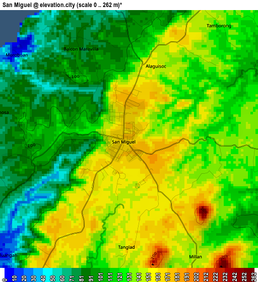
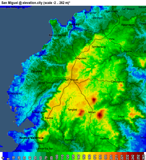
Below is the Elevation map of San Miguel, which displays elevation range with different colors. Scale of the first map is from 0 to 262 m (0 to 860 ft) with average elevation of 122.3 meters (=401 ft) [note 1]
These maps also provides idea of topography and contour of this city, they are displayed at different zoom levels. More info about maps, scale and edge coordinates you can find below images.
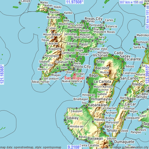
| \ | Map #1 | Map #2 | Topo.Map |
| Scale [m] | 0..262 m | -2..262 m | × |
| Scale [ft] | 0..860 ft | -7..860 ft | × |
| Average | 122.3 m = 401 ft | 93.7 m = 307 ft | × |
| Width | 9.61 km = 6 mi | 19.21 km = 11.9 mi | 307.4 km = 191 mi |
| Height | 9.61 km = 6 mi | 19.21 km = 11.9 mi | 307.4 km = 191 mi |
| ↑Max Latitude | 10.639253° | 10.68244° | 11.97508° |
| Latitude at center | 10.59606° | 10.59606° | 10.59606° |
| ↓Min Latitude | 10.552861° | 10.509656° | 9.2108° |
| ← Min Longitude | 122.545955° | 122.502009° | 121.18365° |
| Longitude center | 122.5899° | 122.5899° | 122.5899° |
| →Max Longitude | 122.633845° | 122.677791° | 123.99615° |
Nearby cities:
Cities around San Miguel sort by population:
• Iloilo elevation 8 m
11.6 km,  346°
346°
• Jordan 54 m
7 km,  5°
5°
• Cabano 10 m
12.1 km,  94°
94°
• Salvacion 19 m
10.1 km,  16°
16°
• Santa Teresa 93 m
3.4 km,  249°
249°
• Concordia 96 m
10.8 km,  204°
204°
• Calaya 89 m
12.2 km,  161°
161°
• Constancia 135 m
5.6 km, 90°
• Nueva Valencia 20 m
11.4 km,  213°
213°
• Morobuan 26 m
5.1 km,  310°
310°
• Rizal 75 m
10.8 km,  26°
26°
• Piña 125 m
7.2 km,  47°
47°
Multilingual:
 En español:
San Miguel elevación 173 m.
 En France:
San Miguel élévation 173 m.
 Auf Deutsch:
San Miguel höhe über dem Meeresspiegel ist 173 m.

Sources and notes:
- [note 1] Map square and city borders are not equal. Map elevation data is calculated only from area inside that square.
- [src 1] Elevation data from geonames database provided with same terms of usage.
- [src 2] The elevation map of San Miguel is generated using elevation data from NASA's 3 arcsec (90m) resolution SRTM data.
- [src 3] Base (background) map © OpenStreetMap contributors tiles are generated by Geofabrik and OpenTopoMap.
Copyright & License:
This San Miguel Elevation Map is licensed under CC BY-SA. You may reuse any part from this page, if you give a proper credit by linking to this URL:
 More info on terms of use page.