Tabio elevation
Tabio (Cordillera, Province of Benguet), Philippines elevation is 1397 meters and Tabio elevation in feet is 4583 ft above sea level [src 1]. Tabio is a populated place (feature code) with elevation that is 1309 meters (4295 ft) bigger than average city elevation in Philippines.
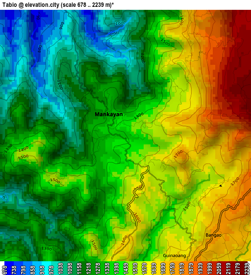
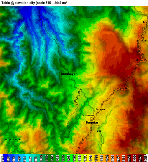
Below is the Elevation map of Tabio, which displays elevation range with different colors. Scale of the first map is from 678 to 2239 m (2224 to 7346 ft) with average elevation of 1404.4 meters (=4608 ft) [note 1]
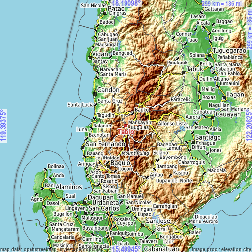
These maps also provides idea of topography and contour of this city, they are displayed at different zoom levels. More info about maps, scale and edge coordinates you can find below images.
| \ | Map #1 | Map #2 | Topo.Map |
| Scale [m] | 678..2239 m | 515..2449 m | × |
| Scale [ft] | 2224..7346 ft | 1690..8035 ft | × |
| Average | 1404.4 m = 4608 ft | 1480.6 m = 4858 ft | × |
| Width | 9.35 km = 5.8 mi | 18.71 km = 11.6 mi | 299.3 km = 186 mi |
| Height | 9.35 km = 5.8 mi | 18.71 km = 11.6 mi | 299.3 km = 186 mi |
| ↑Max Latitude | 16.892054° | 16.934098° | 18.19098° |
| Latitude at center | 16.85° | 16.85° | 16.85° |
| ↓Min Latitude | 16.807937° | 16.765864° | 15.49945° |
| ← Min Longitude | 120.756055° | 120.712109° | 119.39375° |
| Longitude center | 120.8° | 120.8° | 120.8° |
| →Max Longitude | 120.843945° | 120.887891° | 122.20625° |
Nearby cities:
Cities around Tabio sort by population:
• Mankayan elevation 1203 m
2.3 km,  308°
308°
• Baculongan 1615 m
6.6 km,  147°
147°
• Buguias 1463 m
14.5 km,  167°
167°
• Monamon 1957 m
9.6 km,  67°
67°
• Guinsadan 1279 m
14.6 km,  29°
29°
• Bangao 1759 m
5.4 km,  126°
126°
• Gambang 1702 m
11.3 km,  189°
189°
• Comillas Norte 515 m
13.4 km,  335°
335°
• Bulalacao 1571 m
1.8 km, 150°
• Sadsadan 1361 m
11.7 km,  37°
37°
• Dalipey 1234 m
10.5 km,  237°
237°
• Ampusungan 1369 m
11.1 km,  226°
226°
Multilingual:
 En español:
Tabio elevación 1397 m.
 En France:
Tabio élévation 1397 m.


Sources and notes:
- [note 1] Map square and city borders are not equal. Map elevation data is calculated only from area inside that square.
- [src 1] Elevation data from geonames database provided with same terms of usage.
- [src 2] The elevation map of Tabio is generated using elevation data from NASA's 3 arcsec (90m) resolution SRTM data.
- [src 3] Base (background) map © OpenStreetMap contributors tiles are generated by Geofabrik and OpenTopoMap.
Copyright & License:
This Tabio Elevation Map is licensed under CC BY-SA. You may reuse any part from this page, if you give a proper credit by linking to this URL:
 More info on terms of use page.