Tal I Mun Doc elevation
Tal I Mun Doc (Central Luzon, Province of Pampanga), Philippines elevation is 36 meters and Tal I Mun Doc elevation in feet is 118 ft above sea level [src 1]. Tal I Mun Doc is a populated place (feature code) with elevation that is 52 meters (171 ft) smaller than average city elevation in Philippines.
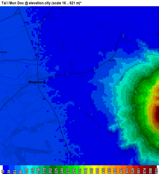
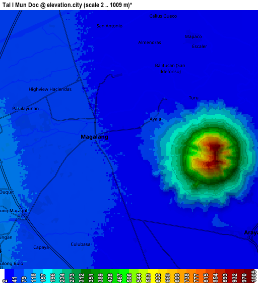
Below is the Elevation map of Tal I Mun Doc, which displays elevation range with different colors. Scale of the first map is from 16 to 621 m (52 to 2037 ft) with average elevation of 66.4 meters (=218 ft) [note 1]
These maps also provides idea of topography and contour of this city, they are displayed at different zoom levels. More info about maps, scale and edge coordinates you can find below images.
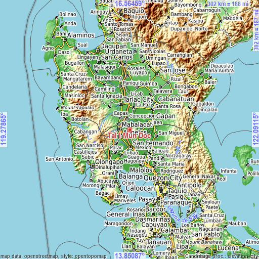
| \ | Map #1 | Map #2 | Topo.Map |
| Scale [m] | 16..621 m | 2..1009 m | × |
| Scale [ft] | 52..2037 ft | 7..3310 ft | × |
| Average | 66.4 m = 218 ft | 72.7 m = 239 ft | × |
| Width | 9.43 km = 5.9 mi | 18.86 km = 11.7 mi | 301.7 km = 187.5 mi |
| Height | 9.43 km = 5.9 mi | 18.86 km = 11.7 mi | 301.8 km = 187.5 mi |
| ↑Max Latitude | 15.254501° | 15.296894° | 16.56459° |
| Latitude at center | 15.2121° | 15.2121° | 15.2121° |
| ↓Min Latitude | 15.16969° | 15.127272° | 13.85087° |
| ← Min Longitude | 120.640955° | 120.597009° | 119.27865° |
| Longitude center | 120.6849° | 120.6849° | 120.6849° |
| →Max Longitude | 120.728845° | 120.772791° | 122.09115° |
Nearby cities:
Cities around Tal I Mun Doc sort by population:
• Magalang elevation 46 m
2.7 km,  277°
277°
• Pandacaqui 51 m
5.5 km,  216°
216°
• Cauayan 40 m
6.9 km,  191°
191°
• Anao 29 m
7.9 km,  174°
174°
• Arenas 37 m
4.6 km,  178°
178°
• San Isidro 51 m
5.3 km,  298°
298°
• Buensuseso 44 m
2.4 km,  211°
211°
• Almendras 28 m
7.2 km,  11°
11°
• Panlinlang 29 m
3.6 km,  153°
153°
• Santo Niño 29 m
4 km,  46°
46°
• San Antonio 31 m
6.6 km, 176°
• San Roque 43 m
6.5 km,  327°
327°
Multilingual:
 En español:
Tal I Mun Doc elevación 36 m.
 En France:
Tal I Mun Doc élévation 36 m.
 Auf Deutsch:
Tal I Mun Doc höhe über dem Meeresspiegel ist 36 m.

Sources and notes:
- [note 1] Map square and city borders are not equal. Map elevation data is calculated only from area inside that square.
- [src 1] Elevation data from geonames database provided with same terms of usage.
- [src 2] The elevation map of Tal I Mun Doc is generated using elevation data from NASA's 3 arcsec (90m) resolution SRTM data.
- [src 3] Base (background) map © OpenStreetMap contributors tiles are generated by Geofabrik and OpenTopoMap.
Copyright & License:
This Tal I Mun Doc Elevation Map is licensed under CC BY-SA. You may reuse any part from this page, if you give a proper credit by linking to this URL:
 More info on terms of use page.