Talomo elevation
Talomo (Davao, Province of Davao del Norte), Philippines elevation is 18 meters and Talomo elevation in feet is 59 ft above sea level [src 1]. Talomo is a populated place (feature code) with elevation that is 70 meters (230 ft) smaller than average city elevation in Philippines.
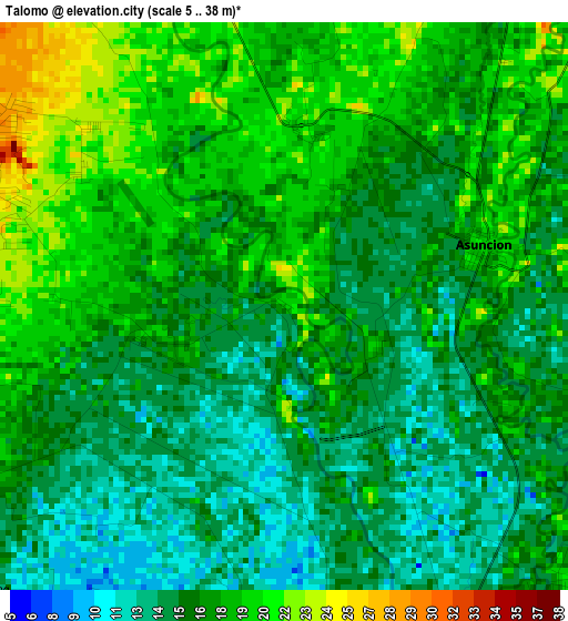
Below is the Elevation map of Talomo, which displays elevation range with different colors. Scale of the first map is from 5 to 38 m (16 to 125 ft) with average elevation of 16.7 meters (=55 ft) [note 1]
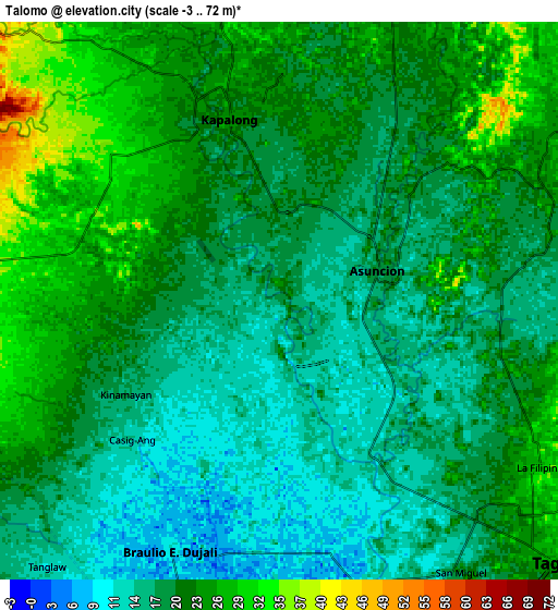
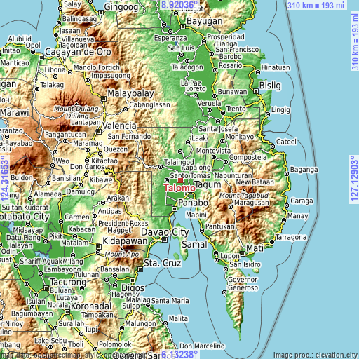
These maps also provides idea of topography and contour of this city, they are displayed at different zoom levels. More info about maps, scale and edge coordinates you can find below images.
| \ | Map #1 | Map #2 | Topo.Map |
| Scale [m] | 5..38 m | -3..72 m | × |
| Scale [ft] | 16..125 ft | -10..236 ft | × |
| Average | 16.7 m = 55 ft | 20.3 m = 67 ft | × |
| Width | 9.69 km = 6 mi | 19.38 km = 12 mi | 310 km = 192.6 mi |
| Height | 9.69 km = 6 mi | 19.38 km = 12 mi | 310 km = 192.6 mi |
| ↑Max Latitude | 7.572174° | 7.615734° | 8.92036° |
| Latitude at center | 7.52861° | 7.52861° | 7.52861° |
| ↓Min Latitude | 7.485041° | 7.441468° | 6.13238° |
| ← Min Longitude | 125.678835° | 125.634889° | 124.31653° |
| Longitude center | 125.72278° | 125.72278° | 125.72278° |
| →Max Longitude | 125.766725° | 125.810671° | 127.12903° |
Nearby cities:
Cities around Talomo sort by population:
• Cambanugoy elevation 19 m
3.9 km,  68°
68°
• Magatos 20 m
3 km,  8°
8°
• La Libertad 23 m
9.9 km,  237°
237°
• Luna 35 m
8.1 km,  310°
310°
• Kinamayan 19 m
6.3 km, 239°
• Pagsabangan 14 m
6 km,  150°
150°
• Pag-asa 28 m
6.8 km,  320°
320°
• Lungaog 20 m
3.9 km,  271°
271°
• San Miguel 14 m
7 km,  226°
226°
• New Leyte 14 m
4.4 km,  136°
136°
• Esperanza 13 m
4.1 km,  171°
171°
• Buclad 15 m
3.1 km,  91°
91°
Multilingual:
 En español:
Talomo elevación 18 m.
 En France:
Talomo élévation 18 m.


Sources and notes:
- [note 1] Map square and city borders are not equal. Map elevation data is calculated only from area inside that square.
- [src 1] Elevation data from geonames database provided with same terms of usage.
- [src 2] The elevation map of Talomo is generated using elevation data from NASA's 3 arcsec (90m) resolution SRTM data.
- [src 3] Base (background) map © OpenStreetMap contributors tiles are generated by Geofabrik and OpenTopoMap.
Copyright & License:
This Talomo Elevation Map is licensed under CC BY-SA. You may reuse any part from this page, if you give a proper credit by linking to this URL:
 More info on terms of use page.