Taytayan elevation
Taytayan (Davao, Province of Davao Oriental), Philippines elevation is 27 meters and Taytayan elevation in feet is 89 ft above sea level [src 1]. Taytayan is a populated place (feature code) with elevation that is 61 meters (200 ft) smaller than average city elevation in Philippines.
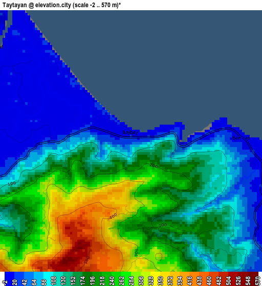
Below is the Elevation map of Taytayan, which displays elevation range with different colors. Scale of the first map is from -2 to 570 m (-7 to 1870 ft) with average elevation of 163.4 meters (=536 ft) [note 1]
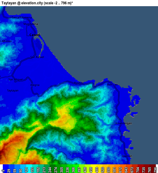
These maps also provides idea of topography and contour of this city, they are displayed at different zoom levels. More info about maps, scale and edge coordinates you can find below images.
| \ | Map #1 | Map #2 | Topo.Map |
| Scale [m] | -2..570 m | -2..796 m | × |
| Scale [ft] | -7..1870 ft | -7..2612 ft | × |
| Average | 163.4 m = 536 ft | 149.6 m = 491 ft | × |
| Width | 9.68 km = 6 mi | 19.37 km = 12 mi | 309.8 km = 192.5 mi |
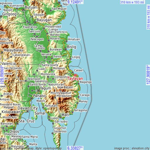
| Height | 9.68 km = 6 mi | 19.37 km = 12 mi | 309.9 km = 192.6 mi |
| ↑Max Latitude | 7.777433° | 7.820972° | 9.12491° |
| Latitude at center | 7.73389° | 7.73389° | 7.73389° |
| ↓Min Latitude | 7.690342° | 7.64679° | 6.33827° |
| ← Min Longitude | 126.457995° | 126.414049° | 125.09569° |
| Longitude center | 126.50194° | 126.50194° | 126.50194° |
| →Max Longitude | 126.545885° | 126.589831° | 127.90819° |
Nearby cities:
Cities around Taytayan sort by population:
• Baganga elevation 14 m
18.9 km,  160°
160°
• Cateel 14 m
8.3 km,  320°
320°
• Lingig 8 m
35.3 km,  343°
343°
• Kinablangan 13 m
6.9 km,  131°
131°
• Mahanob 26 m
17.9 km,  178°
178°
• San Alfonso 29 m
10.4 km,  299°
299°
• Baculin 14 m
32.6 km, 163°
• Boston 21 m
21.5 km, 315°
• Batiano 150 m
20.1 km, 183°
• Santa Maria 45 m
29.3 km,  347°
347°
• San Luis 13 m
33 km,  170°
170°
• San Rafael 13 m
6.1 km, 303°
Multilingual:
 En español:
Taytayan elevación 27 m.
 En France:
Taytayan élévation 27 m.


Sources and notes:
- [note 1] Map square and city borders are not equal. Map elevation data is calculated only from area inside that square.
- [src 1] Elevation data from geonames database provided with same terms of usage.
- [src 2] The elevation map of Taytayan is generated using elevation data from NASA's 3 arcsec (90m) resolution SRTM data.
- [src 3] Base (background) map © OpenStreetMap contributors tiles are generated by Geofabrik and OpenTopoMap.
Copyright & License:
This Taytayan Elevation Map is licensed under CC BY-SA. You may reuse any part from this page, if you give a proper credit by linking to this URL:
 More info on terms of use page.