Telabastagan elevation
Telabastagan (Central Luzon, Province of Pampanga), Philippines elevation is 73 meters and Telabastagan elevation in feet is 240 ft above sea level [src 1]. Telabastagan is a populated place (feature code) with elevation that is 15 meters (49 ft) smaller than average city elevation in Philippines.
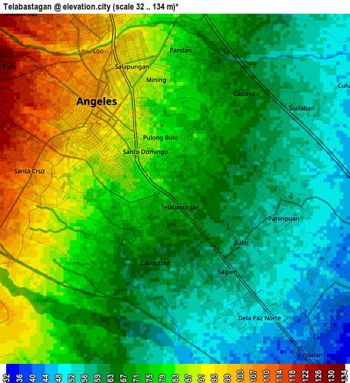
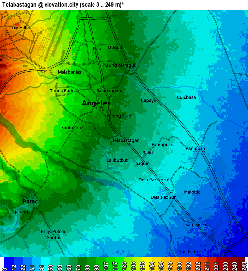
Below is the Elevation map of Telabastagan, which displays elevation range with different colors. Scale of the first map is from 32 to 134 m (105 to 440 ft) with average elevation of 73 meters (=240 ft) [note 1]
These maps also provides idea of topography and contour of this city, they are displayed at different zoom levels. More info about maps, scale and edge coordinates you can find below images.
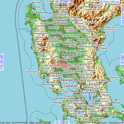
| \ | Map #1 | Map #2 | Topo.Map |
| Scale [m] | 32..134 m | 3..249 m | × |
| Scale [ft] | 105..440 ft | 10..817 ft | × |
| Average | 73 m = 240 ft | 74.7 m = 245 ft | × |
| Width | 9.43 km = 5.9 mi | 18.87 km = 11.7 mi | 301.9 km = 187.6 mi |
| Height | 9.43 km = 5.9 mi | 18.87 km = 11.7 mi | 301.9 km = 187.6 mi |
| ↑Max Latitude | 15.16096° | 15.203372° | 16.47166° |
| Latitude at center | 15.11854° | 15.11854° | 15.11854° |
| ↓Min Latitude | 15.076111° | 15.033674° | 13.75674° |
| ← Min Longitude | 120.563785° | 120.519839° | 119.20148° |
| Longitude center | 120.60773° | 120.60773° | 120.60773° |
| →Max Longitude | 120.651675° | 120.695621° | 122.01398° |
Nearby cities:
Cities around Telabastagan sort by population:
• Angeles City elevation 102 m
4.4 km,  323°
323°
• Santol 126 m
6.5 km, 318°
• Bulaon 31 m
7.1 km,  124°
124°
• Pandacaqui 51 m
7.8 km,  40°
40°
• Manibaug Pasig 91 m
5.3 km,  241°
241°
• Cauayan 40 m
7.8 km,  61°
61°
• Calibutbut 79 m
1.1 km,  248°
248°
• Balibago 96 m
5.1 km,  344°
344°
• Malino 36 m
7.2 km,  82°
82°
• Acli 51 m
4 km, 83°
• Balas 47 m
8 km,  196°
196°
• Culubasa 49 m
5.6 km, 59°
Multilingual:
 En español:
Telabastagan elevación 73 m.
 En France:
Telabastagan élévation 73 m.
 Auf Deutsch:
Telabastagan höhe über dem Meeresspiegel ist 73 m.

Sources and notes:
- [note 1] Map square and city borders are not equal. Map elevation data is calculated only from area inside that square.
- [src 1] Elevation data from geonames database provided with same terms of usage.
- [src 2] The elevation map of Telabastagan is generated using elevation data from NASA's 3 arcsec (90m) resolution SRTM data.
- [src 3] Base (background) map © OpenStreetMap contributors tiles are generated by Geofabrik and OpenTopoMap.
Copyright & License:
This Telabastagan Elevation Map is licensed under CC BY-SA. You may reuse any part from this page, if you give a proper credit by linking to this URL:
 More info on terms of use page.