Tigbauan elevation
Tigbauan (Western Visayas, Province of Iloilo), Philippines elevation is 8 meters and Tigbauan elevation in feet is 26 ft above sea level [src 1]. Tigbauan is a seat of a third-order administrative division (feature code) with elevation that is 80 meters (262 ft) smaller than average city elevation in Philippines.
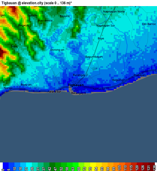
Below is the Elevation map of Tigbauan, which displays elevation range with different colors. Scale of the first map is from 0 to 136 m (0 to 446 ft) with average elevation of 28.2 meters (=93 ft) [note 1]
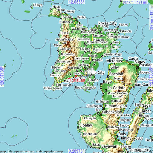
These maps also provides idea of topography and contour of this city, they are displayed at different zoom levels. More info about maps, scale and edge coordinates you can find below images.
| \ | Map #1 | Map #2 | Topo.Map |
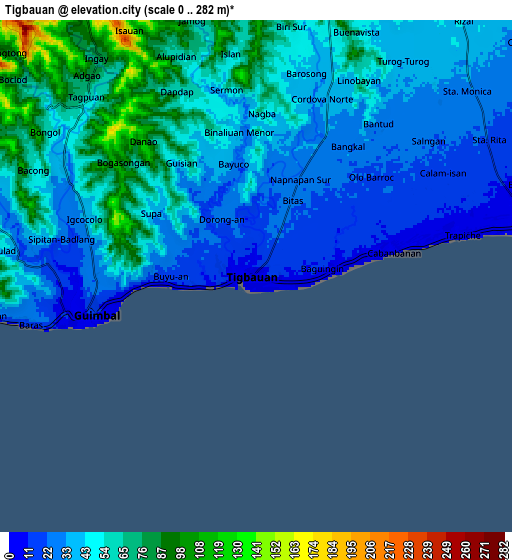
| Scale [m] | 0..136 m | 0..282 m | × |
| Scale [ft] | 0..446 ft | 0..925 ft | × |
| Average | 28.2 m = 93 ft | 47.3 m = 155 ft | × |
| Width | 9.6 km = 6 mi | 19.21 km = 11.9 mi | 307.3 km = 190.9 mi |
| Height | 9.6 km = 6 mi | 19.21 km = 11.9 mi | 307.3 km = 190.9 mi |
| ↑Max Latitude | 10.717842° | 10.761017° | 12.0533° |
| Latitude at center | 10.67466° | 10.67466° | 10.67466° |
| ↓Min Latitude | 10.631472° | 10.588278° | 9.28973° |
| ← Min Longitude | 122.333655° | 122.289709° | 120.97135° |
| Longitude center | 122.3776° | 122.3776° | 122.3776° |
| →Max Longitude | 122.421545° | 122.465491° | 123.78385° |
Nearby cities:
Cities around Tigbauan sort by population:
• Oton elevation 4 m
10.7 km,  78°
78°
• Trapiche 3 m
6.1 km, 79°
• Guimbal 14 m
6.1 km,  258°
258°
• Leon 68 m
11.9 km,  6°
6°
• Buray 14 m
10 km,  63°
63°
• Napnapan 28 m
4.1 km,  24°
24°
• Buyuan 9 m
2.2 km, 259°
• Cordova 38 m
6.7 km, 22°
• Santa Monica 32 m
10.8 km,  50°
50°
• Atabayan 8 m
4.4 km, 77°
• Igcocolo 31 m
6.6 km,  284°
284°
• Tubungan 104 m
11.9 km,  326°
326°
Multilingual:
 En español:
Tigbauan elevación 8 m.
 En France:
Tigbauan élévation 8 m.


Sources and notes:
- [note 1] Map square and city borders are not equal. Map elevation data is calculated only from area inside that square.
- [src 1] Elevation data from geonames database provided with same terms of usage.
- [src 2] The elevation map of Tigbauan is generated using elevation data from NASA's 3 arcsec (90m) resolution SRTM data.
- [src 3] Base (background) map © OpenStreetMap contributors tiles are generated by Geofabrik and OpenTopoMap.
Copyright & License:
This Tigbauan Elevation Map is licensed under CC BY-SA. You may reuse any part from this page, if you give a proper credit by linking to this URL:
 More info on terms of use page.