Titay elevation
Titay (Zamboanga Peninsula, Province of Zamboanga Sibugay), Philippines elevation is 139 meters and Titay elevation in feet is 456 ft above sea level [src 1]. Titay is a populated place (feature code) with elevation that is 51 meters (167 ft) bigger than average city elevation in Philippines.
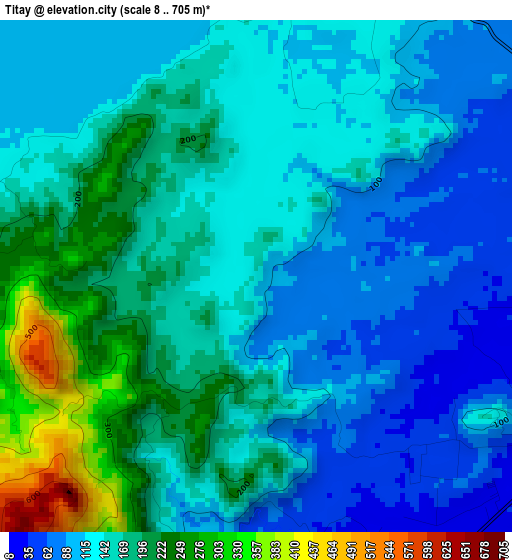
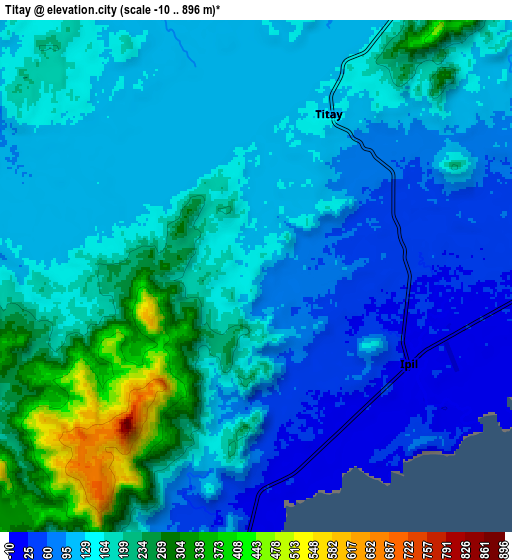
Below is the Elevation map of Titay, which displays elevation range with different colors. Scale of the first map is from 8 to 705 m (26 to 2313 ft) with average elevation of 150 meters (=492 ft) [note 1]
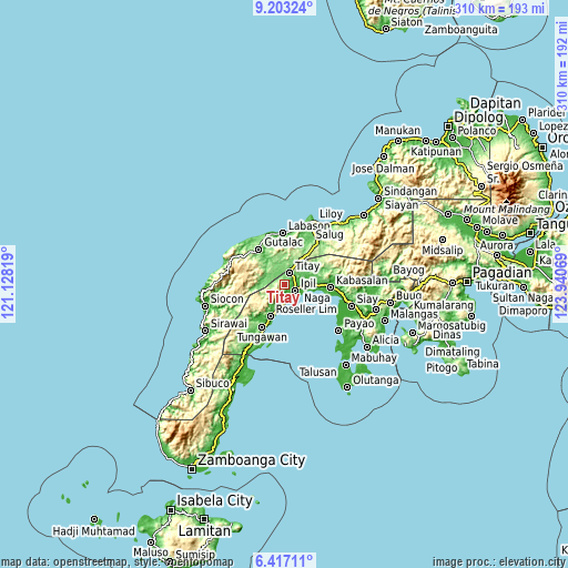
These maps also provides idea of topography and contour of this city, they are displayed at different zoom levels. More info about maps, scale and edge coordinates you can find below images.
| \ | Map #1 | Map #2 | Topo.Map |
| Scale [m] | 8..705 m | -10..896 m | × |
| Scale [ft] | 26..2313 ft | -33..2940 ft | × |
| Average | 150 m = 492 ft | 151.6 m = 497 ft | × |
| Width | 9.68 km = 6 mi | 19.36 km = 12 mi | 309.8 km = 192.5 mi |
| Height | 9.68 km = 6 mi | 19.36 km = 12 mi | 309.8 km = 192.5 mi |
| ↑Max Latitude | 7.856035° | 7.899566° | 9.20324° |
| Latitude at center | 7.8125° | 7.8125° | 7.8125° |
| ↓Min Latitude | 7.76896° | 7.725416° | 6.41711° |
| ← Min Longitude | 122.490495° | 122.446549° | 121.12819° |
| Longitude center | 122.53444° | 122.53444° | 122.53444° |
| →Max Longitude | 122.578385° | 122.622331° | 123.94069° |
Nearby cities:
Cities around Titay sort by population:
• Ipil elevation 16 m
6.5 km,  118°
118°
• Kalawit 5 m
28.3 km,  356°
356°
• Naga 22 m
24.3 km,  101°
101°
• Tampilisan 165 m
28 km,  35°
35°
• Dalangin 67 m
6.4 km,  48°
48°
• Batu 18 m
33.2 km, 101°
• Kipit 101 m
26 km, 359°
• Palomoc 122 m
12.6 km,  25°
25°
• Labason 5 m
28.6 km, 357°
• Kabasalan 8 m
25.5 km,  93°
93°
• Gutalac 162 m
23.7 km,  322°
322°
• Roseller Lim 18 m
18.9 km,  203°
203°
Multilingual:
 En español:
Titay elevación 139 m.
 En France:
Titay élévation 139 m.


Sources and notes:
- [note 1] Map square and city borders are not equal. Map elevation data is calculated only from area inside that square.
- [src 1] Elevation data from geonames database provided with same terms of usage.
- [src 2] The elevation map of Titay is generated using elevation data from NASA's 3 arcsec (90m) resolution SRTM data.
- [src 3] Base (background) map © OpenStreetMap contributors tiles are generated by Geofabrik and OpenTopoMap.
Copyright & License:
This Titay Elevation Map is licensed under CC BY-SA. You may reuse any part from this page, if you give a proper credit by linking to this URL:
 More info on terms of use page.