Upi elevation
Upi (Cagayan Valley, Province of Isabela), Philippines elevation is 48 meters and Upi elevation in feet is 157 ft above sea level [src 1]. Upi is a populated place (feature code) with elevation that is 40 meters (131 ft) smaller than average city elevation in Philippines.
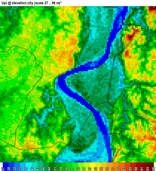
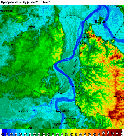
Below is the Elevation map of Upi, which displays elevation range with different colors. Scale of the first map is from 27 to 96 m (89 to 315 ft) with average elevation of 54.3 meters (=178 ft) [note 1]
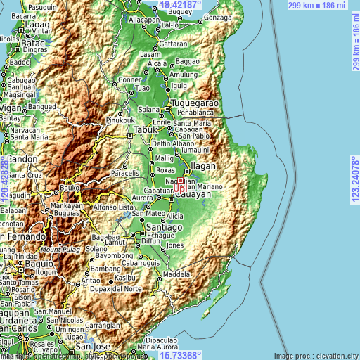
These maps also provides idea of topography and contour of this city, they are displayed at different zoom levels. More info about maps, scale and edge coordinates you can find below images.
| \ | Map #1 | Map #2 | Topo.Map |
| Scale [m] | 27..96 m | 23..114 m | × |
| Scale [ft] | 89..315 ft | 75..374 ft | × |
| Average | 54.3 m = 178 ft | 53.9 m = 177 ft | × |
| Width | 9.34 km = 5.8 mi | 18.68 km = 11.6 mi | 298.9 km = 185.7 mi |
| Height | 9.34 km = 5.8 mi | 18.68 km = 11.6 mi | 298.9 km = 185.7 mi |
| ↑Max Latitude | 17.124622° | 17.166614° | 18.42187° |
| Latitude at center | 17.08262° | 17.08262° | 17.08262° |
| ↓Min Latitude | 17.040609° | 16.998588° | 15.73368° |
| ← Min Longitude | 121.790585° | 121.746639° | 120.42828° |
| Longitude center | 121.83453° | 121.83453° | 121.83453° |
| →Max Longitude | 121.878475° | 121.922421° | 123.24078° |
Nearby cities:
Cities around Upi sort by population:
• Ilagan elevation 55 m
9.4 km,  38°
38°
• Naguilian 50 m
6.6 km,  177°
177°
• Reina Mercedes 52 m
10.8 km, 184°
• Gamu 48 m
3.7 km, 177°
• Mabini 54 m
10.8 km,  279°
279°
• Alibago 42 m
5.1 km, 42°
• Santo Domingo 53 m
12.3 km,  314°
314°
• Minallo 68 m
10.8 km,  169°
169°
• Furao 47 m
6.7 km,  216°
216°
• Banquero 50 m
8.9 km, 222°
• Cabannungan Second 44 m
5 km,  19°
19°
• San Mateo 52 m
11.3 km,  302°
302°
Multilingual:
 En español:
Upi elevación 48 m.
 En France:
Upi élévation 48 m.


Sources and notes:
- [note 1] Map square and city borders are not equal. Map elevation data is calculated only from area inside that square.
- [src 1] Elevation data from geonames database provided with same terms of usage.
- [src 2] The elevation map of Upi is generated using elevation data from NASA's 3 arcsec (90m) resolution SRTM data.
- [src 3] Base (background) map © OpenStreetMap contributors tiles are generated by Geofabrik and OpenTopoMap.
Copyright & License:
This Upi Elevation Map is licensed under CC BY-SA. You may reuse any part from this page, if you give a proper credit by linking to this URL:
 More info on terms of use page.