Vintar elevation
Vintar (Ilocos, Province of Ilocos Norte), Philippines elevation is 29 meters and Vintar elevation in feet is 95 ft above sea level [src 1]. Vintar is a populated place (feature code) with elevation that is 59 meters (194 ft) smaller than average city elevation in Philippines.
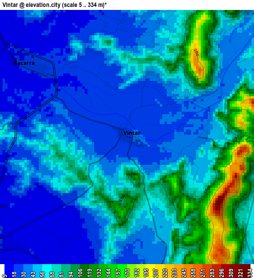
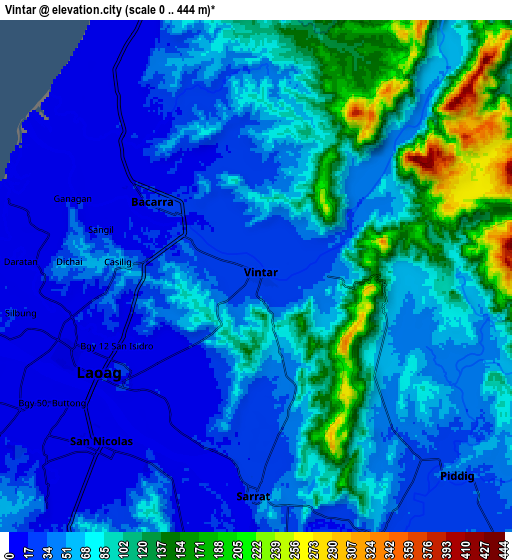
Below is the Elevation map of Vintar, which displays elevation range with different colors. Scale of the first map is from 5 to 334 m (16 to 1096 ft) with average elevation of 57.9 meters (=190 ft) [note 1]
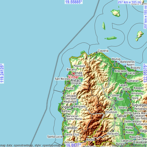
These maps also provides idea of topography and contour of this city, they are displayed at different zoom levels. More info about maps, scale and edge coordinates you can find below images.
| \ | Map #1 | Map #2 | Topo.Map |
| Scale [m] | 5..334 m | 0..444 m | × |
| Scale [ft] | 16..1096 ft | 0..1457 ft | × |
| Average | 57.9 m = 190 ft | 66.7 m = 219 ft | × |
| Width | 9.28 km = 5.8 mi | 18.56 km = 11.5 mi | 297 km = 184.5 mi |
| Height | 9.28 km = 5.8 mi | 18.56 km = 11.5 mi | 297 km = 184.5 mi |
| ↑Max Latitude | 18.270135° | 18.31186° | 19.55885° |
| Latitude at center | 18.2284° | 18.2284° | 18.2284° |
| ↓Min Latitude | 18.186655° | 18.1449° | 16.8877° |
| ← Min Longitude | 120.603555° | 120.559609° | 119.24125° |
| Longitude center | 120.6475° | 120.6475° | 120.6475° |
| →Max Longitude | 120.691445° | 120.735391° | 122.05375° |
Nearby cities:
Cities around Vintar sort by population:
• Laoag elevation 15 m
6.4 km,  238°
238°
• San Nicolas 14 m
8.3 km,  221°
221°
• Bacarra 19 m
4.6 km,  306°
306°
• Dingras 29 m
14.9 km,  159°
159°
• Sarrat 22 m
7.9 km,  180°
180°
• Pasuquin 12 m
12 km,  344°
344°
• Solsona 52 m
19.8 km,  139°
139°
• Piddig 50 m
10.2 km,  133°
133°
• Baay 40 m
14.4 km,  212°
212°
• Nagbacalan 35 m
18.1 km,  226°
226°
• Bil-Loca 20 m
17.7 km, 207°
• San Lorenzo 22 m
10.8 km,  189°
189°
Multilingual:
 En español:
Vintar elevación 29 m.
 En France:
Vintar élévation 29 m.


Sources and notes:
- [note 1] Map square and city borders are not equal. Map elevation data is calculated only from area inside that square.
- [src 1] Elevation data from geonames database provided with same terms of usage.
- [src 2] The elevation map of Vintar is generated using elevation data from NASA's 3 arcsec (90m) resolution SRTM data.
- [src 3] Base (background) map © OpenStreetMap contributors tiles are generated by Geofabrik and OpenTopoMap.
Copyright & License:
This Vintar Elevation Map is licensed under CC BY-SA. You may reuse any part from this page, if you give a proper credit by linking to this URL:
 More info on terms of use page.