Ancón elevation
Ancón (Panamá), Panama elevation is 67 meters and Ancón elevation in feet is 220 ft above sea level [src 1]. Ancón is a populated place (feature code) with elevation that is 105 meters (344 ft) smaller than average city elevation in Panama.
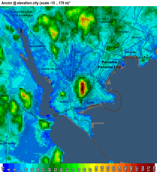
Below is the Elevation map of Ancón, which displays elevation range with different colors. Scale of the first map is from -15 to 179 m (-49 to 587 ft) with average elevation of 24.9 meters (=82 ft) [note 1]
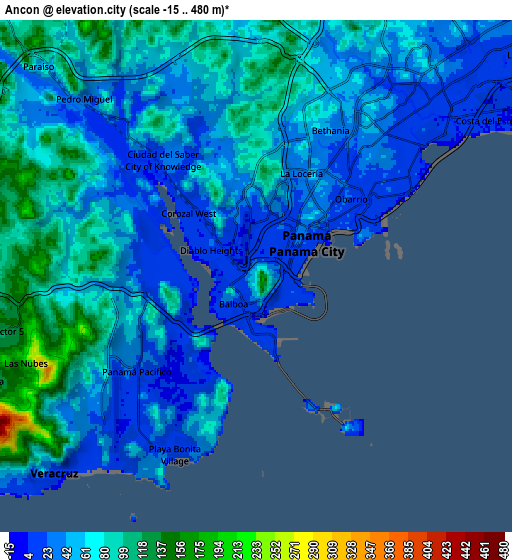
These maps also provides idea of topography and contour of this city, they are displayed at different zoom levels. More info about maps, scale and edge coordinates you can find below images.
| \ | Map #1 | Map #2 | Topo.Map |
| Scale [m] | -15..179 m | -15..480 m | × |
| Scale [ft] | -49..587 ft | -49..1575 ft | × |
| Average | 24.9 m = 82 ft | 56.7 m = 186 ft | × |
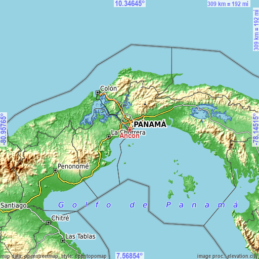
| Width | 9.65 km = 6 mi | 19.31 km = 12 mi | 308.9 km = 191.9 mi |
| Height | 9.65 km = 6 mi | 19.31 km = 12 mi | 308.9 km = 191.9 mi |
| ↑Max Latitude | 9.003556° | 9.046958° | 10.34645° |
| Latitude at center | 8.96015° | 8.96015° | 8.96015° |
| ↓Min Latitude | 8.916738° | 8.873322° | 7.56854° |
| ← Min Longitude | -79.595345° | -79.639291° | -80.95765° |
| Longitude center | -79.5514° | -79.5514° | -79.5514° |
| →Max Longitude | -79.507455° | -79.463509° | -78.14515° |
Nearby cities:
Cities around Ancón sort by population:
• Panamá elevation 17 m
5.1 km,  43°
43°
• San Miguelito 57 m
13.4 km, 41°
• Arraiján 98 m
12 km,  265°
265°
• Las Cumbres 87 m
14.6 km,  10°
10°
• Parque Lefevre 8 m
9.8 km,  49°
49°
• Río Abajo 15 m
8.4 km, 41°
• El Chorrillo 10 m
1.3 km,  158°
158°
• Veracruz 12 m
11.3 km,  226°
226°
• Curundú 7 m
1.3 km,  25°
25°
• San Felipe 8 m
1.8 km,  122°
122°
• San Vicente de Bique 20 m
14.5 km,  248°
248°
• Howard 18 m
4.9 km,  242°
242°
Multilingual:
 En español:
Ancón elevación 67 m.
 En France:
Ancón élévation 67 m.


Sources and notes:
- [note 1] Map square and city borders are not equal. Map elevation data is calculated only from area inside that square.
- [src 1] Elevation data from geonames database provided with same terms of usage.
- [src 2] The elevation map of Ancón is generated using elevation data from NASA's 3 arcsec (90m) resolution SRTM data.
- [src 3] Base (background) map © OpenStreetMap contributors tiles are generated by Geofabrik and OpenTopoMap.
Copyright & License:
This Ancón Elevation Map is licensed under CC BY-SA. You may reuse any part from this page, if you give a proper credit by linking to this URL:
 More info on terms of use page.