Chepo elevation
Chepo (Panamá), Panama elevation is 19 meters and Chepo elevation in feet is 62 ft above sea level [src 1]. Chepo is a populated place (feature code) with elevation that is 153 meters (502 ft) smaller than average city elevation in Panama.
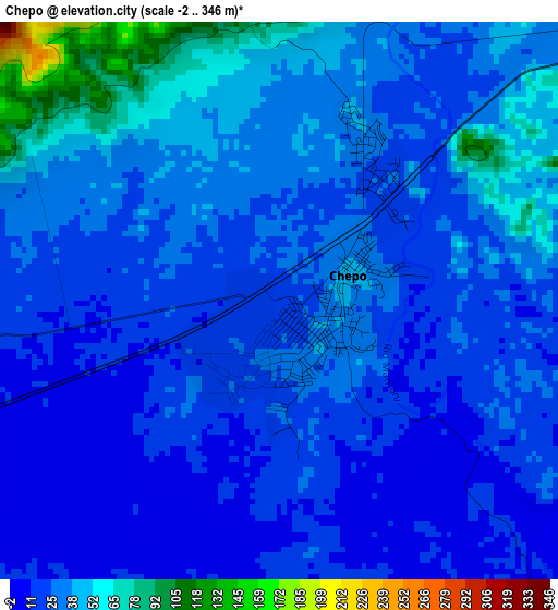
Below is the Elevation map of Chepo, which displays elevation range with different colors. Scale of the first map is from -2 to 346 m (-7 to 1135 ft) with average elevation of 28.9 meters (=95 ft) [note 1]
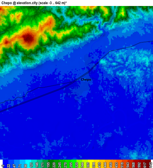
These maps also provides idea of topography and contour of this city, they are displayed at different zoom levels. More info about maps, scale and edge coordinates you can find below images.
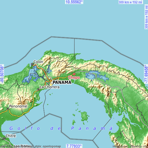
| \ | Map #1 | Map #2 | Topo.Map |
| Scale [m] | -2..346 m | -3..642 m | × |
| Scale [ft] | -7..1135 ft | -10..2106 ft | × |
| Average | 28.9 m = 95 ft | 79.9 m = 262 ft | × |
| Width | 9.65 km = 6 mi | 19.3 km = 12 mi | 308.7 km = 191.8 mi |
| Height | 9.65 km = 6 mi | 19.3 km = 12 mi | 308.7 km = 191.8 mi |
| ↑Max Latitude | 9.213571° | 9.256947° | 10.55562° |
| Latitude at center | 9.17019° | 9.17019° | 9.17019° |
| ↓Min Latitude | 9.126804° | 9.083412° | 7.77933° |
| ← Min Longitude | -79.144775° | -79.188721° | -80.50708° |
| Longitude center | -79.10083° | -79.10083° | -79.10083° |
| →Max Longitude | -79.056885° | -79.012939° | -77.69458° |
Nearby cities:
Cities around Chepo sort by population:
• Tocumen elevation 35 m
32.3 km,  253°
253°
• Nueva Esperanza 24 m
26.7 km, 253°
• Pacora 11 m
23.1 km,  244°
244°
• Vista Hermosa 45 m
29.3 km,  257°
257°
• El Progreso 144 m
10.9 km,  350°
350°
• Las Margaritas 21 m
2.2 km,  43°
43°
• La Mesa 112 m
19 km,  270°
270°
• Cabra Número Uno 44 m
26.8 km, 255°
• Los Lotes 61 m
21.3 km, 256°
• Unión de Azuero 29 m
7.8 km, 255°
• Cañita 27 m
23.3 km,  75°
75°
• Chepillo 8 m
24.2 km,  187°
187°
Multilingual:
 En español:
Chepo elevación 19 m.
 En France:
Chepo élévation 19 m.


Sources and notes:
- [note 1] Map square and city borders are not equal. Map elevation data is calculated only from area inside that square.
- [src 1] Elevation data from geonames database provided with same terms of usage.
- [src 2] The elevation map of Chepo is generated using elevation data from NASA's 3 arcsec (90m) resolution SRTM data.
- [src 3] Base (background) map © OpenStreetMap contributors tiles are generated by Geofabrik and OpenTopoMap.
Copyright & License:
This Chepo Elevation Map is licensed under CC BY-SA. You may reuse any part from this page, if you give a proper credit by linking to this URL:
 More info on terms of use page.