Colón elevation
Colón, Panama elevation is 8 meters and Colón elevation in feet is 26 ft above sea level [src 1]. Colón is a seat of a first-order administrative division (feature code) with elevation that is 164 meters (538 ft) smaller than average city elevation in Panama.
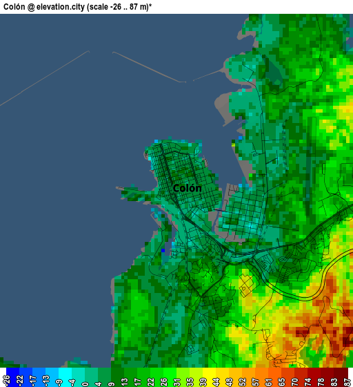
Below is the Elevation map of Colón, which displays elevation range with different colors. Scale of the first map is from -26 to 87 m (-85 to 285 ft) with average elevation of 18.3 meters (=60 ft) [note 1]
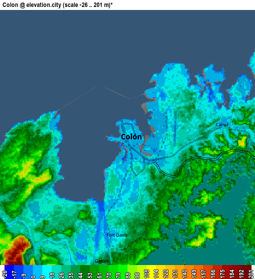
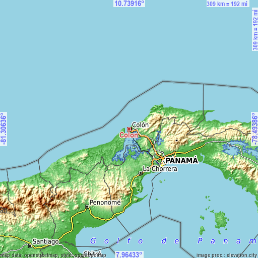
These maps also provides idea of topography and contour of this city, they are displayed at different zoom levels. More info about maps, scale and edge coordinates you can find below images.
| \ | Map #1 | Map #2 | Topo.Map |
| Scale [m] | -26..87 m | -26..201 m | × |
| Scale [ft] | -85..285 ft | -85..659 ft | × |
| Average | 18.3 m = 60 ft | 33.7 m = 111 ft | × |
| Width | 9.64 km = 6 mi | 19.29 km = 12 mi | 308.5 km = 191.7 mi |
| Height | 9.64 km = 6 mi | 19.29 km = 12 mi | 308.6 km = 191.8 mi |
| ↑Max Latitude | 9.397868° | 9.441221° | 10.73916° |
| Latitude at center | 9.35451° | 9.35451° | 9.35451° |
| ↓Min Latitude | 9.311146° | 9.267777° | 7.96433° |
| ← Min Longitude | -79.944055° | -79.988001° | -81.30636° |
| Longitude center | -79.90011° | -79.90011° | -79.90011° |
| →Max Longitude | -79.856165° | -79.812219° | -78.49386° |
Nearby cities:
Cities around Colón sort by population:
• Cativá elevation 12 m
7.5 km,  83°
83°
• Sabanitas 36 m
10 km,  97°
97°
• Puerto Pilón 22 m
11.8 km,  85°
85°
• Las Margaritas 13 m
3.3 km,  161°
161°
• Río Alejandro 22 m
12.4 km, 81°
• Cristóbal 6 m
0.5 km,  241°
241°
• Santa Rita Arriba 111 m
12 km, 102°
• Gatún 32 m
15.8 km,  117°
117°
• Río Rita 132 m
13.1 km, 115°
• María Chiquita 6 m
18.6 km,  59°
59°
• Nueva Providencia 39 m
13.7 km,  137°
137°
• Panama City 12 m
2.5 km, 157°
Multilingual:
 En español:
Ciudad de Colón elevación 8 m.
 En France:
Colón élévation 8 m.


Sources and notes:
- [note 1] Map square and city borders are not equal. Map elevation data is calculated only from area inside that square.
- [src 1] Elevation data from geonames database provided with same terms of usage.
- [src 2] The elevation map of Colón is generated using elevation data from NASA's 3 arcsec (90m) resolution SRTM data.
- [src 3] Base (background) map © OpenStreetMap contributors tiles are generated by Geofabrik and OpenTopoMap.
Copyright & License:
This Colón Elevation Map is licensed under CC BY-SA. You may reuse any part from this page, if you give a proper credit by linking to this URL:
 More info on terms of use page.