El Espinal elevation
El Espinal (Los Santos), Panama elevation is 28 meters and El Espinal elevation in feet is 92 ft above sea level [src 1]. El Espinal is a seat of a third-order administrative division (feature code) with elevation that is 144 meters (472 ft) smaller than average city elevation in Panama.
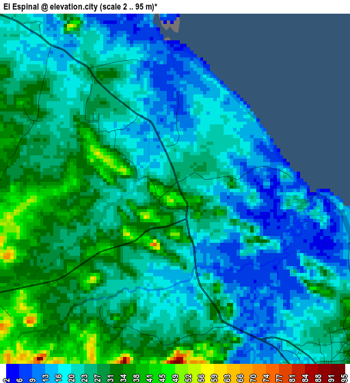
Below is the Elevation map of El Espinal, which displays elevation range with different colors. Scale of the first map is from 2 to 95 m (7 to 312 ft) with average elevation of 24.3 meters (=80 ft) [note 1]
These maps also provides idea of topography and contour of this city, they are displayed at different zoom levels. More info about maps, scale and edge coordinates you can find below images.
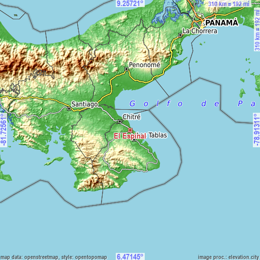
| \ | Map #1 | Topo.Map |
| Scale [m] | 2..95 m | × |
| Scale [ft] | 7..312 ft | × |
| Average | 24.3 m = 80 ft | × |
| Width | 9.68 km = 6 mi | 309.7 km = 192.4 mi |
| Height | 9.68 km = 6 mi | 309.8 km = 192.5 mi |
| ↑Max Latitude | 7.910199° | 9.25721° |
| Latitude at center | 7.86667° | 7.86667° |
| ↓Min Latitude | 7.823136° | 6.47145° |
| ← Min Longitude | -80.363305° | -81.72561° |
| Longitude center | -80.31936° | -80.31936° |
| →Max Longitude | -80.275415° | -78.91311° |
Nearby cities:
Cities around El Espinal sort by population:
• Guararé elevation 29 m
6.9 km,  145°
145°
• La Espigadilla 48 m
8.1 km,  283°
283°
• El Ejido 39 m
9.3 km,  306°
306°
• La Enea 35 m
6.2 km,  126°
126°
• Santa Ana Arriba 17 m
8.8 km,  326°
326°
• Agua Buena 69 m
9 km,  246°
246°
• Tres Quebradas 65 m
10.1 km, 253°
• La Pasera 36 m
7.9 km,  167°
167°
• Sabana Grande 48 m
6.1 km,  235°
235°
• Guararé Arriba 35 m
8.6 km,  211°
211°
• Los Ángeles 29 m
4.7 km,  294°
294°
• Perales 34 m
10.3 km,  183°
183°
Multilingual:
 En español:
El Espinal elevación 28 m.
 En France:
El Espinal élévation 28 m.
 Auf Deutsch:
El Espinal höhe über dem Meeresspiegel ist 28 m.

Sources and notes:
- [note 1] Map square and city borders are not equal. Map elevation data is calculated only from area inside that square.
- [src 1] Elevation data from geonames database provided with same terms of usage.
- [src 2] The elevation map of El Espinal is generated using elevation data from NASA's 3 arcsec (90m) resolution SRTM data.
- [src 3] Base (background) map © OpenStreetMap contributors tiles are generated by Geofabrik and OpenTopoMap.
Copyright & License:
This El Espinal Elevation Map is licensed under CC BY-SA. You may reuse any part from this page, if you give a proper credit by linking to this URL:
 More info on terms of use page.