Jaqué elevation
Jaqué (Darién), Panama elevation is 11 meters and Jaqué elevation in feet is 36 ft above sea level [src 1]. Jaqué is a populated place (feature code) with elevation that is 161 meters (528 ft) smaller than average city elevation in Panama.
Below is the Elevation map of Jaqué, which displays elevation range with different colors. Scale of the first map is from -2 to 312 m (-7 to 1024 ft) with average elevation of 53.9 meters (=177 ft) [note 1]
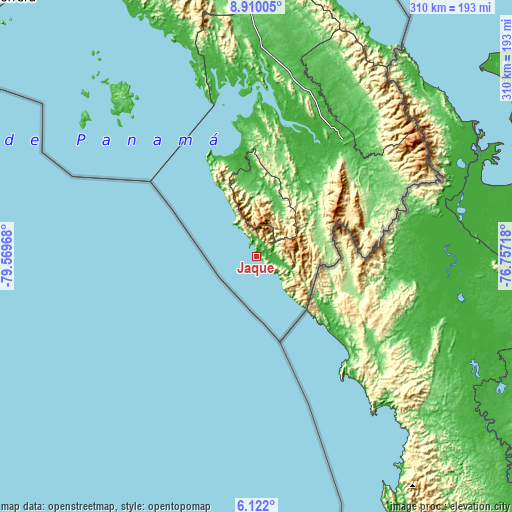
These maps also provides idea of topography and contour of this city, they are displayed at different zoom levels. More info about maps, scale and edge coordinates you can find below images.
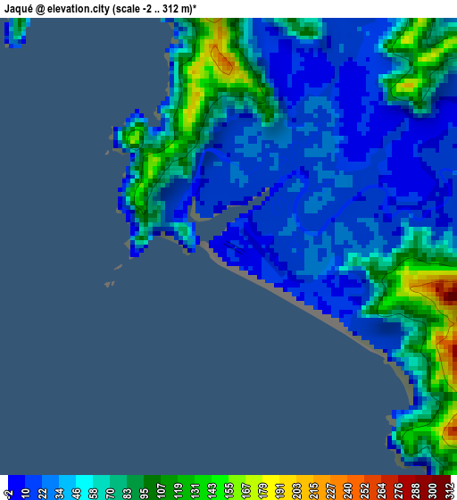
| \ | Map #1 | Topo.Map |
| Scale [m] | -2..312 m | × |
| Scale [ft] | -7..1024 ft | × |
| Average | 53.9 m = 177 ft | × |
| Width | 9.69 km = 6 mi | 310 km = 192.6 mi |
| Height | 9.69 km = 6 mi | 310 km = 192.6 mi |
| ↑Max Latitude | 7.561825° | 8.91005° |
| Latitude at center | 7.51826° | 7.51826° |
| ↓Min Latitude | 7.47469° | 6.122° |
| ← Min Longitude | -78.207375° | -79.56968° |
| Longitude center | -78.16343° | -78.16343° |
| →Max Longitude | -78.119485° | -76.75718° |
Nearby cities:
Cities around Jaqué sort by population:
• Yaviza elevation 10 m
88.1 km,  36°
36°
• Garachiné 9 m
64.9 km,  340°
340°
• Boca de Cupé 33 m
85 km,  47°
47°
• Bayamón 28 m
50.4 km,  353°
353°
• Camogantí 9 m
65.7 km,  27°
27°
• Yape 19 m
89.7 km, 43°
• Setegantí 21 m
86.5 km,  4°
4°
• Chepigana 76 m
86.3 km,  8°
8°
• Pinogana 17 m
84.3 km, 38°
• Pueblo Nuevo 10 m
70.9 km, 352°
• Tucutí 74 m
51.5 km, 27°
• Jingurudó 63 m
41.3 km, 13°
Multilingual:
 En español:
Jaqué elevación 11 m.
 En France:
Jaqué élévation 11 m.


Sources and notes:
- [note 1] Map square and city borders are not equal. Map elevation data is calculated only from area inside that square.
- [src 1] Elevation data from geonames database provided with same terms of usage.
- [src 2] The elevation map of Jaqué is generated using elevation data from NASA's 3 arcsec (90m) resolution SRTM data.
- [src 3] Base (background) map © OpenStreetMap contributors tiles are generated by Geofabrik and OpenTopoMap.
Copyright & License:
This Jaqué Elevation Map is licensed under CC BY-SA. You may reuse any part from this page, if you give a proper credit by linking to this URL:
 More info on terms of use page.