Las Tablas elevation
Las Tablas (Los Santos), Panama elevation is 42 meters and Las Tablas elevation in feet is 138 ft above sea level [src 1]. Las Tablas is a seat of a first-order administrative division (feature code) with elevation that is 130 meters (427 ft) smaller than average city elevation in Panama.
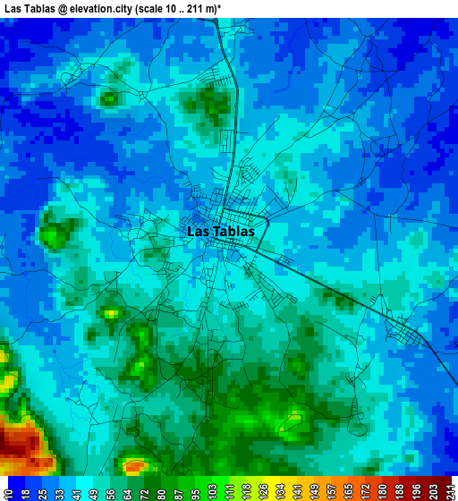
Below is the Elevation map of Las Tablas, which displays elevation range with different colors. Scale of the first map is from 10 to 211 m (33 to 692 ft) with average elevation of 45.2 meters (=148 ft) [note 1]
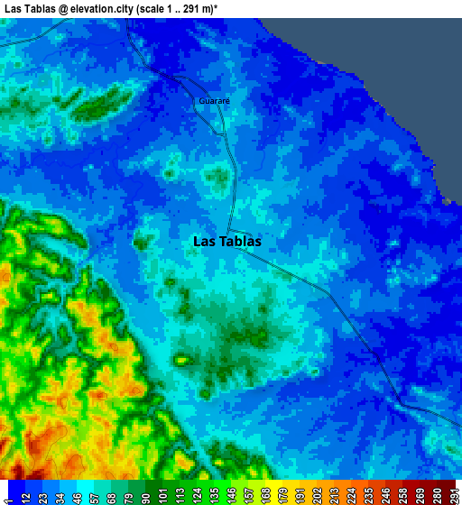
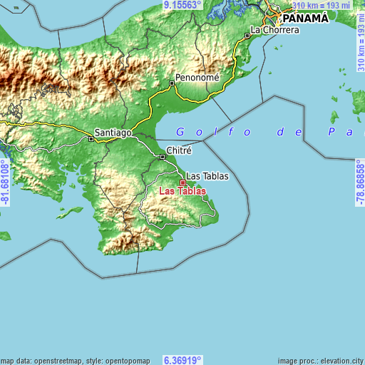
These maps also provides idea of topography and contour of this city, they are displayed at different zoom levels. More info about maps, scale and edge coordinates you can find below images.
| \ | Map #1 | Map #2 | Topo.Map |
| Scale [m] | 10..211 m | 1..291 m | × |
| Scale [ft] | 33..692 ft | 3..955 ft | × |
| Average | 45.2 m = 148 ft | 54 m = 177 ft | × |
| Width | 9.68 km = 6 mi | 19.37 km = 12 mi | 309.8 km = 192.5 mi |
| Height | 9.68 km = 6 mi | 19.37 km = 12 mi | 309.9 km = 192.6 mi |
| ↑Max Latitude | 7.80826° | 7.851796° | 9.15563° |
| Latitude at center | 7.76472° | 7.76472° | 7.76472° |
| ↓Min Latitude | 7.721175° | 7.677626° | 6.36919° |
| ← Min Longitude | -80.318775° | -80.362721° | -81.68108° |
| Longitude center | -80.27483° | -80.27483° | -80.27483° |
| →Max Longitude | -80.230885° | -80.186939° | -78.86858° |
Nearby cities:
Cities around Las Tablas sort by population:
• Santo Domingo elevation 37 m
4.2 km,  119°
119°
• La Tiza 60 m
2.4 km,  231°
231°
• Bella Vista 25 m
4.9 km,  109°
109°
• El Cocal 74 m
3.1 km,  190°
190°
• Las Palmitas 45 m
2.1 km,  271°
271°
• Peña Blanca 87 m
5.1 km, 190°
• Sesteadero 47 m
4.1 km,  134°
134°
• La Pasera 36 m
4.8 km,  319°
319°
• La Laja 65 m
4.5 km,  147°
147°
• El Manantial 26 m
3.6 km,  57°
57°
• El Carate 58 m
4.4 km,  213°
213°
• Perales 34 m
5.6 km,  281°
281°
Multilingual:
 En español:
Las Tablas elevación 42 m.
 En France:
Las Tablas élévation 42 m.
 Auf Deutsch:
Las Tablas höhe über dem Meeresspiegel ist 42 m.

Sources and notes:
- [note 1] Map square and city borders are not equal. Map elevation data is calculated only from area inside that square.
- [src 1] Elevation data from geonames database provided with same terms of usage.
- [src 2] The elevation map of Las Tablas is generated using elevation data from NASA's 3 arcsec (90m) resolution SRTM data.
- [src 3] Base (background) map © OpenStreetMap contributors tiles are generated by Geofabrik and OpenTopoMap.
Copyright & License:
This Las Tablas Elevation Map is licensed under CC BY-SA. You may reuse any part from this page, if you give a proper credit by linking to this URL:
 More info on terms of use page.