Río Sereno elevation
Río Sereno (Chiriquí), Panama elevation is 932 meters and Río Sereno elevation in feet is 3058 ft above sea level [src 1]. Río Sereno is a seat of a second-order administrative division (feature code) with elevation that is 760 meters (2493 ft) bigger than average city elevation in Panama.
Below is the Elevation map of Río Sereno, which displays elevation range with different colors. Scale of the first map is from 712 to 1164 m (2336 to 3819 ft) with average elevation of 955.5 meters (=3135 ft) [note 1]
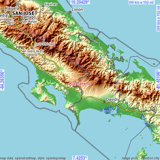
These maps also provides idea of topography and contour of this city, they are displayed at different zoom levels. More info about maps, scale and edge coordinates you can find below images.
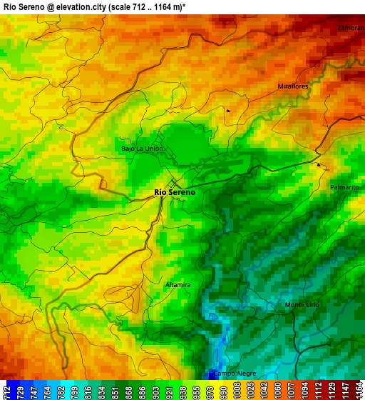
| \ | Map #1 | Topo.Map |
| Scale [m] | 712..1164 m | × |
| Scale [ft] | 2336..3819 ft | × |
| Average | 955.5 m = 3135 ft | × |
| Width | 9.66 km = 6 mi | 309 km = 192 mi |
| Height | 9.66 km = 6 mi | 309 km = 192 mi |
| ↑Max Latitude | 8.860833° | 10.20429° |
| Latitude at center | 8.81741° | 8.81741° |
| ↓Min Latitude | 8.773981° | 7.4253° |
| ← Min Longitude | -82.901255° | -84.26356° |
| Longitude center | -82.85731° | -82.85731° |
| →Max Longitude | -82.813365° | -81.45106° |
Nearby cities:
Cities around Río Sereno sort by population:
• Volcán elevation 1394 m
24.6 km,  101°
101°
• Plaza de Caisán 792 m
9.9 km,  155°
155°
• Santa Clara 1178 m
8.7 km,  78°
78°
• Gómez 342 m
31.2 km, 155°
• San Andrés 522 m
27.9 km,  148°
148°
• Paso Canoas Arriba 216 m
28.3 km,  172°
172°
• Monte Lirio 834 m
4.4 km,  134°
134°
• Cordillera 1083 m
30.5 km,  113°
113°
• Cañas Gordas 1123 m
10.3 km,  216°
216°
• Santa Cruz 664 m
22.2 km, 151°
• Breñón 677 m
22 km, 167°
• Santa Rosa 516 m
30.8 km,  141°
141°
Multilingual:
 En español:
Río Sereno elevación 932 m.
 En France:
Río Sereno élévation 932 m.
 Auf Deutsch:
Río Sereno höhe über dem Meeresspiegel ist 932 m.

Sources and notes:
- [note 1] Map square and city borders are not equal. Map elevation data is calculated only from area inside that square.
- [src 1] Elevation data from geonames database provided with same terms of usage.
- [src 2] The elevation map of Río Sereno is generated using elevation data from NASA's 3 arcsec (90m) resolution SRTM data.
- [src 3] Base (background) map © OpenStreetMap contributors tiles are generated by Geofabrik and OpenTopoMap.
Copyright & License:
This Río Sereno Elevation Map is licensed under CC BY-SA. You may reuse any part from this page, if you give a proper credit by linking to this URL:
 More info on terms of use page.