San Pablo Viejo Abajo elevation
San Pablo Viejo Abajo (Chiriquí), Panama elevation is 75 meters and San Pablo Viejo Abajo elevation in feet is 246 ft above sea level [src 1]. San Pablo Viejo Abajo is a seat of a third-order administrative division (feature code) with elevation that is 97 meters (318 ft) smaller than average city elevation in Panama.
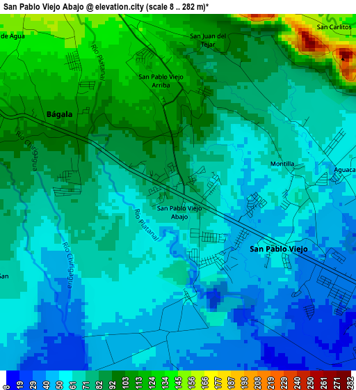
Below is the Elevation map of San Pablo Viejo Abajo, which displays elevation range with different colors. Scale of the first map is from 8 to 282 m (26 to 925 ft) with average elevation of 74.2 meters (=243 ft) [note 1]
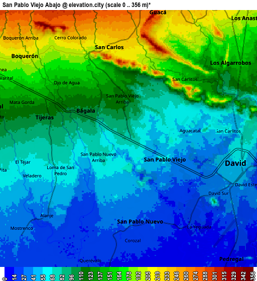
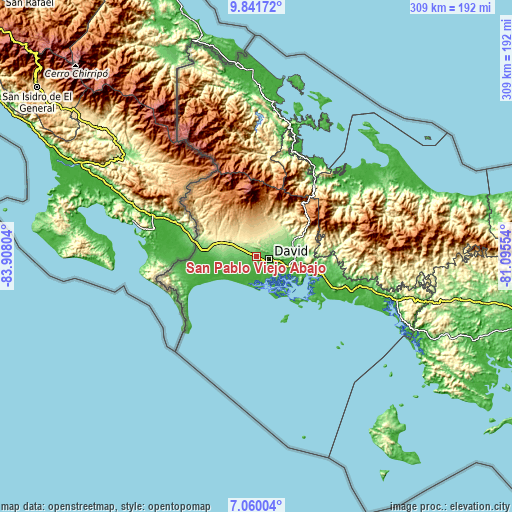
These maps also provides idea of topography and contour of this city, they are displayed at different zoom levels. More info about maps, scale and edge coordinates you can find below images.
| \ | Map #1 | Map #2 | Topo.Map |
| Scale [m] | 8..282 m | 0..356 m | × |
| Scale [ft] | 26..925 ft | 0..1168 ft | × |
| Average | 74.2 m = 243 ft | 96.2 m = 316 ft | × |
| Width | 9.67 km = 6 mi | 19.33 km = 12 mi | 309.3 km = 192.2 mi |
| Height | 9.67 km = 6 mi | 19.33 km = 12 mi | 309.3 km = 192.2 mi |
| ↑Max Latitude | 8.496855° | 8.540316° | 9.84172° |
| Latitude at center | 8.45339° | 8.45339° | 8.45339° |
| ↓Min Latitude | 8.40992° | 8.366444° | 7.06004° |
| ← Min Longitude | -82.545735° | -82.589681° | -83.90804° |
| Longitude center | -82.50179° | -82.50179° | -82.50179° |
| →Max Longitude | -82.457845° | -82.413899° | -81.09554° |
Nearby cities:
Cities around San Pablo Viejo Abajo sort by population:
• David elevation 47 m
8.3 km,  110°
110°
• Los Algarrobos 144 m
9.8 km,  60°
60°
• Nuevo San Carlitos 61 m
7.1 km,  86°
86°
• Boquerón 202 m
9.5 km,  307°
307°
• Alanje 38 m
8.8 km,  225°
225°
• Tijeras 120 m
6.9 km,  290°
290°
• Bágala 95 m
2.9 km, 293°
• Querévalo 15 m
9.5 km,  196°
196°
• Guaca Arriba 269 m
9.4 km,  6°
6°
• San Pablo Nuevo Abajo 50 m
3.1 km,  179°
179°
• San Carlos 226 m
7.1 km,  353°
353°
• El Tejar 55 m
8.3 km,  251°
251°
Multilingual:
 En español:
San Pablo Viejo Abajo elevación 75 m.
 En France:
San Pablo Viejo Abajo élévation 75 m.
 Auf Deutsch:
San Pablo Viejo Abajo höhe über dem Meeresspiegel ist 75 m.
 На русском:
San Pablo Viejo Abajo высота над уровнем моря 75 м
Sources and notes:
- [note 1] Map square and city borders are not equal. Map elevation data is calculated only from area inside that square.
- [src 1] Elevation data from geonames database provided with same terms of usage.
- [src 2] The elevation map of San Pablo Viejo Abajo is generated using elevation data from NASA's 3 arcsec (90m) resolution SRTM data.
- [src 3] Base (background) map © OpenStreetMap contributors tiles are generated by Geofabrik and OpenTopoMap.
Copyright & License:
This San Pablo Viejo Abajo Elevation Map is licensed under CC BY-SA. You may reuse any part from this page, if you give a proper credit by linking to this URL:
 More info on terms of use page.