Soná elevation
Soná (Veraguas), Panama elevation is 13 meters and Soná elevation in feet is 43 ft above sea level [src 1]. Soná is a seat of a second-order administrative division (feature code) with elevation that is 159 meters (522 ft) smaller than average city elevation in Panama.
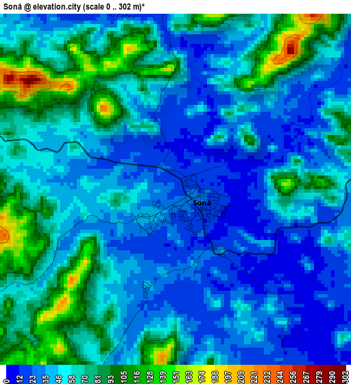
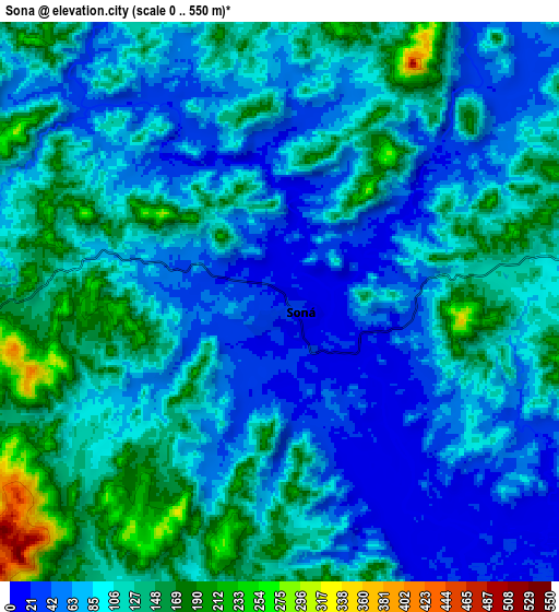
Below is the Elevation map of Soná, which displays elevation range with different colors. Scale of the first map is from 0 to 302 m (0 to 991 ft) with average elevation of 55 meters (=180 ft) [note 1]
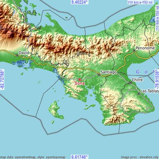
These maps also provides idea of topography and contour of this city, they are displayed at different zoom levels. More info about maps, scale and edge coordinates you can find below images.
| \ | Map #1 | Map #2 | Topo.Map |
| Scale [m] | 0..302 m | 0..550 m | × |
| Scale [ft] | 0..991 ft | 0..1804 ft | × |
| Average | 55 m = 180 ft | 98.5 m = 323 ft | × |
| Width | 9.68 km = 6 mi | 19.35 km = 12 mi | 309.6 km = 192.4 mi |
| Height | 9.68 km = 6 mi | 19.35 km = 12 mi | 309.7 km = 192.4 mi |
| ↑Max Latitude | 8.055744° | 8.099253° | 9.40224° |
| Latitude at center | 8.01223° | 8.01223° | 8.01223° |
| ↓Min Latitude | 7.968711° | 7.925188° | 6.61746° |
| ← Min Longitude | -81.365575° | -81.409521° | -82.72788° |
| Longitude center | -81.32163° | -81.32163° | -81.32163° |
| →Max Longitude | -81.277685° | -81.233739° | -79.91538° |
Nearby cities:
Cities around Soná sort by population:
• San Francisco elevation 47 m
7.8 km,  320°
320°
• Río de Jesús 82 m
18 km,  101°
101°
• Lolá 478 m
18.8 km,  298°
298°
• Boró 189 m
17.6 km,  7°
7°
• Utirá 68 m
12.3 km,  111°
111°
• Calidonia 133 m
9.4 km,  229°
229°
• El Marañón 73 m
12 km,  77°
77°
• Corozal 204 m
14.9 km, 298°
• Rodeo Viejo 77 m
11.1 km,  2°
2°
• El María 201 m
13.6 km,  277°
277°
• Quebrada de Oro 120 m
7.6 km,  289°
289°
• La Soledad 29 m
15.6 km,  161°
161°
Multilingual:
 En español:
Soná elevación 13 m.
 En France:
Soná élévation 13 m.


Sources and notes:
- [note 1] Map square and city borders are not equal. Map elevation data is calculated only from area inside that square.
- [src 1] Elevation data from geonames database provided with same terms of usage.
- [src 2] The elevation map of Soná is generated using elevation data from NASA's 3 arcsec (90m) resolution SRTM data.
- [src 3] Base (background) map © OpenStreetMap contributors tiles are generated by Geofabrik and OpenTopoMap.
Copyright & License:
This Soná Elevation Map is licensed under CC BY-SA. You may reuse any part from this page, if you give a proper credit by linking to this URL:
 More info on terms of use page.