Ibrā’ elevation
Ibrā’ (Northeastern Governorate), Oman elevation is 446 meters and Ibrā’ elevation in feet is 1463 ft above sea level [src 1]. Ibrā’ is a seat of a first-order administrative division (feature code) with elevation that is 239 meters (784 ft) bigger than average city elevation in Oman.
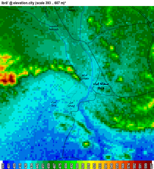
Below is the Elevation map of Ibrā’, which displays elevation range with different colors. Scale of the first map is from 393 to 607 m (1289 to 1991 ft) with average elevation of 446.2 meters (=1464 ft) [note 1]
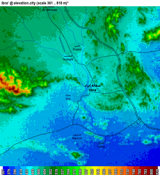
These maps also provides idea of topography and contour of this city, they are displayed at different zoom levels. More info about maps, scale and edge coordinates you can find below images.
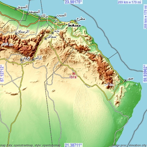
| \ | Map #1 | Map #2 | Topo.Map |
| Scale [m] | 393..607 m | 361..818 m | × |
| Scale [ft] | 1289..1991 ft | 1184..2684 ft | × |
| Average | 446.2 m = 1464 ft | 453.1 m = 1487 ft | × |
| Width | 9.02 km = 5.6 mi | 18.03 km = 11.2 mi | 288.5 km = 179.3 mi |
| Height | 9.02 km = 5.6 mi | 18.03 km = 11.2 mi | 288.5 km = 179.3 mi |
| ↑Max Latitude | 22.731108° | 22.771634° | 23.98175° |
| Latitude at center | 22.69057° | 22.69057° | 22.69057° |
| ↓Min Latitude | 22.65002° | 22.609458° | 21.38711° |
| ← Min Longitude | 58.489425° | 58.445479° | 57.12712° |
| Longitude center | 58.53337° | 58.53337° | 58.53337° |
| →Max Longitude | 58.577315° | 58.621261° | 59.93962° |
Nearby cities:
Cities around Ibrā’ sort by population:
• Muscat elevation 14 m
100.2 km,  352°
352°
• Seeb 7 m
114.5 km,  342°
342°
• Bawshar 15 m
99.6 km, 352°
• Nizwá 511 m
106 km,  284°
284°
• Sur 6 m
103.1 km,  97°
97°
• Sufālat Samā’il 354 m
87.4 km,  322°
322°
• Izkī 547 m
83.1 km,  288°
288°
• Bidbid 219 m
89.9 km,  332°
332°
• Badīyah 298 m
38.3 km,  134°
134°
• Adam 274 m
109 km,  251°
251°
• Al Qābil 343 m
21.2 km, 128°
• Bayt al ‘Awābī 493 m
123.7 km,  303°
303°
Multilingual:
 En español:
Ibrā’ elevación 446 m.
 En France:
Ibrā’ élévation 446 m.


Sources and notes:
- [note 1] Map square and city borders are not equal. Map elevation data is calculated only from area inside that square.
- [src 1] Elevation data from geonames database provided with same terms of usage.
- [src 2] The elevation map of Ibrā’ is generated using elevation data from NASA's 3 arcsec (90m) resolution SRTM data.
- [src 3] Base (background) map © OpenStreetMap contributors tiles are generated by Geofabrik and OpenTopoMap.
Copyright & License:
This Ibrā’ Elevation Map is licensed under CC BY-SA. You may reuse any part from this page, if you give a proper credit by linking to this URL:
 More info on terms of use page.