Şaḩam elevation
Şaḩam (Al Batinah North), Oman elevation is 2 meters and Şaḩam elevation in feet is 7 ft above sea level [src 1]. Şaḩam is a populated place (feature code) with elevation that is 205 meters (673 ft) smaller than average city elevation in Oman.
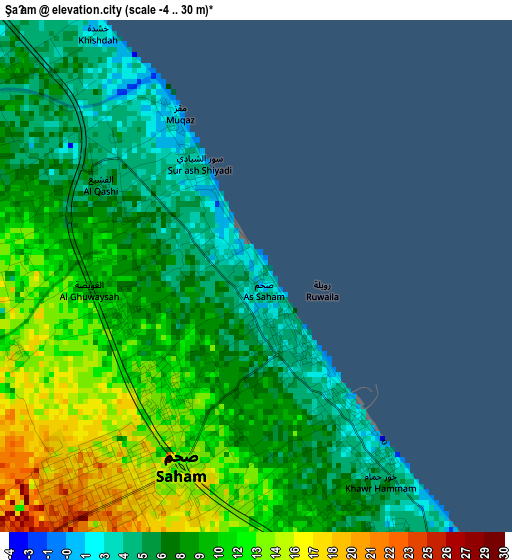
Below is the Elevation map of Şaḩam, which displays elevation range with different colors. Scale of the first map is from -4 to 30 m (-13 to 98 ft) with average elevation of 9.4 meters (=31 ft) [note 1]
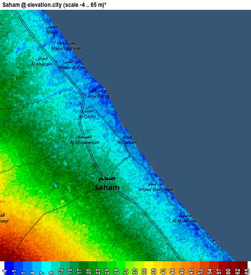
These maps also provides idea of topography and contour of this city, they are displayed at different zoom levels. More info about maps, scale and edge coordinates you can find below images.
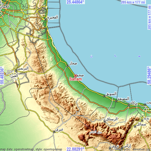
| \ | Map #1 | Map #2 | Topo.Map |
| Scale [m] | -4..30 m | -4..65 m | × |
| Scale [ft] | -13..98 ft | -13..213 ft | × |
| Average | 9.4 m = 31 ft | 17.8 m = 58 ft | × |
| Width | 8.92 km = 5.5 mi | 17.83 km = 11.1 mi | 285.3 km = 177.3 mi |
| Height | 8.92 km = 5.5 mi | 17.83 km = 11.1 mi | 285.3 km = 177.3 mi |
| ↑Max Latitude | 24.212306° | 24.252379° | 25.44864° |
| Latitude at center | 24.17222° | 24.17222° | 24.17222° |
| ↓Min Latitude | 24.132122° | 24.092011° | 22.88291° |
| ← Min Longitude | 56.844665° | 56.800719° | 55.48236° |
| Longitude center | 56.88861° | 56.88861° | 56.88861° |
| →Max Longitude | 56.932555° | 56.976501° | 58.29486° |
Nearby cities:
Cities around Şaḩam sort by population:
• Sohar elevation 12 m
26.6 km,  316°
316°
• As Suwayq 6 m
66.4 km,  122°
122°
• ‘Ibrī 359 m
111.9 km,  199°
199°
• Barkā’ 14 m
115.3 km, 118°
• Rustaq 341 m
102.6 km,  147°
147°
• Al Buraymī 297 m
111.4 km,  274°
274°
• Al Khābūrah 4 m
30.5 km,  137°
137°
• Shināş 3 m
76.4 km,  326°
326°
• Liwá 5 m
51.7 km, 320°
• Oman Smart Future City 69 m
92.5 km,  128°
128°
• Yanqul 684 m
74.2 km,  208°
208°
• Bayt al ‘Awābī 493 m
116.3 km, 146°
Multilingual:
 En español:
Şaḩam elevación 2 m.
 En France:
Şaḩam élévation 2 m.


Sources and notes:
- [note 1] Map square and city borders are not equal. Map elevation data is calculated only from area inside that square.
- [src 1] Elevation data from geonames database provided with same terms of usage.
- [src 2] The elevation map of Şaḩam is generated using elevation data from NASA's 3 arcsec (90m) resolution SRTM data.
- [src 3] Base (background) map © OpenStreetMap contributors tiles are generated by Geofabrik and OpenTopoMap.
Copyright & License:
This Şaḩam Elevation Map is licensed under CC BY-SA. You may reuse any part from this page, if you give a proper credit by linking to this URL:
 More info on terms of use page.